Mount Pye

Mount Pye
Mount Pye

Photo-request.svg

Bild gesucht 

BWf1

Höhe 720 m
Lage Regionsgrenze Otago / Southland, Neuseeland
Gebirge Catlins
Geographische Lage 46° 25′ 0″ S, 169° 17′ 0″ O-46.416666666667169.28333333333720Koordinaten: 46° 25′ 0″ S, 169° 17′ 0″ O
Mount Pye (Neuseeland)
Mount Pye

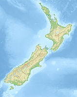
Mount Pye ist ein zerklüfteter Berg im Südosten der Südinsel Neuseelands. Er ist der höchste Punkt der Catlins und erreicht eine Höhe von 720 m. Er befindet sich im Catlins Forest Park, 40 km südöstlich von Gore und ist Teil der Grenze zwischen den Regionen Otago und Southland. An seinen Hängen entspringen der Maclennan River und der Waipati River. Der niedrigere Mount Alfred liegt etwa 7 km südwestlich.

Nächstgelegener Ort ist Mokoreta, etwa 20 km westlich.

Quellen


Wikimedia Foundation.

Игры ⚽ Нужно сделать НИР?

Schlagen Sie auch in anderen Wörterbüchern nach:

  • Mount Pye, New Zealand — Mount Pye is a rugged hill in the southeast of the South Island of New Zealand. It is the highest point in the area known as the Catlins, rising to 720 m (2361 ft). It is located 40 km (25 mi) southeast of Gore, and forms part …   Wikipedia

  • Pye (Begriffsklärung) — Pye steht für Pye, Stadtteil von Osnabrück Pye Records, britisches Musiklabel Mount Pye, Berg in Neuseeland Pye ist der Name Pye Hastings (*1947), schottischer Musiker Jesse Pye (1919–1984), englischer Fußballspieler Scott Pye (* 1990),… …   Deutsch Wikipedia

  • List of mountains of New Zealand by height — The following is a list of the highest mountains in New Zealand, and also of some other notable mountains and hills, ordered by height.The 30 highest mountainsThe 30 highest mountains [This list excludes mountains in the Ross Dependency, an area… …   Wikipedia

  • The Catlins — (sometimes referred to as The Catlins Coast) comprises an area in the southeastern corner of the South Island of New Zealand. The area lies between Balclutha and Invercargill, straddling the boundary between the Otago and Southland regions. It… …   Wikipedia

  • Catlins — The Catlins (manchmal auch The Catlins Coast) ist ein Gebiet im Südwesten der Südinsel Neuseelands zwischen Balclutha und Invercargill. Es streift die Grenze zwischen den Regionen Otago und Southland und umfasst auch den südlichsten Punkt der… …   Deutsch Wikipedia

  • The Catlins — (manchmal auch The Catlins Coast) ist ein Gebiet im Südwesten der Südinsel Neuseelands zwischen Balclutha und Invercargill. Es streift die Grenze zwischen den Regionen Otago und Southland und umfasst auch den südlichsten Punkt der Südinsel, Slope …   Deutsch Wikipedia

  • Toorak College, Mt Eliza — Infobox Aust school private name = Toorak College, Mt Eliza motto = la. In Labore Quies (Latin: In work is the true rest of life ) established = 1874cite web|url = http://services.ais.vic.edu.au/ebiz/customerservice/schooldetails.aspx?ID=184|title… …   Wikipedia

  • New Democratic Party candidates, 2008 Canadian federal election — This is a list of nominated candidates for the New Democratic Party in the 40th Canadian federal election, which resulted in a Conservative minority government.[1] Contents 1 Newfoundland and Labrador 7 seats 2 Prince Edward Island 4 seats …   Wikipedia

  • Barney Gumble — Inhaltsverzeichnis 1 Familie Simpson 2 Im Kernkraftwerk 2.1 C. Montgomery Burns 2.2 Waylon Smithers 2.3 Lenford „Lenny“ Leonard 2.4 …   Deutsch Wikipedia

  • Bienenmann — Inhaltsverzeichnis 1 Familie Simpson 2 Im Kernkraftwerk 2.1 C. Montgomery Burns 2.2 Waylon Smithers 2.3 Lenford „Lenny“ Leonard 2.4 …   Deutsch Wikipedia

Share the article and excerpts

Direct link
Do a right-click on the link above
and select “Copy Link”