Armidale Dumaresq Council
- Armidale Dumaresq Council
-
-30.5151.66666666667
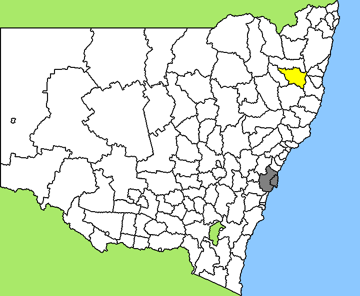
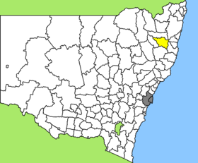
Armidale Dumaresq ist ein lokales Verwaltungsgebiet (LGA) im australischen Bundesstaat New South Wales. Das Gebiet ist 4.235 km² groß und hat etwa 23.000 Einwohner.
Armidale Dumaresq liegt im Nordosten des Staats etwa 550 km nördlich von Sydney. Das Gebiet umfasst 83 Ortsteile und Ortschaften, darunter Armidale, Dangarsleigh, Dumaresq, Hillgrove, Jeogla, Kelly Plains, Lower Creek, Wollomombi und Teile von Black Mountain und Ebor. Der Verwaltungssitz des Councils befindet sich in der Stadt Armidale im Westen der LGA, die etwa 19.500 Einwohner hat.
Das Gebiet liegt in der Region New England und ist landwirtschaftlich geprägt (Wollerzeugung, Rinderzucht). Armidale ist eine Universitätsstadt und Sitz der University of New England, der ältesten Universität Australiens außerhalb einer der Großstädte. Mehrere Nationalparks liegen in der Region und machen den Tourismus zu einem wichtigen Wirtschaftsfaktor von Armidale Dumaresq.
Verwaltung
Der Armidale Dumaresq Council hat zehn Mitglieder, die von den Bewohnern der LGA gewählt werden. Armidale Dumaresq ist nicht in Bezirke untergliedert. Aus dem Kreis der Councillor rekrutiert sich auch der Mayor (Bürgermeister) des Councils.
Weblinks
Einzelnachweise
- ↑ Australian Bureau of Statistics (25. Oktober 2007): Armidale Dumaresq (A) (Local Government Area) (Englisch). 2006 Census QuickStats. Abgerufen am 6. April 2010.
Kategorie:
- Local Government Area in New South Wales
Wikimedia Foundation.
Schlagen Sie auch in anderen Wörterbüchern nach:
Armidale Dumaresq Council — Infobox Australian Place | type = lga name = Armidale Dumaresq state = nsw caption = Location in NSW pop = 24,749cite web publisher = Australian Bureau of Statistics title= Armidale Dumaresq (A) (Local Government Area) work=2001 Census QuickStats … Wikipedia
Armidale — Staat … Deutsch Wikipedia
Armidale, New South Wales — Infobox Australian Place | type = city name = Armidale state = New South Wales caption = Looking south across Armidale City lga = Armidale Dumaresq Council county = Sandon postcode = 2350 est = 1849 pop = 24,660 area = propval =… … Wikipedia
Armidale Airport — Infobox Airport name = Armidale Airport nativename = nativename a = nativename r = image width = caption = IATA = ARM ICAO = YARM type = Public owner = operator = Armidale Dumaresq Shire Council city served = location = Armidale elevation f =… … Wikipedia
Bellingen Shire Council — Infobox Australian Place | type = lga name = Bellingen Shire state = nsw caption = Location in New South Wales pop = 12,758 publisher = Australian Bureau of Statistics title=Regional Population Growth, Australia, 2004 05 accessdate = 2006 12 03… … Wikipedia
Nambucca Shire Council — Infobox Australian Place | type = lga name = Nambucca Shire state = nsw caption = Location in New South Wales pop = 18,755cite web publisher = Australian Bureau of Statistics title=Regional Population Growth, Australia, 2004 05 url =… … Wikipedia
Kempsey Shire Council — Infobox Australian Place | type = lga name = Kempsey Shire state = nsw caption = Location in New South Wales pop = 28,742 publisher = Australian Bureau of Statistics title=Regional Population Growth, Australia, 2004 05 url =… … Wikipedia
Sandon County — Map of all coordinates from Google Map of all coordinates from Bing Export all coordinates as KML … Wikipedia
Clarke County, New South Wales — Map of all coordinates from Google Map of all coordinates from Bing Export all coordinates as KML … Wikipedia
Ebor, New South Wales — Infobox Australian Place | type = town name = Ebor state = nsw caption = lga = Guyra Shire Council and Armidale Dumaresq Council county = Clarke postcode = 2453 est = pop = 160 elevation= maxtemp = mintemp = rainfall = stategov = Northern… … Wikipedia
 Australien
 New South Wales