Nimpkish Lake Provincial Park
- Nimpkish Lake Provincial Park
-
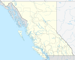
Der Nimpkish Lake Provincial Park ist ein 39 km² großer Naturpark auf Vancouver Island in der Provinz British Columbia in Kanada. Der Naturpark liegt am Südende des Nimpkish Lake und bietet zahlreiche Erholungsmöglichkeiten für Urlauber. Die Tier- und Pflanzenwelt ist vielfältig, markant für das Gebiet ist die ausgeprägte Rotwild-Population.
Weblinks
Wikimedia Foundation.
Schlagen Sie auch in anderen Wörterbüchern nach:
Nimpkish Lake Provincial Park — is a provincial park in British Columbia, Canada on Vancouver Island. The M/V Nimpkish in the BC Ferries fleet is named after the lake. See also Lower Nimpkish Provincial Park Coordinates … Wikipedia
Woss Lake Provincial Park — IUCN Kategorie II … Deutsch Wikipedia
Provincial Parks in British Columbia — Karte der Provincial Parks in British Columbia Die kanadische Provinz British Columbia unterhält 620 Provincial Parks (Stand: November 2010). Damit besitzt die Provinz nach den kanadischen Nationalparks das größte Parksystem des Landes. Über 13,5 … Deutsch Wikipedia
List of British Columbia Provincial Parks — The following is a list of all British Columbia land currently managed by [http://www.env.gov.bc.ca/bcparks BC Parks] . Any parks that are closed are not currently listed.There were a number of provincial parks, protected areas and ecological… … Wikipedia
Vancouver Island Ranges — Geobox|Range name=Vancouver Island Ranges image caption=Golden Hinde, south aspect, August 2006. country=Canada region type=Province region=British Columbia parent=Insular Mountains highest=Golden Hinde highest elevation=2195 highest lat… … Wikipedia
Insular Mountains — Geobox | Range name=Insular Mountains image caption=Golden Hinde, south aspect, August 2006. country=Canada region type=Province region=British Columbia parent=Pacific Cordillera highest=Golden Hinde highest elevation=2195 highest lat… … Wikipedia
Woss, British Columbia — Woss, British Columbia, commonly known as Woss Lake, is a small west coast village in the Nimpkish Valley, located 75 km (47 mi) south east of Port McNeill, and 128 km (80 mi) north of Campbell River on Highway 19, in northern Vancouver Island.… … Wikipedia
Roderick Haig-Brown — Infobox Writer name = Roderick Haig Brown imagesize = caption = pseudonym = birthname = birthdate = 21 February 1908 birthplace = deathdate = 9 October 1976 deathplace = occupation = writer nationality = Canadian period = genre = non fiction,… … Wikipedia
British Columbia Coast — Howe Sound, along British Columbia s South Coast. The British Columbia Coast or BC Coast is Canada s western continental coastline on the Pacific Ocean. The usage is synonymous with the term West Coast of Canada. In a sense excluding the urban… … Wikipedia