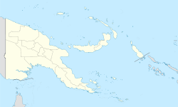
Normanby Island

Normanby Island
Normanby
Topographische Karte der Normanby-Insel
Gewässer Pazifischer Ozean
Inselgruppe D'Entrecasteaux-Inseln
Geographische Lage 10° 4′ S, 151° 2′ O-10.061944444444151.038333333331158Koordinaten: 10° 4′ S, 151° 2′ O
Normanby (Papua-Neuguinea)
DEC
Normanby
Länge 70 km
Breite 20 km
Fläche 850 km²
Höchste Erhebung 1.158 m
Einwohner dep1
Hauptort Esa'ala

Normanby ist eine vulkanische, etwa 850 km² große, L-förmige Insel im Pazifischen Ozean. Sie ist die südlichste der D'Entrecasteaux-Inseln, die zur Provinz Milne Bay in Papua-Neuguinea gehören.

Die Insel liegt 16 Kilometer nordöstlich des East Cape auf Neuguinea, von der sie durch die Goschen-Straße getrennt ist, sowie wenige Kilometer südlich der Fergusson-Insel, von der sie durch die Dawson-Straße getrennt ist. Im Südosten erhebt sich die Landmasse auf eine maximale Höhe von 1158 m über dem Meer, die Beschaffenheit der Oberfläche ist im Südosten geprägt von bergigem Terrain, an den Küsten durch flache Strände und Sumpfland. Hauptstadt der Insel ist Esa'ala im Norden.

1873 wurde die Insel durch den britischen Kapitän John Moresby bereist, welcher sie nach dem George Augustus Constantine Phipps, dem Marquess von Normanby benannte. Früher wurde auf Normanby Gold abgebaut, heutzutage werden dort hauptsächlich Kopra und Bauholz gewonnen.


Wikimedia Foundation.

Игры ⚽ Нужно сделать НИР?

Schlagen Sie auch in anderen Wörterbüchern nach:

  • Normanby Island — may refer to: Normanby Island (Queensland), in Australia Normanby Island, Papua New Guinea This disambiguation page lists articles about distinct geographical locations with the same name. If an internal link led you he …   Wikipedia

  • Normanby Island (Papua New Guinea) — Normanby Topographic map of Normanby Island …   Wikipedia

  • Normanby Island (Queensland) — Normanby Island North Queensland is part of the Frankland Islands 30 km North East of Babinda and South West of Cairns. The Frankland Islands are teeming with permanent and migratory marine life, especially the Green Sea Turtle which nests… …   Wikipedia

  • Normanby Island — ▪ island, Papua New Guinea       one of the D Entrecasteaux Islands, Papua New Guinea, southwestern Pacific Ocean. The island lies 10 miles (16 km) from the eastern tip of the island of New Guinea, across Goschen Strait, and is separated from… …   Universalium

  • Normanby — could be: Contents 1 Places 1.1 Places in England 1.2 Places in Australia 1.3 Places in Canada 1.4 …   Wikipedia

  • Normanby — Isla Normanby Normanby Island Localización País  Papúa Nueva Guinea Archipiélago Islas D Entrecaste …   Wikipedia Español

  • Normanby, New Zealand — There are two places in New Zealand called Normanby: Normanby, Otago is a suburb of Dunedin Normanby, Taranaki is a town in the western North Island This disambiguation page lists articles associated with the same title. If an …   Wikipedia

  • Fergusson Island — ▪ island, Papua New Guinea       largest of the D Entrecasteaux Islands, Papua New Guinea, in the southwestern Pacific Ocean. The island lies 30 miles (50 km) across Ward Hunt Strait from the southeastern tip of New Guinea, in the Solomon Sea. It …   Universalium

  • Nuakata Island — is a small, mountainous island in the Goschen Strait south of Normanby Island and east of East Cape. It is part of Milne Bay Province, Papua New Guinea. The island is inhabited by about 500 people. The people of the island speak a dialect of the… …   Wikipedia

  • Dobu Island — Chief Gaganamole and wife, Dobu. Picture by George Brown (missionary) (1835 – 1917). Dobu Island is an island, part of D Entrecasteaux Islands in Papua New Guinea. It is located south of Fergusson Island and north of Normanby Island. The people… …   Wikipedia

Share the article and excerpts

Direct link
Do a right-click on the link above
and select “Copy Link”