Ofunato

Ofunato
大船渡市
Ōfunato-shi
Ōfunato
Geographische Lage in Japan
Ōfunato (Japan)
DEC
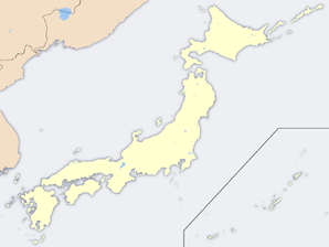
Region: Tōhoku
Präfektur: Iwate
Koordinaten: 39° 5′ N, 141° 43′ O39.081944444444141.708611111117Koordinaten: 39° 4′ 55″ N, 141° 42′ 31″ O
Basisdaten
Fläche: 323,25 km²
Einwohner: 43.176
(31. Okt. 2006)
Bevölkerungsdichte: 134 Einwohner je km²
Gemeindeschlüssel: 03203-4
Symbole
Wappen:
Wappen von Ōfunato
Baum: Kiefer
Blume: Kamelie
Vogel: Larus crassirostris
Rathaus
Adresse: Ōfunato City Hall
15 Aza Utsunosawa, Sakari-chō
Ōfunato-shi
Iwate 022-8501
Webadresse:
Lage Ōfunatos in der Präfektur Iwate
Lage Ōfunatos in der Präfektur

Ōfunato (jap. 大船渡市, -shi) ist eine Stadt in der Präfektur Iwate auf Honshu, der Hauptinsel von Japan.

Inhaltsverzeichnis

Geschichte

Die Stadt Ōfunato wurde am 1. April 1952 gegründet.

Geographie

Ōfunato liegt südöstlich von Morioka und nordöstlich von Sendai am Pazifischen Ozean.

Verkehr

  • Straße:
    • Sanriku-Jukan-Autobahn
    • Nationalstraße 45,107,397
  • Zug:
    • JR Ōfunato-Linie
    • Sanriku-Eisenbahn

Angrenzende Städte und Gemeinden

Weblinks


Wikimedia Foundation.

Игры ⚽ Поможем решить контрольную работу

Schlagen Sie auch in anderen Wörterbüchern nach:

  • Ōfunato — shi 大船渡市 Geographische Lage in Japan …   Deutsch Wikipedia

  • Ofunato — Original name in latin funato Name in other language Ofunato, da chuan du, funato State code JP Continent/City Asia/Tokyo longitude 39.07167 latitude 141.71667 altitude 7 Population 35418 Date 2012 01 19 …   Cities with a population over 1000 database

  • Ōfunato, Iwate — Ōfunato 大船渡市   City   …   Wikipedia

  • Ōfunato Station — (大船渡駅) is a train station located on the JR Ōfunato Line in Ōfunato, Iwate, Japan. Contents 1 Histor …   Wikipedia

  • Ōfunato Line — Ichinoseki Station Overview Termini Ichinoseki Station Sakari Station Statio …   Wikipedia

  • Ofunato-shi — Admin ASC 2 Code Orig. name Ōfunato shi Country and Admin Code JP.00.2111528 JP …   World countries Adminstrative division ASC I-II

  • Oofunato — 大船渡市 Ōfunato shi Geographische Lage in Japan …   Deutsch Wikipedia

  • Tōhoku-Erdbeben 2011 — Vorlage:Infobox Erdbeben/Wartung/Sachschaden fehlt Großes Tōhoku Erdbeben …   Deutsch Wikipedia

  • 2011 Tōhoku earthquake and tsunami — 2011 Miyagi earthquake redirects here. For the aftershock that occurred on 7 April, see April 2011 Miyagi earthquake. 2011 Tōhoku earthquake and tsunami 東日本大震災 An aerial view of damage in the Tōhoku region with black smoke coming from the Nippon… …   Wikipedia

  • Sakari Station — (盛駅) is a train station located on the JR Ōfunato Line in Ōfunato, Iwate, Japan. This station is the largest in Ōfunato City.Lines*JR East Ōfunato Line *Sanriku Railway Company South Rias Line *Iwate Development Railway Company Akasaki Line… …   Wikipedia

Share the article and excerpts

Direct link
Do a right-click on the link above
and select “Copy Link”