- Palauig
-
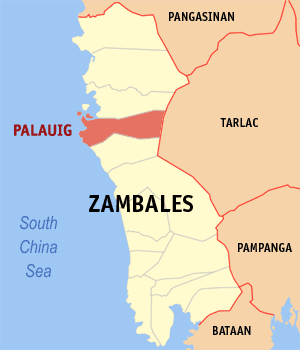
Municipality of Palauig Lage von Palauig in der Provinz Zambales 
Basisdaten Bezirk: Central Luzon Provinz: Zambales Barangays: 19 Distrikt: 2. Distrikt von Zambales PSGC: 037108000 Einkommensklasse: 3. Einkommensklasse Haushalte: 5945 Zensus 1. Mai 2000Einwohnerzahl: 30.747 Zensus 1. August 2007Koordinaten: 15° 26′ N, 120° 3′ O15.433333333333120.05Koordinaten: 15° 26′ N, 120° 3′ O Postleitzahl: 2210 Bürgermeister: Generoso Fallorina Amog Geographische Lage auf den Philippinen 

Palauig Palauig ist eine philippinische Stadtgemeinde in der Provinz Zambales. Nach dem Zensus vom 1. Mai 2000 hat sie 29.983 Einwohner in 5945 Haushalten.
Baranggays
Palauig ist politisch in 19 Baranggays unterteilt.
- Alwa
- Bato
- Bulawen
- Cauyan
- East Poblacion
- Garreta
- Libaba
- Liozon
- Lipay
- Locloc
- Macarang
- Magalawa
- Pangolingan
- Salaza
- San Juan
- Santo Niño
- Santo Tomas
- Tition (San Vicente)
- West Poblacion
- Scarborough-Riff (Von den Philippinen beanspruchte Ausschließliche Wirtschaftszone)
Städte: Olongapo City
Stadtgemeinden: Botolan | Cabangan | Candelaria | Castillejos | Iba | Masinloc | Palauig | San Antonio | San Felipe | San Marcelino | San Narciso | Santa Cruz | Subic

Wikimedia Foundation.