- Asuogyaman District
-
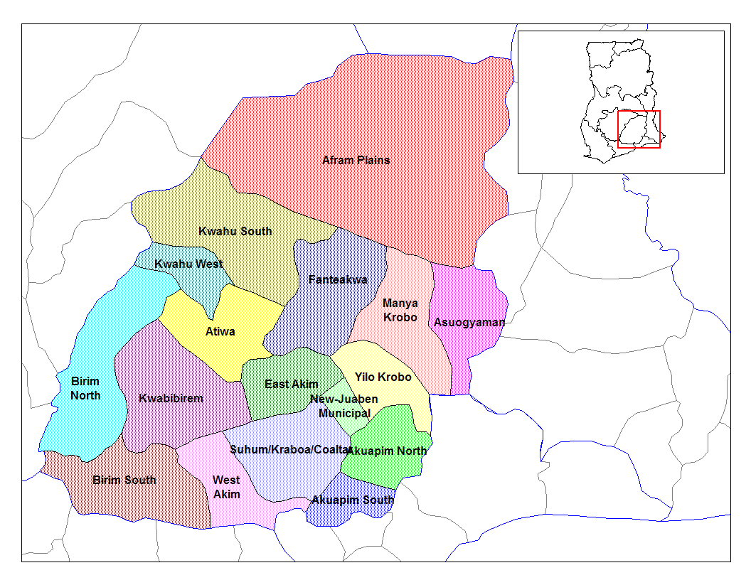
Asuogyaman District 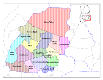
Land  Ghana
GhanaRegion Eastern Region Hauptstadt Atimpoku Distriktform üblich District Chief Executive Emmanuel Ntow Bediako Fläche 664 km² Einwohnerzahl 80.529 (2000) ISO 3166-2 GH-EP-AG Der Asuogyaman District liegt in der Eastern Region von Ghana. Chief Exekutive des 664 km² großen Distriktes mit 80.529 (2000) Einwohnern ist Emmanuel Ntow Bediako. Distrikthauptstadt ist Atimpoku. Der Distrikt wurde erst 1989 aus dem Distrikt Kaoga gebildet.

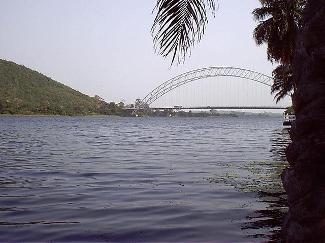
Der Akosombo-Staudamm, das wichtigste Wasserkraftwerk Ghanas liegt in diesem Distrikt. Traditionell ist der Distrikt an beiden Seiten des Volta-Stausees gelegen und daher ein wichtiger Handelspunkt für den Inlands-Schiffsverkehr und den Handel. Auch aufgrund der touristischen Attraktion des Volta-Stausees und des Staudammes besuchen eine Vielzahl von Touristen den Distrikt. Die Adomi-Brücke stellt eine der wichtigsten Verkehrsverbindungen zwischen beiden Seiten des Volta dar. Diese Brücke wurde 1956 gebaut und ist mit 241,50 Metern (805 Fuß) die längste Brücke in Ghana.
Noch im Jahr 1960 ergab eine Volkszählung eine Bevölkerung von 23.797 im heutigen Distrikt. 1970 lebten bereits 43.024 Menschen im Distrikt 1984 55.827.
Inhaltsverzeichnis
Ortschaften
- Akosombo
- Atimpoku
- Anum (Ort)
- Frankadua
- Boso Ort
- South Senchi
- New Akrade
- Asikuma
- Apeguso
- Akwamufie
- Pupuni
- Old Senchi
- Gyakiti
- New Senchi
- Aboasa
- Labolabo
- Anyansu
- Mpakadan Quarters
- Abomanyaw
- Agbodokope
- Fintey
- New Adjena
Wahlbezirke
Der Asuogyaman District besteht aus einem Wahlkreis. Im Wahlkreis Aburi-Nsawam wurde Magnus Opare-Asamoah von der Partei New Patriotic Party (NPP) als Direktkandidat in das ghanaische Parlament gewählt.
Siehe auch
Weblinks

Afram Plains | Akuapim North | Akuapim South | Asuogyaman | Atiwa | Birim North | Birim South | East Akim | Fanteakwa | Kwaebibirem | Kwahu South | Kwahu West | Manya Krobo | New-Juaben Municipal | Suhum/Kraboa/Coaltar | West Akim | Yilo Krobo
Wikimedia Foundation.