Polangui

Polangui
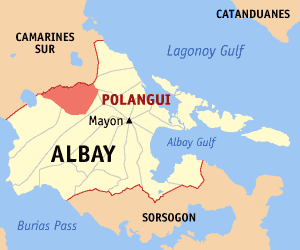
Municipality of Polangui
Lage von Polangui in der Provinz Albay
Karte
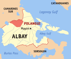
Basisdaten
Bezirk: Bicol-Region
Provinz: Albay
Barangays: 44
Distrikt: 3. Distrikt von Albay
PSGC: 050514000
Einkommensklasse: 1. Einkommensklasse
Haushalte: 13.773
Zensus 1. Mai 2000
Einwohnerzahl: 77.122
Zensus 1. August 2007
Koordinaten: 13° 18′ N, 123° 29′ O13.3123.48333333333Koordinaten: 13° 18′ N, 123° 29′ O
Postleitzahl: 4506
Vorwahl: +63 52
Bürgermeister: Jesus Salceda Sr.
Geographische Lage auf den Philippinen
Polangui (Philippinen)
Polangui
Polangui

Polangui ist eine philippinische Stadtgemeinde in der Provinz Albay.

Geschichte

Die Gemeinde wurde ursprünglich Binanuaan genannt. Sie wurde von dem Mönch Baltazar de la Magdalena gegründet, einhergehend mit der Taufe von fünf älteren Bewohnern. Zu dieser Zeit hatte die Ortschaft ungefähr 500 Einwohner. Diese Ortschaft lag in einem flachen Gebiet und war Überschwemmungen ausgesetzt, deshalb zogen die Bewohner der Ortschaft später an den heutigen Platz der Ortschaft, der höher gelegen war, und deshalb weniger der Gefahr durch Überschwemmungen ausgesetzt war. Der Name der Stadtgemeinde leitet sich von oyangi dem Namen einer Baumart ab, die in dieser Gegend vorkam.

1654 wurde unter dem Mönch Juan Bautista der Bau einer Gemeindekirche begonnen, die zehn Jahre später fertiggestellt werden konnte. Im Jahre 1897 wurde der Fotograf und Einwohner von Polangui Camilo Jacob zusammen mit anderen Einwohnern von Bicol exekutiert. Ein Jahr später meuterte die von Don Elias Angeles angeführte Guardia Civil gegen die Spanier. Dies beendete die spanische Herrschaft in der Bicol-Region.

Baranggays

Polangui ist politisch unterteilt in 44 Baranggays.

  • Agos
  • Alnay
  • Alomon
  • Amoguis
  • Anopol
  • Apad
  • Balaba
  • Balangibang
  • Balinad
  • Basud
  • Binagbangan (Pintor)
  • Buyo
  • Centro Occidental (Pob.)
  • Centro Oriental (Pob.)
  • Cepres
  • Cotmon
  • Cotnogan
  • Danao
  • Gabon
  • Gamot
  • Itaran
  • Kinale
  • Kinuartilan
  • La Medalla
  • La Purisima
  • Lanigay
  • Lidong
  • Lourdes
  • Magpanambo
  • Magurang
  • Matacon
  • Maynaga
  • Maysua
  • Mendez
  • Napo
  • Pinagdapugan
  • Ponso
  • Salvacion
  • San Roque
  • Santicon
  • Santa Cruz
  • Santa Teresita
  • Sugcad
  • Ubaliw

Wikimedia Foundation.

Игры ⚽ Поможем написать курсовую

Schlagen Sie auch in anderen Wörterbüchern nach:

  • Polangui — Carte d Albay avec localisation de Polangui Polangui est une municipalité de la province d Albay, aux Philippines …   Wikipédia en Français

  • Polangui — Original name in latin Polangui Name in other language Polangui State code PH Continent/City Asia/Manila longitude 13.2923 latitude 123.4855 altitude 28 Population 77122 Date 2011 08 19 …   Cities with a population over 1000 database

  • Polangui (Albay) — Polangui Carte d Albay avec localisation de Polangui Polangui est une municipalité de la province d Albay, aux Philippines. Villes et municipalités d …   Wikipédia en Français

  • Polangui, Albay — Polangui is a 1st class municipality in the province of Albay, Philippines. According to the 2007 census, it has a population of 77,122 people in 13,773 households.HistoryThe municipality of Polangui was originally called Binanuaan . It was… …   Wikipedia

  • Bicol University — Infobox University name = Bicol University native name = Universidad kan Bikol motto = established = June 21 1969 type = State University president = Dr. Fay Lauraya city = Legazpi City country = Philippines campus = Legazpi City, Daraga,… …   Wikipedia

  • Ligao — City of Ligao Lungsod ng Ligao Lage von Ligao in der Provinz Albay Basisdaten Bezirk: Bicol Region …   Deutsch Wikipedia

  • PH-ALB — Lage der Provinz Albay Albay ist eine eine Provinz der Philippinen. Sie befindet sich im Süden der Insel Luzon auf der Bicol Halbinsel und gehört politisch dem Bezirk Bicol Region (Region V) an. Ihre Hauptstadt ist Legazpi City, der Gouverneur… …   Deutsch Wikipedia

  • Bikol languages — This article is about the various sociolinguistic dialects of Bikol. For the standardized dialect of Bikol based on the Canaman variant, see Bikol language. Bikol Geographic distribution: Bicol Region Linguistic classification: Austronesian… …   Wikipedia

  • Tabaco City — For the narcotic, see tobacco. Infobox Philippine city infoboxtitle = City of Tabaco sealfile = locatormapfile = Ph locator albay tabaco.png caption = Map of Albay showing the location of Tabaco City. region = Bicol Region (Region V) province =… …   Wikipedia

  • Malilipot, Albay — Map of Albay showing the location of Malilipot Malilipot is a 4th class municipality in the province of Albay, Philippines. According to the 2007 census, it has a population of 33,593 people in 5,714 households. Contents …   Wikipedia

Share the article and excerpts

Direct link
Do a right-click on the link above
and select “Copy Link”