Pomona Island

Pomona Island

Vorlage:Infobox Insel/Wartung/Bild fehltVorlage:Infobox Insel/Wartung/Fläche fehltVorlage:Infobox Insel/Wartung/Höhe fehlt

Pomona Island
Gewässer Lake Manapouri
Geographische Lage 45° 30′ 30″ S, 167° 28′ 25″ O-45.508333333333167.47361111111Koordinaten: 45° 30′ 30″ S, 167° 28′ 25″ O
Pomona Island (Neuseeland)
Pomona Island
Einwohner (unbewohnt)

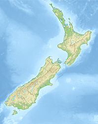
Pomona Island ist die größte Insel im Lake Manapouri im Fiordland-Nationalpark auf Neuseelands Südinsel. Sie ist eine der größten Seeinseln in Neuseeland.

Die Insel ist unbewohnt und liegt nahe dem Zugang zum Südarm des Sees, 11 km westlich von Manapouri. Die Insel wurde 1862 von James McKerrow nach der Hauptinsel der Orkneyinseln in Schottland benannt, für die damals der Name Pomona üblich war.

2005 wurde der Pomona Island Charitable Trust gegründet, um auf der Insel eingeschleppte Säuger wie Hermeline, Possums, Hirsche und Nager auszurotten und die natürliche Flora und Fauna wieder herzustellen.

Quellen


Wikimedia Foundation.

Игры ⚽ Нужна курсовая?

Schlagen Sie auch in anderen Wörterbüchern nach:

  • Pomona Island — is the largest island within Lake Manapouri, in Fiordland National Park, in New Zealand s South Island. It is one of the largest islands to be found within any New Zealand lake.The island is uninhabited, and lies close to the entrance to the lake …   Wikipedia

  • Pomona (Begriffsklärung) — Pomona ist: Pomona, die römische Göttin des Obstsegens (32) Pomona, ein Asteroid eine pomologische Zeitschrift in der Mitte des 19. Jahrhunderts, deren Herausgeber der Pfälzer Friedrich Jakob Dochnahl war Pomona (Zeitschrift), eine… …   Deutsch Wikipedia

  • Pomona, Río Negro — Pomona is a small village on the island of Choele Choel in Río Negro Province, in Argentina. It s was used as a cross point for the Negro River into the Choele Choel Island already in 1890, when it was known as Paso Peñalva . It was formally… …   Wikipedia

  • Pomona, or Mainland —    POMONA, or MAINLAND, an island, in the county of Orkney and Shetland; containing 16,141 inhabitants. This island, which is the largest of the Orkneys, is situated between the sound of Wire and other sounds, on the north, and Scalpa Flow, Holm… …   A Topographical dictionary of Scotland

  • Pomona Lisa — Infobox Album Name = Pomona Lisa Type = studio Artist = The Ziggens Released = April 1998 Recorded = Genre = Surf punk Length = Label = Producer = Reviews = Last album = This album = Next album = Pomona Lisa is the fifth album by the surf punk… …   Wikipedia

  • POMONA —    1) or MAINLAND    the largest island in the Orkneys, has a low treeless surface, many lakes, and extensive pasture land; agriculture has of late improved, and, with stock raising and fishing, is the chief industry; the only towns are Kirkwall… …   The Nuttall Encyclopaedia

  • Ichaboe Island — historische Ansicht von Ichaboe, Mitte 19. Jahrhundert Gewässer Südatlantik …   Deutsch Wikipedia

  • Shark Island (Namibia) — Shark Island Haifischinsel Shark Island (rechte Bildmitte) mit der Lüderitzbucht (links) und der Stadt Lüderitz im Hintergrund …   Deutsch Wikipedia

  • Sinclair Island — Vorlage:Infobox Insel/Wartung/Bild fehlt Sinclair Island (Roastbeef Island) Gewässer Baker Bay, Südatlantik Inselgruppe Penguin Islands Geographische Lage …   Deutsch Wikipedia

  • Halifax Island — Gewässer Lüderitzbucht, Südatlantik Insel …   Deutsch Wikipedia

Share the article and excerpts

Direct link
Do a right-click on the link above
and select “Copy Link”