- Port Adelaide Enfield City
-
City of Port Adelaide Enfield 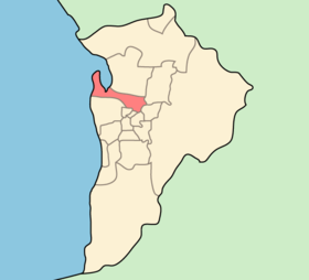
Lage von Port Adelaide Enfield City in AdelaideGliederung Staat:  Australien
Bundesstaat:  South Australia
Verwaltungssitz: Port Adelaide Daten und Zahlen Fläche: 92 km² Einwohner: 102.928 (2006) [1] Bevölkerungsdichte: 1.119 Einwohner je km² Wards: 7 -34.85138.5Koordinaten: 34° 51′ S, 138° 30′ ODie City of Port Adelaide Enfield ist ein lokales Verwaltungsgebiet (LGA) im australischen Bundesstaat South Australia. Port Adelaide Enfield gehört zur Metropole Adelaide, der Hauptstadt von South Australia. Das Gebiet ist 92 km² groß und hat etwa 106.000 Einwohner.
Port Adelaide Enfield liegt nördlich und nordwestlich des Stadtzentrums von Adelaide und bildet den südlichen Abschluss des Barker Inlets. Das Gebiet beinhaltet 51 Stadtteile: Alberton, Angle Park, Birkenhead, Blair Athol, Broadview, Clearview, Croydon Park, Dernancourt, Devon Park, Dry Creek, Dudley Park, Enfield, Ethelton, Exeter, Ferryden Park, Gepps Cross, Gilles Plains, Gillman, Glanville, Greenacres, Hampstead Gardens, Hillcrest, Holden Hill, Kilburn, Klemzig, Largs Bay, Largs North, Manningham, Mansfield Park, Northfield, Northgate, North Haven, Oakden, Osborne, Ottoway, Outer Harbour, Peterhead, Port Adelaide, Queenstown, Regency Park, Rosewater, Sefton Park, Semaphore, Semaphore South, Taperoo, Valley View, Walkleys Heights,Windsor Gardens, Wingfield und Woodville Gardens. Der Verwaltungssitz des Councils befindet sich im Stadtteil Port Adelaide im Westen der LGA.
Verwaltung
Der Port Adelaide Enfield City Council hat 18 Mitglieder, 17 Councillor werden von den Bewohnern der sieben Wards gewählt (je zwei aus Klemzig, Outer Harbour, Port Adelaide und Semaphore Ward, je drei aus Enfield, Northfield, Parks Ward). Diese sieben Bezirke sind unabhängig von den Stadtteilen festgelegt. Der Ratsvorsitzende und Mayor (Bürgermeister) wird zusätzlich von allen Bewohnern der City gewählt.
Weblinks
Einzelnachweise
- ↑ Australian Bureau of Statistics (25. Oktober 2007): Port Adelaide Enfield (C) (Local Government Area) (Englisch). 2006 Census QuickStats. Abgerufen am 6. April 2010.
Kategorien:- Local Government Area in South Australia
- Local Government Area in Adelaide

Wikimedia Foundation.