Puerto Santo Tomás de Castilla
- Puerto Santo Tomás de Castilla
-
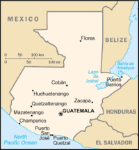
Karte von Guatemala mit Puerto Barrios
Puerto Barrios ist die größte Hafenstadt in Guatemala an der Karibikküste. Die Stadt hat knapp 60.000 Einwohner [1] und gehört verwaltungstechnisch zur Provinz Izabal. Benannt wurde die Stadt nach dem früheren guatemaltekischen Präsidenten Justo Rufino Barrios Auyón.
Zu ihrer Blütezeit wurde der gesamte guatemaltekische Bananenexport über diesen Hafen abgewickelt. Für die erste Eisenbahnstrecke Guatemalas war sie Endpunkt. Heute wird der kommerzielle Seeverkehr vorwiegend über den neuen Hafen von Santo Tomás de Castilla abgewickelt, der wenige Kilometer südwestlich von Puerto Barrios liegt. Knapp 100 Kilometer von Puerto Barrios entfernt liegt die Maya-Ruine von Quirigua.
Quellen
- ↑ Bevölkerungsstatistik von Puerto Barrios
15.73-88.67Koordinaten: 15° 44′ N, 88° 36′ W
Wikimedia Foundation.
Schlagen Sie auch in anderen Wörterbüchern nach:
Santo Tomás de Castilla — Saltar a navegación, búsqueda Santo Tomás de Castilla De Santo Tomás de Castilla, también conocido como Matías de Gálvez es una ciudad portuaria en el departamento de Izabal, Guatemala. Se encuentra en alrededor de 15 ° 41 20 N 88 ° 36 45 W /… … Wikipedia Español
Santo Tomás de Castilla — Santo Tomás de Castilla, also known as Matías de Gálvez is a port city in Izabal Department, Guatemala. It is located at around coord|15|41|60|N|88|37|0|W|display=inline,title. It lies at Amatique Bay off the Gulf of Honduras and is… … Wikipedia
Santo Tomás de Castilla — Containerhafen von Santo Tomás Santo Tomás de Castilla ist ein Stadtteil der Hafenstadt Puerto Barrios im Departamento Izabal an der Karibikküste Guatemalas. Sie liegt an der Bahía de Amatique, einer Bucht im Golf von Honduras, unweit der Mündung … Deutsch Wikipedia
Santo Tomás de Castilla — Carte du Guatemala Santo Tomás de Castilla, aussi appelée Matías de Gálvez est une ville portuaire du département d Izabal au Guatemala. Elle est située autour de … Wikipédia en Français
Santo Tomás de Castilla — ▪ Guatemala also called Matías de Gálvez port, northeastern Guatemala. It lies on Amatique Bay off the Gulf of Honduras and is administratively a part of Puerto Barrios. Santo Tomás was settled originally by Belgians in the 19th century;… … Universalium
Santo Tomás de Castilla — Sạnto Tomạ́s de Castilla [ kas tija], 1959 69 Matíaz de Gálvez [ma tiaȓ ȓe ɣalβes], wichtigster Hafen Guatemalas an der Karibikküste, seit 1952 Ersatz für den veralteten Hafen von Puerto Barrios; auch Marinehafen, Freihandels und Industriezone … Universal-Lexikon
Puerto Barrios — Saltar a navegación, búsqueda Ciudad de Puerto Barrios Apodo(s): La Tierra de Dios Ubicación Coordenadas … Wikipedia Español
Puerto Barrios — 15.73 88.63 Koordinaten: 15° 44′ N, 88° 36′ W Puerto Barrios … Deutsch Wikipedia
Puerto Barrios — Infobox Settlement name = official name =Puerto Barrios other name = native name = nickname = settlement type = total type = motto = imagesize = 300px image caption = Puerto Barrios cathedral flag size = image seal size = image shield = shield… … Wikipedia
Puerto Barrios Airport — Infobox Airport name = Puerto Barrios Airport nativename = nativename a = nativename r = image width = caption = IATA = PBR ICAO = MGPB type = Civil owner = operator = Dirección General de Aeronáutica Civil city served = location = Puerto Barrios … Wikipedia
