Raukumara Range

Raukumara Range

p1f1p5

Raukumara Range
Höchster Gipfel Mt. Hikurangi (1.754 m)
Lage Nordinsel (Neuseeland)
Raukumara Range (Neuseeland)
Raukumara Range
Koordinaten 37° 47′ S, 178° 2′ O-37.783333333333178.033333333331754Koordinaten: 37° 47′ S, 178° 2′ O

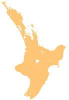
Die Raukumara Range ist ein Gebirgszug im Norden von Gisborne auf Neuseelands Nordinsel.

Sie bildet einen Teil der Hauptgebirgskette der Insel, die von Wellington in Richtung Nord-Nordost zum East Cape verläuft.

Das Gebirge besteht vor allem aus Grauwacke, Argilliten, Schluffstein und Sandstein. Der höchste nichtvulkanische Gipfel der Nordinsel, Mount Hikurangi, ist Teil des Gebirgszuges.


Wikimedia Foundation.

Игры ⚽ Поможем написать реферат

Schlagen Sie auch in anderen Wörterbüchern nach:

  • Raukumara Range — The Raukumara Range lies north of Gisborne, near East Cape in New Zealand s North Island. It forms part of the North Island s main mountain chain, which runs north northeast from Wellington to East Cape, and is composed primarily of greywacke,… …   Wikipedia

  • Raukumara Range — /raʊkʊˌmarə ˈreɪndʒ/ (say rowkoo.mahruh raynj) noun a range of mountains in the north eastern part of the North Island, NZ. Highest peak, Mt Hikurangi, 1754 m …  

  • Mount Raukumara — is the northernmost major peak in the Raukumara Range in the northeast of New Zealand s North Island. Part of the backbone of the range, which forms part of a line of mountains extending across much of the North Island, 1343 metre (4404 ft)… …   Wikipedia

  • Montes Raukumara — Montes Raukumara …   Wikipedia Español

  • Ruahine Range — p1f1p5 Ruahine Range Höchster Gipfel Mangaweka (1.733 m) Lage Nordinsel (Neuseeland) …   Deutsch Wikipedia

  • Ruahine Range — The Ruahine Range is one of several mountain ranges in the North Island of New Zealand which form a ridge running parallel with the east coast of the island between East Cape and Wellington.The ridge is at its most pronounced in the southern part …   Wikipedia

  • Maungahaumi — is a mountain in the Raukumara Range in the northeast of New Zealand s North Island. Part of the backbone of the range, which forms part of a line of mountains extending across much of the North Island, 1213 metre (3979 ft) Maungahaumi is the… …   Wikipedia

  • Ruahine Ranges — Die Ruahine Range ist einer von mehreren Gebirgszügen auf der Nordinsel Neuseelands, die parallel zur Ostküste der Insel zwischen East Cape und Wellington verlaufen. Diese Gebirgsrücken ist im Südteil der Insel am ausgeprägtesten, wo er aus der… …   Deutsch Wikipedia

  • Waiapu River — The Waiapu River is a river of the East Coast of the North Island of New Zealand. Flowing from the Raukumara Range, it passes through Ruatoria before reaching the Pacific Ocean at Rangitukia. The river lies within the rohe of the Ngati Porou… …   Wikipedia

  • Mount Arowhana — lies in the Raukumara Range in the northeast of New Zealand s North Island. Part of the backbone of the range, which forms part of a line of mountains extending across much of the North Island, 1440 metre (4724 ft) Arowhana is second only to… …   Wikipedia

Share the article and excerpts

Direct link
Do a right-click on the link above
and select “Copy Link”