- Rotuma Island
-
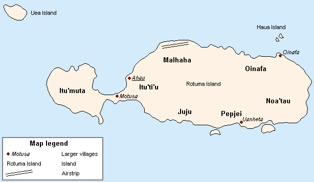
Rotuma Island Karte von Rotuma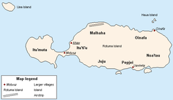
Gewässer Pazifischer Ozean Inselgruppe Rotuma-Inseln Geographische Lage 12° 30′ S, 177° 5′ O-12.501944444444177.07916666667200Koordinaten: 12° 30′ S, 177° 5′ O 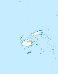

Länge 13 km Breite 3,5 km Fläche 44 km² Höchste Erhebung 200 m Einwohner 2.095 (2007)
48 Einw./km²Hauptort Ahau Rotuma Island, einst Grenville genannt, ist eine zum Inselstaat Fidschi gehörende Insel im südlichen Pazifischen Ozean.
Geographie
Die 44 km² große Insel ist vulkanischen Ursprungs, hügelig und dicht bewaldet. Rotuma liegt 570 km nördlich der Nordwestküste von Viti Levu, der Hauptinsel von Fidschi. Mit einigen kleinen, nahe gelegenen Inselchen bildet sie die Gruppe der Rotuma-Inseln.
Rotuma Island ist eine Doppelinsel – der weit größere östliche Inselteil ist markant durch einen kaum 700 Meter langen Isthmus von der deutlich kleineren, unbesiedelten westlichen Ituʻmuta-Halbinsel getrennt. Drei Kilometer nordwestlich dieser Halbinsel liegt die heute unbewohnte Insel Uea. Die Inselhauptstadt Ahau liegt im Westen der Ostinsel. Auf dem Isthmus selbst befindet sich der Ort Motusa, größte Ansiedlung von Rotuma mit dem Haupthafen der Insel.
Geschichte
Als europäischer Erstentdecker gilt Kapitän Edward Edwards von der HMS Pandora, der die Insel während der Suche nach den Meuterern der Bounty am 8. August 1791 sichtete und zu Ehren des Marineministers George Grenville „Grenville's Island“ taufte. Es kam lediglich zu einem kurzen Kontakt mit den misstrauischen und kriegsbereiten Einwohnern, der in einem Austausch von Geschenken gegen Proviant endete. 1881 wurde Rotuma von Großbritannien annektiert. Als Teil des unabhängigen Inselstaats Fidschi erlangten 1970 alle Rotuma-Inseln ihre Unabhängigkeit.
Die Inseln sind heute geopolitisch ein besonderer Verwaltungsbezirk (Dependency) von Fidschi (siehe Rotuma (Fidschi)). Auf Rotuma Island lebten 2007 etwa 2095 Menschen.
Quellen
Kategorien:- Insel (Fidschi)
- Insel (Australien und Ozeanien)
- Insel (Pazifischer Ozean)
- Doppelinsel
- Rotuma

Wikimedia Foundation.