Sailana — Infobox Indian Jurisdiction native name = Sailana | type = city | latd = 23.47 | longd = 74.92 locator position = right | state name = Madhya Pradesh district = Ratlam leader title = leader name = altitude = 479 population as of = 2001 population … Wikipedia
Sailana — Original name in latin Sailna Name in other language Sailana, Sailna State code IN Continent/City Asia/Kolkata longitude 23.46219 latitude 74.92318 altitude 547 Population 10810 Date 2012 09 06 … Cities with a population over 1000 database
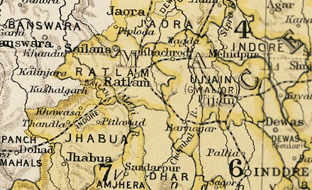
Sailana (Staat) — Flagge von Sailana Kartenausschnitt aus dem Imperial Gazetteer of India Sai … Deutsch Wikipedia
Shailana — Flagge von Sailana Kartenausschnitt aus dem Imperial Gazetteer of India Sailana (सैलाना) war einer der Fürstenstaaten der Central India Agency von Britisch Indien im heutigen Bund … Deutsch Wikipedia
Rathor Dynasty — The Rathor Dynasty was a ruling dynasty in India.HistoryIts origins can be traced back to Rao Shivaji of Palli, the Rao of Palli between 1226 or 1250 and 1273. Later scholars claim that he was a son of Set Ram, a descendant of Maharajadhiraj Jai… … Wikipedia
Liste indischer Fürstenstaaten — Patiala, Nabha, Malerkota, Jind und der Distrikt Ludhiana im Punjab (1911) Diese Liste indischer Fürstenstaaten gibt die bedeutenderen Staatsgebilde wieder, die zur Zeit der britischen Kolonialherrschaft auf dem Subkontinent (ohne Birma)… … Deutsch Wikipedia
Chhatarpur — This article is about the municipality in Madhya Pradesh, India. For its namesake district, see Chhatarpur District. Chhatarpur city … Wikipedia
Flora and fauna of Madhya Pradesh — Madhya Pradesh is often called the Heart of India , is a state in central India. Its capital is Bhopal. Madhya Pradesh was originally the largest state in India until November 1, 2000 when the state of Chhattisgarh was carved out. It borders the… … Wikipedia
Datia State — [1] had formerly been a state in the Bundelkhand region founded in 1626. The ruling family were Rajputs of the Bundela clan; they descended from a younger son of a former raja of Orchha. The state was administered as part of the Bundelkhand… … Wikipedia
Dhar State — Dhar was a princely state of India during the British Raj. Dhar began as one of the states during Mahratta dominance in India about 1730. In 1941 it had an area of 1,798 square miles (4,660 km2) and a population of 253,210. Dhar was part of… … Wikipedia
 Flagge von Sailana
 Kartenausschnitt aus dem Imperial Gazetteer of India