San Clemente Island

San Clemente Island
San Clemente Island
NASA-Bild von San Clemente Island
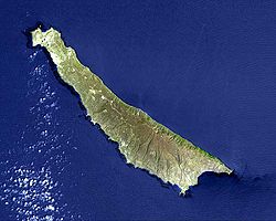
Gewässer Pazifischer Ozean
Inselgruppe Kanalinseln
Geographische Lage 32° 55′ N, 118° 31′ W32.920833333333-118.51555555556599Koordinaten: 32° 55′ N, 118° 31′ W
San Clemente Island (Kalifornien)
San Clemente Island
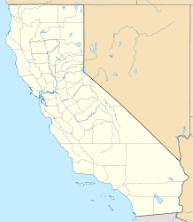
Länge 39 km
Fläche 147,13 km²
Höchste Erhebung Vista Point
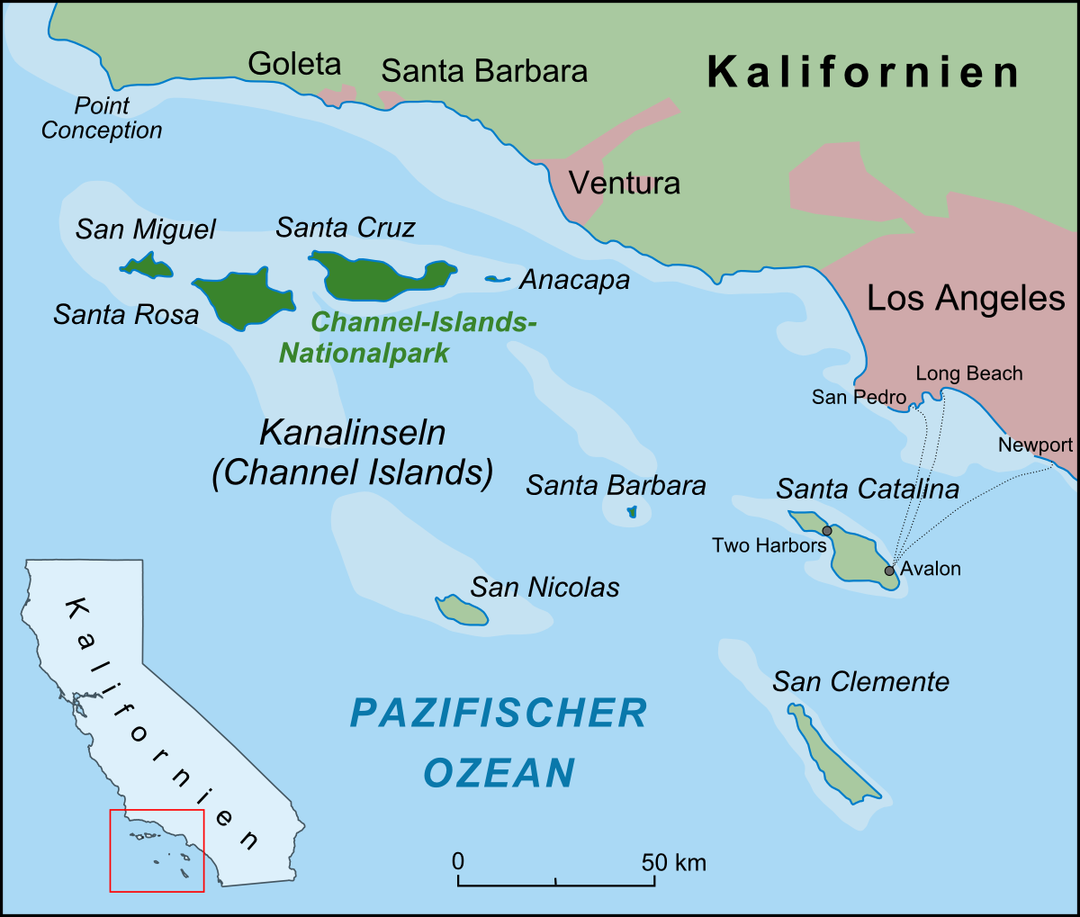
599 m
Einwohner (unbewohnt)
Karte der Kanalinseln, San Clemente im Südosten

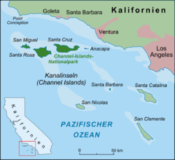
San Clemente Island, kurz SCI, ist die südlichste Insel der kalifornischen Kanalinseln. Die 39 km lange und 147,13 km² große, unbewohnte Insel erreicht eine Höhe von 599 m über dem Meer[1] und gehört administrativ zum Los Angeles County in Kalifornien. Die Stadt San Clemente im Orange County ist nach der Insel benannt.

Geschichte

Archäologen fanden auf der Insel 10.000 Jahre alte Spuren von Menschen. Die Insel wurde am 23. November 1602 von Sebastian Vizcaino entdeckt. Er nannte die Insel San Clemente, da an dem Tag der Gedenktag von Clemens von Rom war. Im 19. und 20. Jahrhundert bewohnten die Insel Farmer, Fischer und Schmuggler. Seit 1934 wird die Insel von der United States Navy verwaltet.

Weblinks

 Commons: San Clemente Island – Sammlung von Bildern, Videos und Audiodateien

www.scisland.org Informationen zur Insel (englisch)

Einzelnachweise

  1. UNEP Islands Directory (englisch)

Wikimedia Foundation.

Игры ⚽ Нужен реферат?

Schlagen Sie auch in anderen Wörterbüchern nach:

  • San Clemente Island — or SCI is the southernmost of the Channel Islands of California. It is owned and operated by the United States Navy, and is a part of Los Angeles County. Defined by the United States Census Bureau as Block Group 2 of Census Tract 5991 of Los… …   Wikipedia

  • San Clemente Island — Île San Clemente Image satellite de l île de San Clemente L île San Clemente ou SCI est la plus au sud de l archipel. Son territoire est dirigé par la Marine américaine et fait partie du Comté de Los Angeles. Elle mesure 39 kilomètres de long et… …   Wikipédia en Français

  • San Clemente Island — Sp Sán Klemeñtės salà Ap San Clemente Island L Ramiajame vand., Sąsiaurio ss., JAV (Kalifornija) …   Pasaulio vietovardžiai. Internetinė duomenų bazė

  • San Clemente Island goats — first arrived on San Clemente Island from Santa Catalina Island in 1875. There they remained feral until the United States Navy, which was under a directive to preserve the endangered flora and fauna of the island that were threatened by the… …   Wikipedia

  • San Clemente Island — geographical name island S California, southernmost of Channel Islands …   New Collegiate Dictionary

  • Naval Auxiliary Landing Field San Clemente Island — NALF San Clemente Island Frederick Sherman Field IATA: none – ICAO: KNUC – FAA LID: NUC …   Wikipedia

  • US Naval Auxiliary Landing Facility San Clemente Island — The US Navy has owned the Naval Auxiliary Landing Field (NALF), San Clemente Island since 1937, but came into its current importance during the past decade. It is the Navy s only remaining live fire range. San Clemente is the southernmost Channel …   Wikipedia

  • San Nicolas Island — w1Vorlage:Infobox Insel/Wartung/Höhe fehlt San Nicolas Island Luftaufnahme von San Nicolas Gewässer Pazifischer Ozean …   Deutsch Wikipedia

  • San Clemente (Kalifornien) — San Clemente Die Stadt vom San Clemente Pier aus gesehen Lage in Kalifornien …   Deutsch Wikipedia

  • San Clemente Palace Venice (Venice) — San Clemente Palace Venice country: Italy, city: Venice (City Centre: St. Mark s Square) San Clemente Palace Venice From its vantage point on San Clemente Island in the centre of the lagoon, the San Clemente Palace Venice boasts views of Piazza… …   International hotels

Share the article and excerpts

Direct link
Do a right-click on the link above
and select “Copy Link”