Sipadan

Sipadan

Vorlage:Infobox Insel/Wartung/Bild fehltVorlage:Infobox Insel/Wartung/Fläche fehltVorlage:Infobox Insel/Wartung/Höhe fehlt

Sipadan
Gewässer Celebessee
Geographische Lage 4° 6′ 52,86″ N, 118° 37′ 43,52″ O4.1146833333333118.62875555556Koordinaten: 4° 6′ 52,86″ N, 118° 37′ 43,52″ O
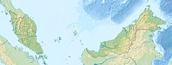
Sipadan (Malaysia)
Sipadan
Tauchrevier Sipadan
Riffhai Sipadan

Sipadan ist eine zu Malaysia gehörende Insel in der Celebessee östlich von Borneo. Sie ist Teil des malaysischen Bundesstaates Sabah. Die Insel wurde international bekannt durch den Entführungsfall Abu Sayyaf im Jahr 2000, bei dem ausländische Touristen von islamischen Terroristen entführt wurden.

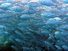
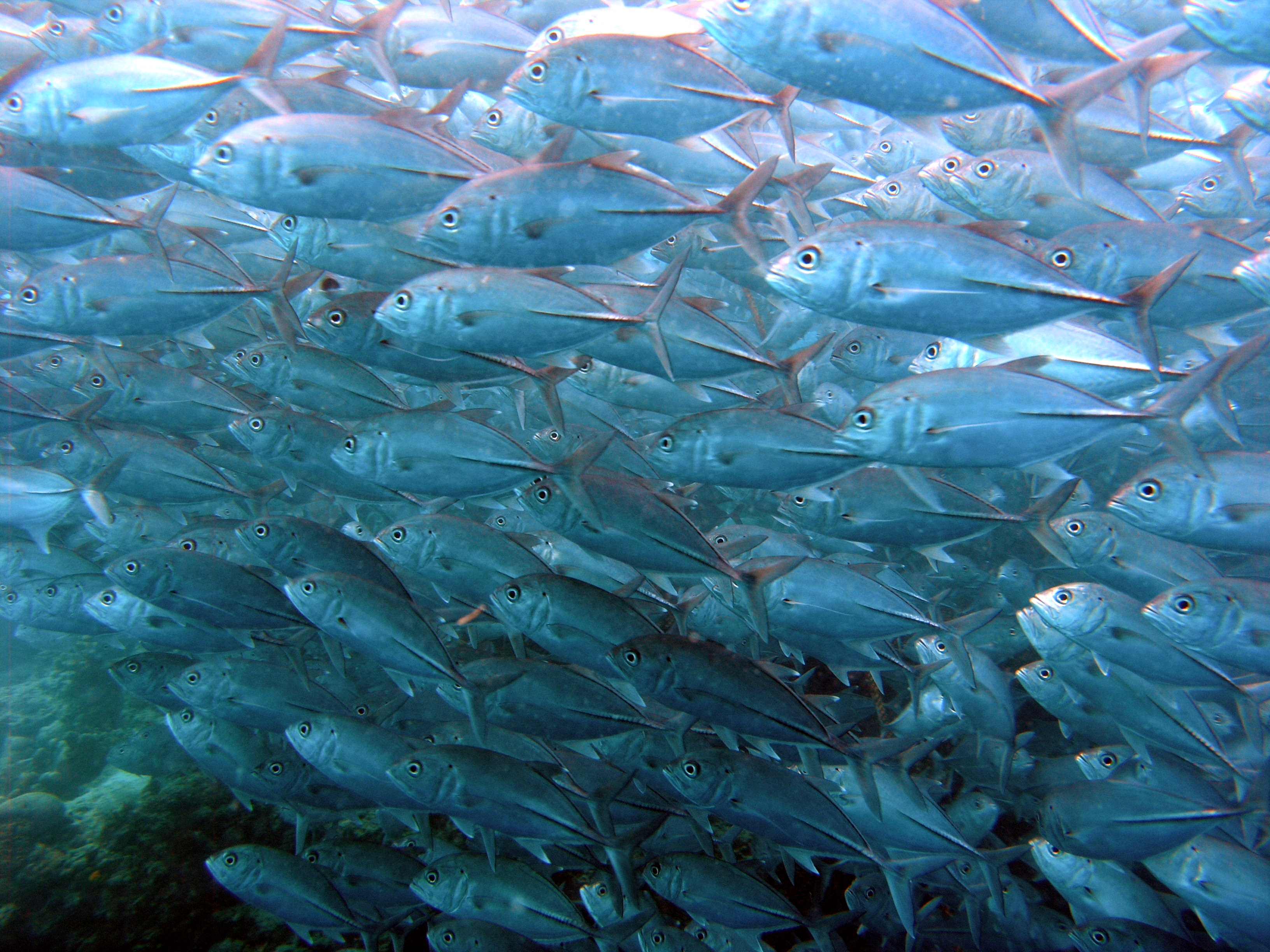
Sipadan ist als Tauchgebiet bekannt. Der Reichtum an maritimem Leben ist enorm und reicht von Riffhai(Foto) und Barracuda bis zu den verschiedensten Büffelkopf-Papageifischen (Bolbometopon muricatum). Zudem können auch Schildkröten in großer Zahl beobachtet werden.[1]

Die wichtigsten Tauchplätze auf Sipadan sind:

  • Barracuda Point
  • Coral Garden
  • The Drop Off
  • Hanging Gardens
  • Sipidan Midreef
  • South Point
  • Staghorn Crest
  • Turtle Cavern
  • Whitetip Avenue

2004 wurde die Insel zum Naturschutzgebiet erklärt und das dortige Touristenresort geschlossen. Die nächsten Resorts befinden sich auf den nahe gelegenen Inseln Mabul oder Kapalai. Die Insel darf seither nur noch bei Tageslicht von einer begrenzten Anzahl von Personen besucht werden und es ist nicht mehr erlaubt, auf der Insel zu übernachten. Auch das Betreten eines großen Teils der Insel wurde eingeschränkt. Einzig eine kleine Militär- und Polizeistation ist noch bewohnt.

Weblinks

Einzelnachweis

  1. Hier sieht man die Schildkröten auf Sipadan schwimmen. Gefilmt von Christoph Brüx

Wikimedia Foundation.

Игры ⚽ Нужно сделать НИР?

Schlagen Sie auch in anderen Wörterbüchern nach:

  • Sipadan — is the only oceanic island in Malaysia, rising 2,000 feet or 600m from the seabed. It is located in the Celebes Sea east of the major town of Tawau and off the coast of East Malaysia on the Island of Borneo. It was formed by living corals growing …   Wikipedia

  • Sipadan — 4°6′52.86″N 118°37′43.52″E / 4.1146833, 118.6287556 Sipadan est la seule île océanique de la Malaisie, avec une élév …   Wikipédia en Français

  • Indonesia-Malaysia border — The border between the Southeast Asian countries of Indonesia and Malaysia consist of both a land border separating the two countries territories on the island of Borneo as well as maritime boundaries along the length of the Straits of Malacca,… …   Wikipedia

  • Mabul — is an island off the south eastern coast of Sabah in Malaysia. It first became popular due to its proximity to Sipadan island. Few years back, it has gained its recognition as one of the best muck diving sites in the world. Mabul island is a… …   Wikipedia

  • Лигитанские острова — малайск. Kepulauan Ligitan англ. Ligitan group of islands …   Википедия

  • Abu Sayyaf — Sword of God redirects here. For the 7th century Arab Muslim military commander known as the Sword of God , see Khalid ibn al Walid. For the album by Quasi, see The Sword of God Infobox War Faction name=Abu Sayyaf Group. war=the Islamic… …   Wikipedia

  • Капалай — малайск. Kapalai Координаты: Координаты …   Википедия

  • Лигитан — Координаты: 4°14′45.45″ с. ш. 118°37′52.01″ в. д. / 4.245958° с. ш. 118.631114° в. д.  …   Википедия

  • North Borneo dispute — refers to the status of northeastern part of the state of Sabah in Malaysia. Sabah was previously known as North Borneo prior to the formation of the Malaysian federation in 1963. The Philippines through the heirs of the Sultanate of Sulu claim… …   Wikipedia

  • Foreign relations of Malaysia — Malaysia This article is part of the series: Politics and government of Malaysia …   Wikipedia

Share the article and excerpts

Direct link
Do a right-click on the link above
and select “Copy Link”