São Francisco da Serra

São Francisco da Serra
Wappen Karte
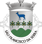
Wappen von São Francisco da Serra
São Francisco da Serra (Portugal)
São Francisco da Serra
Basisdaten
Region: Alentejo
Unterregion: Alentejo Litoral
Distrikt: Setúbal
Concelho: Santiago do Cacém
Koordinaten: 38° 6′ N, 8° 40′ W38.091944444444-8.6630555555556Koordinaten: 38° 6′ N, 8° 40′ W
Einwohner: 1.400 (Stand: 2001)
Fläche: 51,42 km²
Bevölkerungsdichte: 27 Einwohner pro km²

Vorlage:Infobox Ort in Portugal/Wartung/Art ist leer

Vorlage:Infobox Ort in Portugal/Wartung/Karte ist leer


Vorlage:Infobox Ort in Portugal/Wartung/Höhe ist leer Vorlage:Infobox Ort in Portugal/Wartung/PLZ ist leer Vorlage:Infobox Ort in Portugal/Wartung/Bürgermeister ist leer

Vorlage:Infobox Ort in Portugal/Wartung/Einwohnerstand ist leer

Vorlage:Infobox Ort in Portugal/Wartung/Verwaltungsort ist leer Vorlage:Infobox Ort in Portugal/Wartung/Webseite ist leer Vorlage:Infobox Ort in Portugal/Wartung/Email ist leer

São Francisco da Serra ist eine Gemeinde an der Atlantikküste des Alentejo Litoral in Portugal. Sie ist Teil des Regierungsbezirks (concelho) von Santiago do Cacém.

Typische Windmühlen im Gebiet von São Francisco da Serra

São Francisco da Serra besteht aus den Orten Cruz de João Mendes, Foros da Palhota, Roncão und São Francisco da Serra. Die Gemeinde umfasst eine Gesamtfläche 51,42 km², mit einer Bevölkerung von ca. 1.400 Einwohnern. Es handelt sich um eine ländliche gebirgige Gegend inmitten einer touristisch kaum erschlossenen Küstenlandschaft. Neben einer Korkfabrik gibt es eine historische Kirche und einige alte Windmühlen in der Gemeinde.

Die Gründung der Gemeinde geht auf die mittelalterliche Periode des Ordens von Santiago zurück. Die ersten menschlichen Ansiedlungen bestehen bereits seit der Bronzezeit in der die Kelten und Phönizier diesen Landstrich besiedelten. Dies bezeugen zahlreiche Ausgrabungen und Funde, die im staatlichen Museum von Santiago do Cacém zu sehen sind.

Weblinks


Wikimedia Foundation.

Игры ⚽ Поможем написать курсовую

Schlagen Sie auch in anderen Wörterbüchern nach:

  • São Francisco da Serra — Freguesia de Portugal …   Wikipedia Español

  • Sao Francisco da Serra — 38.091944444444 8.66305555555567Koordinaten: 38° 6′ N, 8° 40′ W …   Deutsch Wikipedia

  • São Bartolomeu da Serra — Wappen Karte …   Deutsch Wikipedia

  • São Francisco de Paula — São Francisco de Paula …   Wikipedia Español

  • São Francisco de Paula — is a city located in the Serra Gaúcha of the state of Rio Grande do Sul, Brazil. The municipality covers about 3,289.7 km² and sits about 112 km from Porto Alegre. City population estimate for 2004 is 19,968. The municipality was originally… …   Wikipedia

  • São Francisco —   [sãu̯ frã sisku], Rio São Francisco [rriu̯ ], Strom in Brasilien, 2 900 km lang (1 500 km schiffbar), mit einem Einzugsgebiet von 630 000 km2, entspringt im Süden von Minas Gerais in der Serra da Canastra, mündet als Grenzfluss zwischen Sergipe …   Universal-Lexikon

  • São Francisco [2] — São Francisco, Fluß in Brasilien, entspringt im brasil. Staate Minas Geraës, in der Serra de Canastra, unter 20°20´ südl. Br., durchfließt diesen Staat, dann Bahia, bildet darauf die Grenze gegen Pernambuco, dann zwischen Alagoas und Sergipe und… …   Meyers Großes Konversations-Lexikon

  • Sao Francisco — Vorlage:Infobox Fluss/DGWK fehltVorlage:Infobox Fluss/FLUSSSYSTEM fehltVorlage:Infobox Fluss/ABFLUSS altVorlage:Infobox Fluss/ABFLUSS fehlt Rio São Francisco Canyon am Rio São Francisco …   Deutsch Wikipedia

  • São Francisco River — River, eastern Brazil. The largest river wholly within Brazil, it flows north and east across the great Central Plateau for about 1,811 mi (2,914 km) to its mouth on the Atlantic Ocean. The upper river valley is an area of thorny forest… …   Universalium

  • Muquém de São Francisco —   Municipality and town   Country  Brazil Region …   Wikipedia

Share the article and excerpts

Direct link
Do a right-click on the link above
and select “Copy Link”