- Balilihan
-
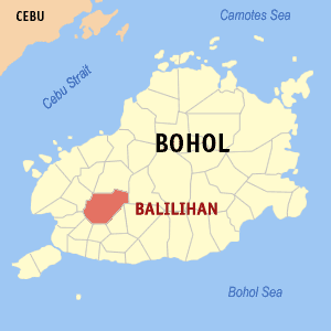
Municipality of Balilihan Lage von Balilihan in der Provinz Bohol 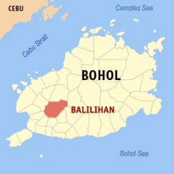
Basisdaten Bezirk: Central Visayas Provinz: Bohol Barangays: 31 Distrikt: 1. Distrikt von Bohol PSGC: 071206000 Einkommensklasse: 5. Einkommensklasse Haushalte: 3101 Zensus 1. Mai 2000Einwohnerzahl: 17.131 Zensus 1. August 2007Bevölkerungsdichte: 114 Einwohner je km² Fläche: 150,22 km² Koordinaten: 9° 45′ N, 124° 1′ O9.75778124.00955Koordinaten: 9° 45′ N, 124° 1′ O Postleitzahl: 6342 Bürgermeister: Victoria Migriño Chatto Offizielle Webpräsenz: Balilihan Geographische Lage auf den Philippinen 

Balilihan Balilihan ist eine philippinische Stadtgemeinde in der Provinz Bohol. Sie hat 17.131 Einwohner in 3101 Haushalten (Zensus 1. Mai 2000).
Den Namen erhielt die Gemeinde von dem Gras balili, welches in der Gegend reichlich vorkommt. Die Gründung der Gemeinde Balilihan erfolgte am 29. September 1828. Davor gehörte das Gebiet zu der sehr viel älteren Gemeinde Baclayon.
Baranggays
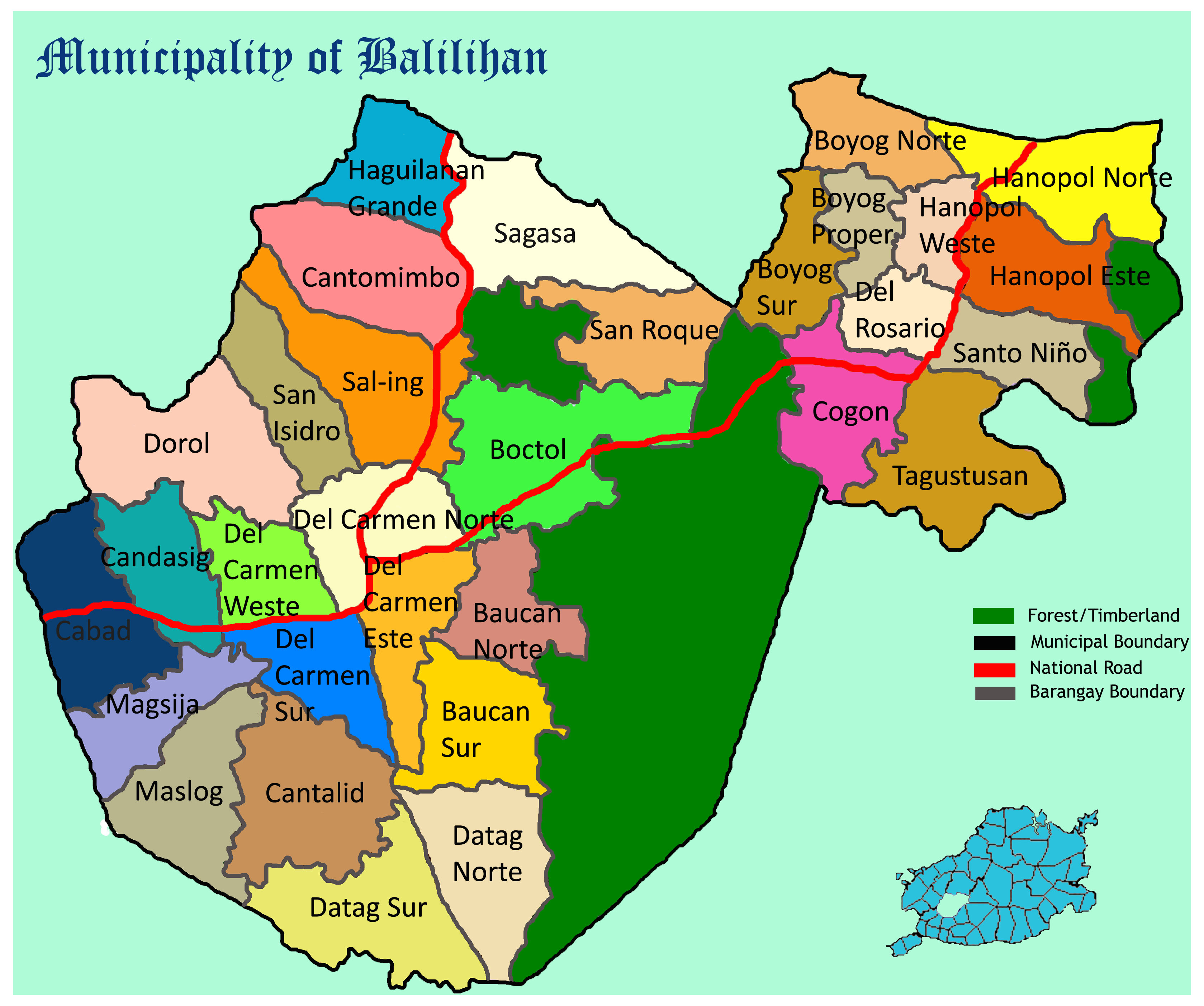
Balilihan ist politisch in 31 Baranggays unterteilt.
- Baucan Norte
- Baucan Sur
- Boctol
- Boyog Norte
- Boyog Proper
- Boyog Sur
- Cabad
- Candasig
- Cantalid
- Cantomimbo
- Cogon
- Datag Norte
- Datag Sur
- Del Carmen Este (Pob.)
- Del Carmen Norte (Pob.)
- Del Carmen Weste (Pob.)
- Del Carmen Sur (Pob.)
- Del Rosario
- Dorol
- Haguilanan Grande
- Hanopol Este
- Hanopol Norte
- Hanopol Weste
- Magsija
- Maslog
- Sagasa
- Sal-ing
- San Isidro
- San Roque
- Santo Niño
- Tagustusan
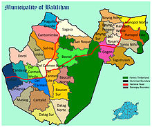 Karte der Gemeinde Balilihan
Bilder
-
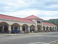
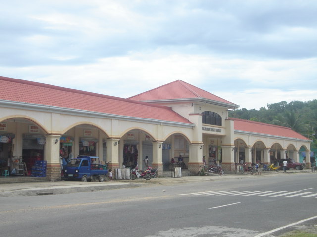
Öffentlicher Markt von Balilihan
-

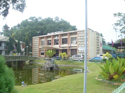
Gemeindeverwaltung von Balilihan
-

Deckengemälde in der röm. katholischen Kirche von Balilihan
Weblinks
Städte und Stadtgemeinden in der Provinz BoholStädte: Tagbilaran
Stadtgemeinden: Alburquerque | Alicia | Anda | Antequera | Baclayon | Balilihan | Batuan | Bien Unido | Bilar | Buenavista | Calape | Candijay | Carmen | Catigbian | Clarin | Corella | Cortes | Dagohoy | Danao | Dauis | Dimiao | Duero | Garcia Hernandez | Getafe | Guindulman | Inabanga | Jagna | Lila | Loay | Loboc | Loon | Mabini | Maribojoc | Panglao | Pilar | Pres. Carlos P. Garcia | Sagbayan | San Isidro | San Miguel | Sevilla | Sierra Bullones | Sikatuna | Talibon | Trinidad | Tubigon | Ubay | Valencia
Wikimedia Foundation.
Schlagen Sie auch in anderen Wörterbüchern nach:
Balilihan — carte de Bohol avec localisation de Balilihan Balilihan est une municipalité de la province de Bohol. Elle compte 31 barangays : Baucan Norte Baucan Sur Boctol Boyog Norte Boyog Proper Boyog Sur Cabad Candasig Cantalid Cantomimbo … Wikipédia en Français
Balilihan — Original name in latin Balilihan Name in other language Balilihan, Balilinan State code PH Continent/City Asia/Manila longitude 9.7561 latitude 123.973 altitude 104 Population 2931 Date 2011 07 31 … Cities with a population over 1000 database
Balilihan (Bohol) — Balilihan carte de Bohol avec localisation de Balilihan Balilihan est une municipalité de la province de Bohol. Elle compte 31 barangays : Baucan Norte Baucan Sur Boctol Boyog Norte Boyog Proper Boyog Sur Cabad Candasig … Wikipédia en Français
Balilihan, Bohol — Infobox Philippine municipality infoboxtitle = Municipality of Balilihan locatormapfile = Ph locator bohol balilihan.png caption = Map of Bohol showing the location of Balilihan. region = Central Visayas province = Bohol districts = 1st district… … Wikipedia
Churches in Bohol — Bohol, in the Philippines, has a number of very old churches, dating back to the early years of the Spanish colonization of the island. Contents 1 Alburquerque 2 Anda 3 Antequera 4 Baclayon … Wikipedia
Bohol — Infobox Philippine province name = Bohol sealfile = Ph seal bohol.png region = Central Visayas (Region VII) capital = Tagbilaran City founded = March 25, 1565 pop2000 = 1,137,268 pop2000rank = 18th largest popden2000 = 276 popden2000rank = 25th… … Wikipedia
Catigbian, Bohol — Infobox Philippine municipality infoboxtitle = Municipality of Catigbian sealfile = locatormapfile = Ph locator bohol catigbian.png caption = Map of Bohol showing the location of the town of Catigbian. region = Central Visayas (Region VII)… … Wikipedia
Cortes, Bohol — Map of Bohol showing the location of Cortes Poblacion … Wikipedia
Legislative districts of Bohol — Philippines This article is part of the series: Politics and government of the Philippines … Wikipedia
Corella, Bohol — Corella Municipality Map of Bohol showing the location of Corella … Wikipedia
Balilihan


18+
© Academic, 2000-2026
- Kontaktieren Sie uns: Unterstützung, Werbung
Wörterbücher Export, schritte mit PHP, Joomla, Drupal, WordPress, MODx.