Tamalpais-Homestead Valley
- Tamalpais-Homestead Valley
-
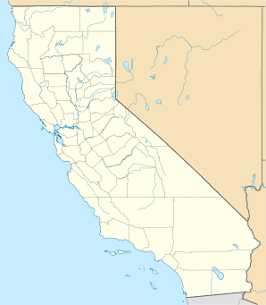
Tamalpais-Homestead Valley ist eine Stadt im Marin County im US-Bundesstaat Kalifornien, Vereinigte Staaten, mit 11.000 Einwohnern (Stand: 2004). Die geographischen Koordinaten sind: 37,89° Nord, 122,54° West. Das Stadtgebiet hat eine Größe von 12,9 km².
Wikimedia Foundation.
Schlagen Sie auch in anderen Wörterbüchern nach:
Tamalpais-Homestead Valley — Lugar designado por el censo de los Estados Unidos … Wikipedia Español
Tamalpais-Homestead Valley — Tamalpais Homestead Valley, CA U.S. Census Designated Place in California Population (2000): 10691 Housing Units (2000): 4646 Land area (2000): 4.982342 sq. miles (12.904205 sq. km) Water area (2000): 0.012460 sq. miles (0.032271 sq. km) Total… … StarDict's U.S. Gazetteer Places
Tamalpais-Homestead Valley, CA — U.S. Census Designated Place in California Population (2000): 10691 Housing Units (2000): 4646 Land area (2000): 4.982342 sq. miles (12.904205 sq. km) Water area (2000): 0.012460 sq. miles (0.032271 sq. km) Total area (2000): 4.994802 sq. miles… … StarDict's U.S. Gazetteer Places
Tamalpais-Homestead Valley — Original name in latin Tamalpais Homestead Valley Name in other language State code US Continent/City America/Los Angeles longitude 37.87834 latitude 122.53625 altitude 12 Population 10735 Date 2011 05 14 … Cities with a population over 1000 database
Tamalpais-Homestead Valley, California — Infobox Settlement official name = Tamalpais Homestead Valley, California other name = native name = nickname = settlement type = CDP motto = imagesize = image caption = flag size = image seal size = image shield = shield size = image blank… … Wikipedia
Tamalpais — Homestead Valley, CA U.S. Census Designated Place in California Population (2000): 10691 Housing Units (2000): 4646 Land area (2000): 4.982342 sq. miles (12.904205 sq. km) Water area (2000): 0.012460 sq. miles (0.032271 sq. km) Total area (2000) … StarDict's U.S. Gazetteer Places
Tamalpais, CA — Tamalpais Homestead Valley, CA U.S. Census Designated Place in California Population (2000): 10691 Housing Units (2000): 4646 Land area (2000): 4.982342 sq. miles (12.904205 sq. km) Water area (2000): 0.012460 sq. miles (0.032271 sq. km) Total… … StarDict's U.S. Gazetteer Places
Tamalpais High School — Infobox Education in the United States name= Tamalpais High School imagesize= 320px motto= motto translation= Tam s Arch Tower at Dusk, Summer 2006 streetaddress = 700 Miller Avenue city = Mill Valley state = California country = USA zipcode =… … Wikipedia
Tamalpais Union High School District — Infobox Education in the United States name= Tamalpais Union High School District imagesize= motto= motto translation= streetaddress = 395 Doherty Drive city = Larkspur state = California zipcode = 94977 url = http://www.tamdistrict.org/index.htm … Wikipedia
Mill Valley, California — For the former settlement of this name, see Mill Valley, Calaveras County, California. City of Mill Valley City Throckmorton Ave. in downtown … Wikipedia