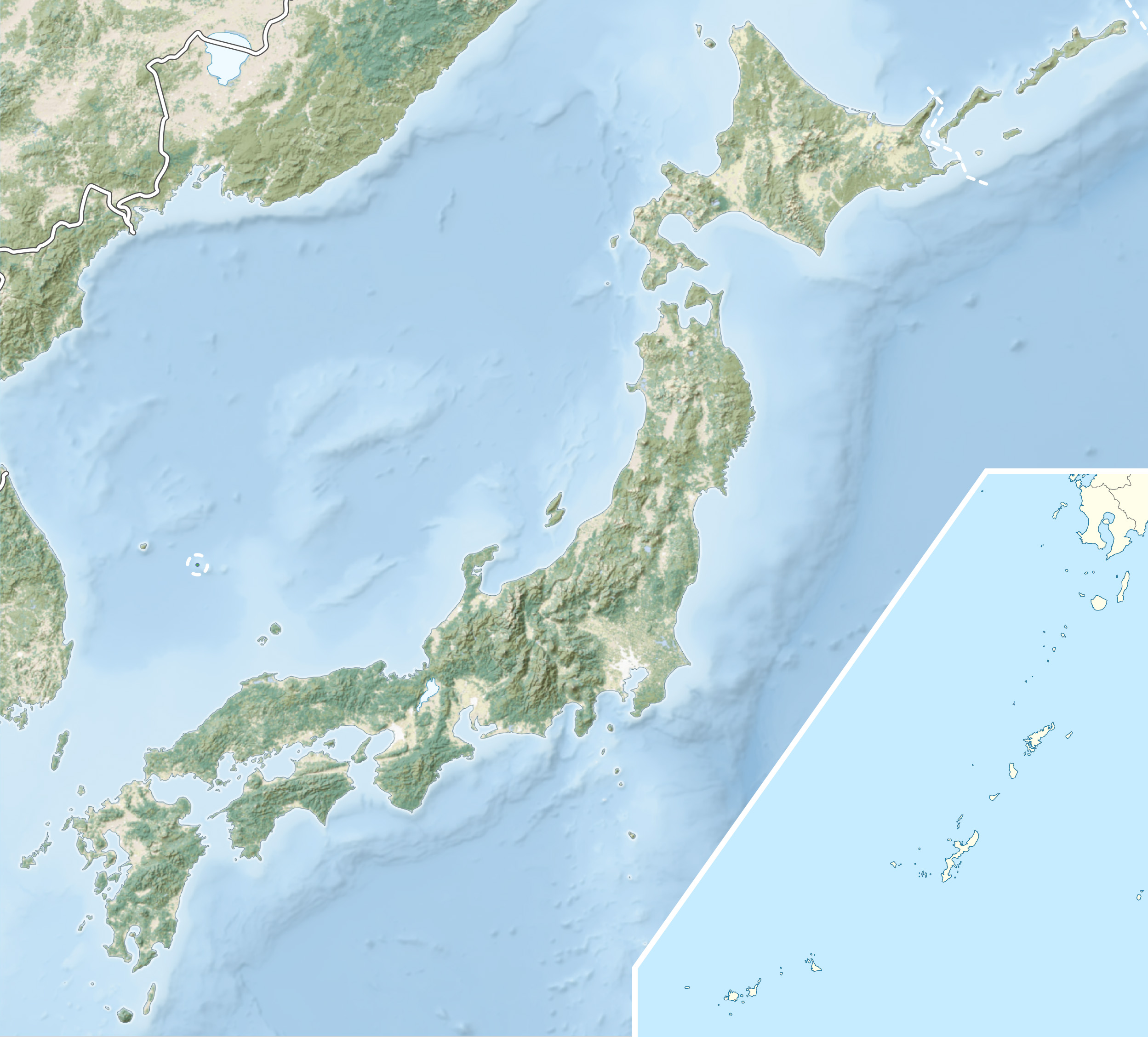
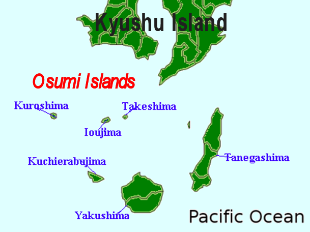
Tanegashima

Tanegashima
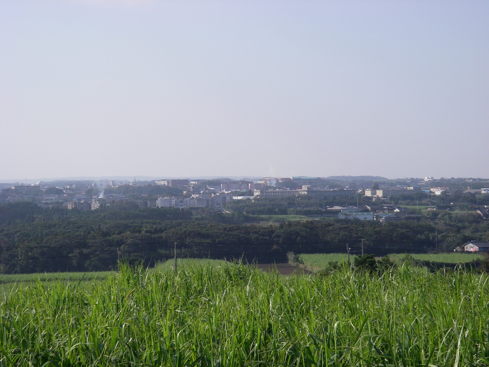
Tanegashima
Ort Nakatane
Ort Nakatane
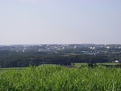
Gewässer Ostchinesisches Meer
Inselgruppe Ōsumi-Inseln
Geographische Lage 30° 34′ N, 130° 59′ O30.573888888889130.98111111111282Koordinaten: 30° 34′ N, 130° 59′ O
Tanegashima (Japan)
Tanegashima
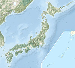
Länge 57,5 km
Breite 12 km
Fläche 444,99 km²
Höchste Erhebung Takamineo-yama
282 m
Einwohner 36.000
81 Einw./km²
Hauptort Nishinoomote
Karte mit Tanegashima im Osten

Tanegashima (jap. 種子島, deutsch „Insel von Tane“) ist eine Insel im Süden von Japan. Sie gehört zur Präfektur Kagoshima. Im Südosten liegt ein japanischer Weltraumbahnhof, das Tanegashima Space Center, und die japanische Weltraumagentur hat dort ihren Sitz.

Auf der Insel befindet sich die kreisfreie Stadt Nishinoomote, sowie die Gemeinden Nakatane und Minamitane des Landkreises Kumage.

Historische Bedeutung bekam die Insel im Jahr 1543, als ein chinesisches Schiff mit den Portugiesen Antônio da Mota, Antônio Peixoto, und Francisco Zeimoto an Bord am Kap Kadokura (門倉崎, Kadokura-saki) im Süden der Insel auflief. Dies war der erste Kontakt zwischen Europäern und Japanern und mit dem Tanegashima-Gewehr die erste westliche Feuerwaffe eingeführt wurde.

Siehe auch

Literatur

  • Olof Lidin: Tanegashima: The Arrival of Europe in Japan. NIAS Press, Kopenhagen 2002, ISBN 0-7007-1674-2

Karte

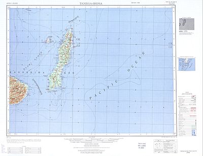
Kartenblatt Tanegashima 1:250.000

Wikimedia Foundation.

Игры ⚽ Поможем сделать НИР

Schlagen Sie auch in anderen Wörterbüchern nach:

  • Tanegashima — (Japanese: 種子島) is an island lying to the south of Kyūshū, south Japan, and is part of the Kagoshima Prefecture. The island is the second largest of the Osumi Islands.It is a long low stretch of land, carefully cultivated, 57.5 kilometers from… …   Wikipedia

  • Tanegashima — Para otros usos de este término, véase Tanegashima (desambiguación). Vista de la ciudad de Nishinoomote …   Wikipedia Español

  • Tanegashima — 30°34′26″N 130°58′52″E / 30.57389, 130.98111 Tanegashima (japonais : 種子島) est une île se situant au sud de l île de Kyus …   Wikipédia en Français

  • Tanegashima-Arkebuse — Allgemeine Information Zivile Bezeichnung …   Deutsch Wikipedia

  • Tanegashima (desambiguación) — Tanegashima puede referirse a: Tanegashima, isla del sur de Japón y conocido por ser el lugar de contacto entre europeos y japoneses en 1543. Centro Espacial Tanegashima, ubicado en la isla señalada anteriormente. (8866) Tanegashima, un asteroide …   Wikipedia Español

  • Tanegashima Araki Hotel — (Nishinoomote,Япония) Категория отеля: 3 звездочный отель Адрес: 891 3111 Ка …   Каталог отелей

  • Tanegashima Space Center — Centre spatial de Tanegashima Lancement du fusée H IIA du centre de Tanegashima Le centre spatial de Tanegashima (種子島宇宙センター) est un port spatial japonais. Il est situé sur l ile de Tanegashima, à 115 km au sud de Kyushu. Il a été construit en… …   Wikipédia en Français

  • Tanegashima Space Center — Start einer H IIA mit Kayuga vom Launch Pad 1 des Launch Complex Yoshinobu Das Tanegashima Space Center (jap. 種子島宇宙センター, Tanegashima uchū sentā, oft als TNSC abgekürzt) ist ein japanischer Weltraumbahnhof in Minamitane auf der Insel Tanegashima …   Deutsch Wikipedia

  • Tanegashima clan — The nihongo|Tanegashima clan|種子島氏|Tanegashima shi| is a Japanese clan that originated on Tanegashima Island, just south of Kyūshū. From the Sengoku era to the start of the Meiji era, the Tanegashima were retainers of the Shimazu clan of Satsuma… …   Wikipedia

  • Tanegashima Space Center — The nihongo|Tanegashima Space Center|種子島宇宙センター|tanegashima uchū sentā (TNSC) is one of Japan s space development facilities. It is located on Tanegashima Island, 115 km south of Kyūshū. It was established in 1969 when the National Space… …   Wikipedia

Share the article and excerpts

Direct link
Do a right-click on the link above
and select “Copy Link”