Taos County (New Mexico)

Taos County (New Mexico)
Verwaltung
US-Bundesstaat: New Mexico
Verwaltungssitz: Taos
Adresse des
Verwaltungssitzes:
Gründung:
Gebildet aus:
Vorwahl:
Demographie
Einwohner: 29.979  (2000)
Bevölkerungsdichte: 5,3 Einwohner/km²
Geographie
Fläche gesamt: 5.710 km²
Wasserfläche: 4 km²
Karte
Karte von Taos County innerhalb von New Mexico
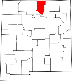
Website: taoscounty.org/

Das Taos County ist ein County im Norden des US-Bundesstaates New Mexico. Das County hat eine Einwohnerzahl von 29.979 und eine Fläche von 5710 km². Höchster Punkt des Countys und des ganzen Bundesstaates ist der Wheeler Peak mit 4011 m ü. NN.

Geographie

Das County hat eine Fläche von 5.710 km², davon sind 5.706 km² Land und 4 km² Wasser.

Nachbarcountys

Städte und Dörfer

  • Amalia
  • Arroyo Hondo
  • Arroyo Seco
  • Carson
  • Cerro
  • Chamisa
  • Costilla
  • El Prado
  • El Rito
  • Las Trampas
  • Llano
  • Ojo Caliente
  • Ojo Sarco
  • Penasco
  • Picuris Pueblo
  • Questa
  • Ranchos de Taos
  • Red River
  • Rio Lucio
  • Taos
  • Taos Pueblo
  • Taos Ski Valley
  • Vadito

36.57-105.637Koordinaten: 36° 34′ N, 105° 38′ W


Wikimedia Foundation.

Игры ⚽ Поможем решить контрольную работу

Schlagen Sie auch in anderen Wörterbüchern nach:

  • Taos County, New Mexico — Infobox U.S. County county = Taos County state = New Mexico map size = 200 founded = seat = Taos | largest city = Taos area total sq mi =2205 area water sq mi =1 area percentage = 0.07% census yr = 2000 pop = 29979 density km2 =5.2538 web =… …   Wikipedia

  • National Register of Historic Places listings in Taos County, New Mexico — Location of Taos County in New Mexico This is a list of the National Register of Historic Places listings in Taos County, New Mexico. This is intended to be a complete list of the properties and districts on the National Register of Historic… …   Wikipedia

  • Taos Pueblo, New Mexico — Infobox Settlement official name = Taos Pueblo, New Mexico settlement type = CDP nickname = motto = imagesize = 250px image caption = Taos Pueblo image image mapsize = 250px map caption = Location of Taos Pueblo, New Mexico mapsize1 = map… …   Wikipedia

  • Baldy Mountain (Taos County, New Mexico) — For other peaks with this name in New Mexico, see Baldy Mountain (New Mexico). For other peaks in North America with this name, see Baldy Mountain. Baldy Mountain is a high peak of the Sangre de Cristo Mountains of New Mexico, just east of Latir… …   Wikipedia

  • Colfax County, New Mexico — Colfax County Courthouse in Raton, New Mexico …   Wikipedia

  • Mora County, New Mexico — Mora County Courthouse in Mora, New Mexico …   Wikipedia

  • Rio Arriba County, New Mexico — Infobox U.S. County county = Rio Arriba County state = New Mexico map size = 200 founded = 1852 seat = Tierra Amarilla | largest city = Española area total sq mi =5896 area water sq mi =38 area percentage = 0.65% census yr = 2000 pop = 41190… …   Wikipedia

  • Mora County (New Mexico) — Verwaltung US Bundesstaat: New Mexico Verwaltungssitz: Mora Adresse des Verwaltungssitzes: County Courthouse P.O. Box 580 Mora, NM 87732 0580 Gründung: 1859 …   Deutsch Wikipedia

  • Bernalillo County (New Mexico) — Verwaltung US Bundesstaat: New Mexico Verwaltungssitz: Albuquerque Adresse des Verwaltungssitzes: Gründung …   Deutsch Wikipedia

  • Catron County (New Mexico) — Verwaltung US Bundesstaat: New Mexico Verwaltungssitz: Reserve Adresse des Verwaltungssitzes: Gründung: 25. Februar 1921 …   Deutsch Wikipedia

Share the article and excerpts

Direct link
Do a right-click on the link above
and select “Copy Link”