- Tarahiki Island
-
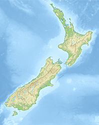
Tarahiki Island Gewässer Hauraki-Golf Geographische Lage 36° 47′ 30″ S, 175° 12′ 58″ O-36.791666666667175.2161111111168Koordinaten: 36° 47′ 30″ S, 175° 12′ 58″ O Fläche 6 km² Höchste Erhebung 68 m Einwohner (unbewohnt) Tarahiki Island, auch Shag Island genannt, ist eine 6 Hektar große Insel im Hauraki-Golf in Neuseeland.
Der höchste Punkt der Insel liegt 68 m über dem mittleren Meeresspiegel. Die Insel liegt 15,6 km von der neuseeländischen Nordinsel und etwa 3 km östlich von Waiheke Island.[1]
Die Insel ist bekannt für ihre Brutkolonie von bis zu 700 Tüpfelscharben.[2][3]
Einzelnachweise
- ↑ Auckland University Rodent Invasion Project: Shag Island / Tarahiki
- ↑ Taylor, Graeme A. (1990). Classified summarised notes, North Island, 1 July 1988 to 30 June 1989. Notornis 37: 183-235.
- ↑ Parrish, G.R. (2002). Classified summarised notes, North Island, 1 July 2000 to 30 June 2001. Notornis 49: 100-110.
Kategorien:- Unbewohnte Insel
- Insel (Australien und Ozeanien)
- Insel (Neuseeland)
- Auckland (Region)
- Insel (Pazifischer Ozean)
Wikimedia Foundation.

