- Tingloy
-
Municipality of Tingloy Lage von Tingloy in der Provinz Batangas 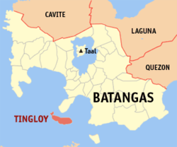
Basisdaten Bezirk: CALABARZON Provinz: Batangas Barangays: 15 Distrikt: 2. Distrikt von Batangas PSGC: 041033000 Einkommensklasse: 5. Einkommensklasse Haushalte: 3269 Zensus 1. Mai 2000Einwohnerzahl: 18.548 Zensus 1. August 2007Koordinaten: 13° 39′ N, 120° 52′ O13.65120.86666666667Koordinaten: 13° 39′ N, 120° 52′ O Postleitzahl: 4203 Geographische Lage auf den Philippinen 

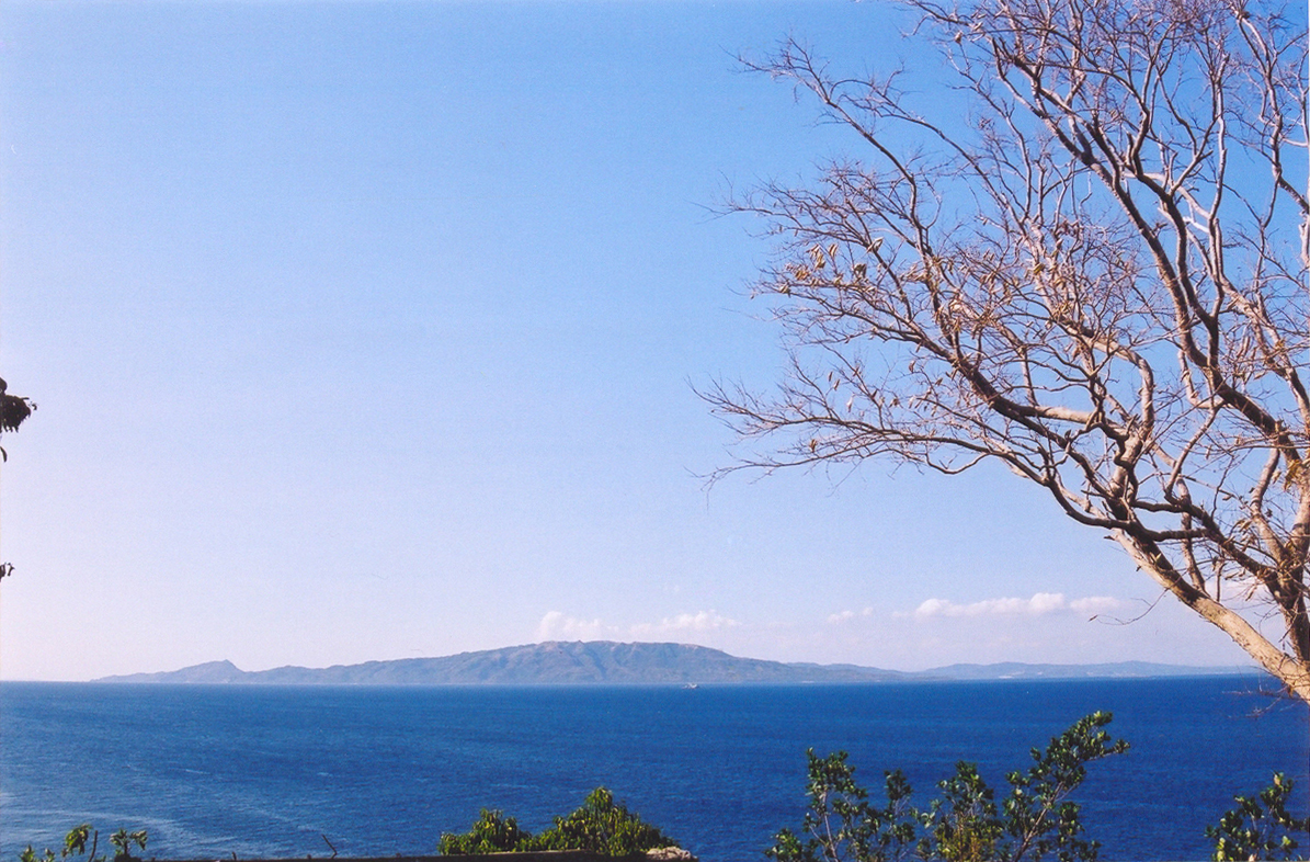
Tingloy  Blick Richtung Maricaban Island von Mindoro
Tingloy ist eine philippinische Stadtgemeinde in der Provinz Batangas. Sie hat 17.028 Einwohner in 3269 Haushalten (Zensus 1. Mai 2000).
Baranggays
Tingloy ist politisch unterteilt in 15 Baranggays.
- Corona
- Gamao
- Makawayan
- Marikaban
- Papaya
- Pisa
- Barangay 13 (Poblacion 1)
- Barangay 14 (Poblacion 2)
- Barangay 15 (Poblacion 3)
- San Isidro
- San Jose
- San Juan
- San Pedro
- Santo Tomas
- Talahib
Städte und Stadtgemeinden in der Provinz BatangasStädte: Batangas City | Lipa City | Tanauan City
Stadtgemeinden: Agoncillo | Alitagtag | Balayan | Balete | Bauan | Calaca | Calatagan | Cuenca | Ibaan | Laurel | Lemery | Lian | Lobo | Mabini | Malvar | Mataas na Kahoy | Nasugbu | Padre Garcia | Rosario | San Jose | San Juan | San Luis | San Nicolas | San Pascual | Santa Teresita | Santo Tomas | Taal | Talisay | Taysan | Tingloy | Tuy
Wikimedia Foundation.
Schlagen Sie auch in anderen Wörterbüchern nach:
Tingloy — 13° 39′ 00″ N 120° 52′ 00″ E / 13.65, 120.86666667 … Wikipédia en Français
Tingloy — Original name in latin Tingloy Name in other language Tinglay, Tingloy, Tingluy State code PH Continent/City Asia/Manila longitude 13.66091 latitude 120.8711 altitude 13 Population 2646 Date 2012 01 17 … Cities with a population over 1000 database
Tingloy (Batangas) — Tingloy Carte de Batangas avec localisation de Tingloy Tingloy est une municipalité de la province de Batangas. Villes et municipalités de Batangas … Wikipédia en Français
Tingloy, Batangas — Tingloy is a 5th class municipality in the province of Batangas, Philippines. According to the 2000 census, it has a population of 17,028 people in 3,269 households.BarangaysTingloy is politically subdivided into 15 barangays.* Corona * Gamao *… … Wikipedia
Legislative districts of Batangas — Philippines This article is part of the series: Politics and government of the Philippines … Wikipedia
Batangas — 13° 50′ 00″ N 121° 00′ 00″ E / 13.8333, 121 … Wikipédia en Français
Tanauan, Batangas — City of Tanauan Lungsod ng Tanauan Component City Nickname(s): Cradle of the Noble Heroes … Wikipedia
Batangas — Infobox Philippine province name = Batangas sealfile = Ph seal batangas.png region = CALABARZON (Region IV A) capital = Batangas City founded = March 10, 1917 pop2000 = 1,905,348 pop2000rank = 9th largest popden2000 = 602 popden2000rank = 7th… … Wikipedia
List of islands in the South China Sea — Islands in the South China Sea includes the South China Sea Islands (Spratly Islands, Pratas Islands, Paracel Islands and Macclesfield Bank), islands on the China coast, on the Vietnam coast, on the Borneo coast, and the peripheral islands of… … Wikipedia
Cuenca, Batangas — Cuenca Bayan ng Cuenca Munisipalidad ng Cuenca pueblo de Cuenca Municipality Nickname(s): Home of the Bakers … Wikipedia
Tingloy


18+
© Academic, 2000-2026
- Kontaktieren Sie uns: Unterstützung, Werbung
Wörterbücher Export, schritte mit PHP, Joomla, Drupal, WordPress, MODx.