Alitagtag

Alitagtag
Municipality of Alitagtag
Lage von Alitagtag in der Provinz Batangas
Karte
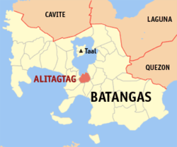
Basisdaten
Bezirk: CALABARZON
Provinz: Batangas
Barangays: 19
PSGC: 041002000
Einkommensklasse: 5. Einkommensklasse
Haushalte: 3708
Zensus 1. Mai 2000
Einwohnerzahl: 22.794
Zensus 1. August 2007
Bevölkerungsdichte: 831,9 Einwohner je km²
Fläche: 27,40 km²
Koordinaten: 13° 52′ N, 121° 0′ O13.866666666667121Koordinaten: 13° 52′ N, 121° 0′ O
Postleitzahl: 4205
Vorwahl: +63 43
Geographische Lage auf den Philippinen
Alitagtag (Philippinen)
Alitagtag
Alitagtag

Alitagtag ist eine philippinische Stadtgemeinde in der Provinz Batangas. Sie hat 20.192 Einwohner in 3708 Haushalten (Zensus 1. Mai 2000).

Baranggays

Alitagtag ist politisch unterteilt in 19 Baranggays.

  • Balagbag
  • Concepcion
  • Concordia
  • Dalipit East
  • Dalipit West
  • Dominador East
  • Dominador West
  • Munlawin Sur
  • Munlawin Norte
  • Muzon Primero
  • Muzon Segundo
  • Pinagkurusan
  • Ping-As
  • Poblacion East
  • Poblacion West
  • San Jose
  • Santa Cruz
  • Tadlac
  • San Juan

Wikimedia Foundation.

Игры ⚽ Поможем написать реферат

Schlagen Sie auch in anderen Wörterbüchern nach:

  • Alitagtag — Carte de Batangas avec localisation de Alitagtag Alitagtag est une municipalité de la province de Batangas …   Wikipédia en Français

  • Alitagtag — Original name in latin Alitagtag Name in other language Alitagtag State code PH Continent/City Asia/Manila longitude 13.8645 latitude 121.0041 altitude 217 Population 3960 Date 2011 07 31 …   Cities with a population over 1000 database

  • Alitagtag (Batangas) — Alitagtag Carte de Batangas avec localisation de Alitagtag Alitagtag est une municipalité de la province de Batangas …   Wikipédia en Français

  • Alitagtag, Batangas — Alitagtag is a 5th class municipality in the province of Batangas, Philippines. According to the 2000 census, it has a population of 20,192 people in 3,708 households. Alitagtag is bordered on the north by Taal Lake, Cuenca and San Jose to the… …   Wikipedia

  • Subli — is a folkdance in the Philippines. It is considered a favorite of the people of the barrios of the municipality of Bauan, Batangas. It is a ceremonial worship dance performed in homage to the Holy Cross referred to in the vernacular as Mahal Na… …   Wikipedia

  • Legislative districts of Batangas — Philippines This article is part of the series: Politics and government of the Philippines …   Wikipedia

  • Cuenca, Batangas — Cuenca Bayan ng Cuenca Munisipalidad ng Cuenca pueblo de Cuenca   Municipality   Nickname(s): Home of the Bakers …   Wikipedia

  • Lake Taal — Satellitenfoto des Taalsees mit der Vulkaninsel in seiner Mitte Der Lake Taal oder Taalsee ist ein Süßwassersee auf der philippinischen Insel Luzon. Innerhalb des Sees befindet sich eine Caldera, die durch einen starken Vulkanausbruch vor etwa… …   Deutsch Wikipedia

  • Taal-See — Satellitenfoto des Taalsees mit der Vulkaninsel in seiner Mitte Der Lake Taal oder Taalsee ist ein Süßwassersee auf der philippinischen Insel Luzon. Innerhalb des Sees befindet sich eine Caldera, die durch einen starken Vulkanausbruch vor etwa… …   Deutsch Wikipedia

  • Batangas — 13° 50′ 00″ N 121° 00′ 00″ E / 13.8333, 121 …   Wikipédia en Français

Share the article and excerpts

Direct link
Do a right-click on the link above
and select “Copy Link”