Tuatapere

Tuatapere
Tuatapere
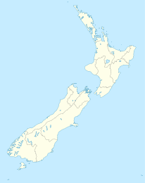
Tuatapere (Neuseeland)
Tuatapere
Koordinaten 46° 8′ S, 167° 41′ O-46.133333333333167.68333333333Koordinaten: 46° 8′ S, 167° 41′ O
Einwohner 579 (2006)
Region Southland
Distrikt Southland-Distrikt

Tuatapere ist eine kleine Landgemeinde auf der der Südinsel Neuseelands, 8 km von der Südküste der Insel entfernt gelegen. Der Waiau River fließt durch den Ort und mündet dann in der Te Waewae Bay in die Foveaux-Straße. Der Ort erlebte in den letzten Jahren einen deutlichen Bevölkerungsrückgang: hatte er 1996 noch 741 ständige Bewohner, waren es 2001 noch 681 und 2006 nur noch 579 Einwohner. [1]

Die wichtigsten Wirtschaftszweige sind Forstwirtschaft und Landwirtschaft. Beim Zenus 2001 waren 24,2 % der Einwohner in der Landwirtschaft beschäftigt.

Tuatapere hat ein Holzfällermuseum. In seiner Nähe liegt das größte Viadukt der Südhalbkugel. Der Ort liegt auf der Tourismusroute Southern Scenic Route von Invercargill nach Te Anau und ist daher ein gutbesuchter Zwischenstop. Diesen werden unter anderem "weltbekannte" Würstchen angeboten, wegen derer sich Tuatapere als "Würstchenhauptstadt" Neuseelands ansieht. Die Blue Cliffs und der Hump Ridge Track sind weitere Sehenswürdigkeiten.

Railway

Am 1. Oktober 1909 wurde eine Nebenbahn von Invercargill nach Tuatapere, der Tuatapere Branch, eröffnet. Eine Erweiterung bis nach Orawia wurde am 20. Oktober 1925 in Betrieb genommen und ein Lokdepot in der Stadt eingerichtet. Dieses wurde als Basis für den Betrieb der Strecke benutzt, so dass es de facto zwei Teilstrecken gab: eine von Invercargill nach Tuatapere und eine von Tuatapere nach Orawia. Bis 1968 wurden alle Züge von Dampflokomotiven gezogen. Im Juni 1968 wurde auf Dieselbetrieb umgestellt und das Lokdepot daraufhin geschlossen. Am 1. Oktober 1970 wurde die Linie wegen zu geringem Frachtaufkommen bis Tuatapere gekürzt und am 30. Juli 1976 auch der Abschnitt zwischen Riverton und Tuatapere geschlossen. Einige Reste der Eisenbahn in Tuatapere wurden erhalten, darunter Bauwerke auf dem Bahnhofsgebiet wie der Bahnhof und ein Lagerschuppen.

Quellen

  1. Statistics New Zealand

Wikimedia Foundation.

Игры ⚽ Поможем сделать НИР

Schlagen Sie auch in anderen Wörterbüchern nach:

  • Tuatapere — is a small rural town in Southland, New Zealand. It is located eight kilometres from the southern coast. The Waiau River flows through the town before reaching Te Waewae Bay, where it has its outflow into Foveaux Strait. It has a population of… …   Wikipedia

  • Tuatapere Branch — The Tuatapere Branch, including the Orawia Branch, was a branch line railway in Southland, New Zealand. Although the Tuatapere and Orawia Branches look like a single line, operationally they were considered separate lines. The first section… …   Wikipedia

  • Hump Ridge Track — The Hump Ridge Track is located in the south east of Fiordland National Park, South Island, New Zealand. [http://www.humpridgetrack.co.nz Link to Tuatapere Hump Ridge Track website] The Tuatapere Hump Ridge Track is 53 km, based in Waitutu Forest …   Wikipedia

  • Wairio Branch — The Wairio Branch, now incorporating the Ohai Industrial Line, is a branch line railway in Southland, New Zealand. It opened in 1882 and is the sole remaining branch line in Southland, and one of only a few in the entire country. A number of… …   Wikipedia

  • Orepuki — …   Wikipedia

  • Southern Scenic Route — Die Southern Scenic Route ist eine touristische Straße im Süden der Südinsel Neuseelands. Sie verbindet das Fiordland, Te Anau und die Milford Road über Riverton, Invercargill und The Catlins[1] mit Dunedin . Inhaltsverzeichnis 1 Geschichte und… …   Deutsch Wikipedia

  • Percy Burn Viaduct — is located in the far south of the South Island of New Zealand. It is reputedly the largest surviving wooden viaduct in the world. A former logging tramway, it is now a footbridge and the most popular feature of the Tuatapere Hump Ridge Track.… …   Wikipedia

  • Riverton, New Zealand — Riverton or Aparima is a small town at the south of the South Island of New Zealand. It is in the Southland region and lies at the western end of Oreti Beach, 30 kilometres west of Invercargill on the Southern Scenic Route. It is approx. 45 km… …   Wikipedia

  • List of New Zealand railway lines — The New Zealand railway network consists of four main lines, seven secondary lines and numerous short branch lines in almost every region. It links all major urban centres, with the notable exceptions of Nelson and Taupo. The network is owned and …   Wikipedia

  • Grace Presbyterian Church of New Zealand — (GPCNZ) is a Presbyterian denomination in New Zealand which was formed in 2002. It currently consists of 9 churches and 4 mission churches, which are congregations in the process of becoming fully established churches.Many members of the GPCNZ… …   Wikipedia

Share the article and excerpts

Direct link
Do a right-click on the link above
and select “Copy Link”