Te Waewae Bay

Te Waewae Bay
-46.25167.5
Te Waewae Bay (Neuseeland)
Te Waewae Bay
Te Waewae Bay

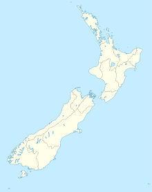
Die Te Waewae Bay ist die westlichste der drei großen Buchten, die die Küste der Foveaux-Straße auf Seiten der Südinsel Neuseelands bilden. Die anderen beiden sind Oreti Beach und Toetoes Bay. Die Bucht ist 27 km lang. Das Westende ist das gebirgige Ende der Südalpen und des Fiordland National Park.

Die kleine Landsiedlung Orepuki liegt auf den Klippen am Ostende der Bucht, die von Forstwirtschaft geprägte Gemeinde Tuatapere 7 km nördlich von der Bucht am Ufer des Waiau River, der in die Bucht mündet.


Wikimedia Foundation.

Игры ⚽ Поможем решить контрольную работу

Schlagen Sie auch in anderen Wörterbüchern nach:

  • Te Waewae Bay — is the westernmost of three large bays lying on the Foveaux Strait coast of Southland, New Zealand, the others being Oreti Beach and Toetoes Bay. Twenty seven kilometres in length, the western end of the bay is mountainous, with the southern… …   Wikipedia

  • Toetoes Bay — is the easternmost of three large bays lying on the Foveaux Strait coast of Southland, New Zealand, the others being Te Waewae Bay and Oreti Beach. Thirty kilometres (20 miles) in length, the bay is the southern end of the Awarua Plain, an area… …   Wikipedia

  • Toetoes Bay — 46.587777777778168.73027777778 Koordinaten: 46° 35′ S, 168° 44′ O …   Deutsch Wikipedia

  • Foveaux-Straße — Übersichtskarte der Straße Die Foveaux Straße (engl. Foveaux Strait) ist eine Meerenge in Neuseeland. Ihre Nordseite wird von der Südküste der Neuseeländischen Südinsel, die hier drei große Buchten, Te Waewae Bay, Oreti Beach und Toetoes Bay hat …   Deutsch Wikipedia

  • Foveaux Strait — Übersichtskarte der Straße Die Foveaux Straße (engl. Foveaux Strait) ist eine Meerenge in Neuseeland. Ihre Nordseite wird von der Südküste der Neuseeländischen Südinsel, die hier drei große Buchten, Te Waewae Bay, Oreti Beach und Toetoes Bay hat …   Deutsch Wikipedia

  • Foveauxstraße — Foveaux Strait Stewart Island/Rakiura und Foveaux Strait vom Bluff Hill aus gesehen. Die Foveaux Strait befindet sich mitten in …   Deutsch Wikipedia

  • Southern Scenic Route — Die Southern Scenic Route ist eine touristische Straße im Süden der Südinsel Neuseelands. Sie verbindet das Fiordland, Te Anau und die Milford Road über Riverton, Invercargill und The Catlins[1] mit Dunedin . Inhaltsverzeichnis 1 Geschichte und… …   Deutsch Wikipedia

  • Orepuki — …   Wikipedia

  • Foveaux Strait — is the strait between the South Island, New Zealand on the north side, with the three large bays Te Waewae Bay, Oreti Beach and Toetoes Bay, and the Solander Islands, Stewart Island/Rakiura and Ruapuke Island on the south.Its European discoverer… …   Wikipedia

  • Estrecho de Foveaux — Saltar a navegación, búsqueda Estrecho de Foveaux (Foveaux Strait) El estrecho de Foveaux, y al fondo la isla Rakiura, vistos desde B …   Wikipedia Español

Share the article and excerpts

Direct link
Do a right-click on the link above
and select “Copy Link”