Tusnica

Tusnica

f1

Tušnica
Höhe 1.697 m
Lage Bosnien-Herzegowina
Geographische Lage 43° 42′ 58″ N, 17° 4′ 52″ O43.71611111111117.0811111111111697Koordinaten: 43° 42′ 58″ N, 17° 4′ 52″ O
Tušnica (Bosnien und Herzegowina)
DEC
Tušnica

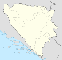
Der Berg Tušnica (Vitrenik 1697 m) befindet sich im Südosten der Gemeinde Livno in Bosnien und Herzegowina. Er ist ein beliebtes Ausflugsziel, besonders für Bergsteiger.

Unterhalb des Berges befindet sich das 1888 gegründete Bergwerk Rudnici Tušnica. Es ist unterteilt sich in drei Betriebe: einen Steinkohle-Tagebau, einen Braunkohle-Tagebau und einen Steinbruch. Die Gesamtproduktion betrug 1998 37.500 t. Durch große Vorräte (ca. 600 Millionen Tonnen) an Braunkohle in den Gemeinden Livno und Tomislavgrad ist in der Umgebung ein Wärmekraftwerk geplant.

Am Anfang des Bosnienkrieges, am 8. Mai 1992, wurden die Sendeanlagen auf dem Berg von der Jugoslawischen Volksarmee durch einen Raketenangriff zerstört.

Weblinks


Wikimedia Foundation.

Игры ⚽ Поможем решить контрольную работу

Schlagen Sie auch in anderen Wörterbüchern nach:

  • Tušnica — Höhe 1.697 m.&# …   Deutsch Wikipedia

  • Delminium — Tomislavgrad Томиславград Hilfe zu Wappen …   Deutsch Wikipedia

  • Duvno — Tomislavgrad Томиславград Hilfe zu Wappen …   Deutsch Wikipedia

  • Vidosi — Die Gemeinde Vidoši (dt. veraltet Widitsch) befindet sich südöstlich der Stadt Livno in Bosnien und Herzegowina. Sie liegt an der Quelle des Flusses Sturba und ist umgeben vom Tušnica Bergmassiv. Vidoši ist die älteste katholische Gemeinde in der …   Deutsch Wikipedia

  • Livno — Infobox Settlement official name = Livno settlement type = subdivision type = Country subdivision name = BIH timezone=CET utc offset=+1 map caption =Location of Livno within Bosnia and Herzegovina. timezone DST=CEST utc offset DST=+2 latNS=N… …   Wikipedia

  • Vidosi — The parish Vidoši is situated in the south east of a district Livno (Bosnia and Herzegovina), on a spring of a river Sturba and it is surrounded by Tušnica s hills.In the last census of 1991 there were 3021 inhabitants. Vidoši is the oldest… …   Wikipedia

  • Livno field — The Livno field (Croatian/Bosnian/Serbian Livanjsko polje ) is a karstic field, circled by tall peaks. Buško Blato lies to the southeast, and Ždralovac to the northwest. Ždralovac is a narrow corridor by which the Livno field is connected to the… …   Wikipedia

  • Livno — Ливно …   Deutsch Wikipedia

  • Tomislavgrad — Tomislavgrad …   Deutsch Wikipedia

  • Vidoši — Die Gemeinde Vidoši (dt. veraltet Widitsch) befindet sich südöstlich der Stadt Livno in Bosnien und Herzegowina. Sie liegt an der Quelle des Flusses Sturba und ist umgeben vom Tušnica Bergmassiv. Vidoši ist die älteste katholische Gemeinde in der …   Deutsch Wikipedia

Share the article and excerpts

Direct link
Do a right-click on the link above
and select “Copy Link”