Ungkaya Pukan

Ungkaya Pukan
Municipality of Ungkaya Pukan
Lage von Ungkaya Pukan in der Provinz Basilan
Karte
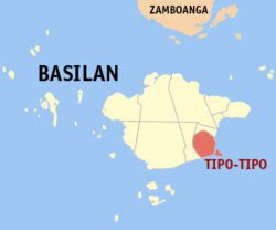
Basisdaten
Bezirk: Autonomous Region in Muslim Mindanao
Provinz: Basilan
Barangays: 12
PSGC: 150711000
Einkommensklasse: unbekannt (1-6)
Haushalte:
Zensus 1. Mai 2000
Einwohnerzahl: 30.472
Zensus 1. August 2007
Koordinaten: 6° 35′ N, 122° 11′ O6.5833333333333122.18333333333Koordinaten: 6° 35′ N, 122° 11′ O
Geographische Lage auf den Philippinen
Ungkaya Pukan (Philippinen)
Ungkaya Pukan
Ungkaya Pukan

Ungkaya Pukan ist eine philippinische Stadtgemeinde in der Provinz Basilan. Sie wurde durch den Muslim Mindanao Act Nr. 193, der am 22. Mai 2006 in einer Volksabstimmung ratifiziert wurde, gegründet. Die Stadtgemeinde besteht aus zwölf Baranggays, die zuvor zu Tipo-Tipo gehörten.

Baranggays

Ungkaya Pukan ist politisch unterteilt in zwölf Baranggays.

  • Amaloy
  • Bohe-Pahuh
  • Bohe-Suyak
  • Cabangalan
  • Danit
  • Kamamburingan
  • Matata
  • Materling
  • Pipil
  • Sungkayut
  • Tongbato
  • Ulitan

Wikimedia Foundation.

Игры ⚽ Нужно сделать НИР?

Schlagen Sie auch in anderen Wörterbüchern nach:

  • Ungkaya Pukan — 6°35′N 122°11′E / 6.583, 122.183 …   Wikipédia en Français

  • Ungkaya Pukan (Basilan) — Ungkaya Pukan 6°35′N 122°11′E / 6.583, 122.183 …   Wikipédia en Français

  • Ungkaya Pukan, Basilan — Ungkaya Pukan is a municipality in the province of Basilan, Philippines. It was created by Muslim Mindanao Autonomy Act No. 193, ratified by plebiscite on May 22, 2006. It is composed of 12 barangays that were formerly part of Tipo… …   Wikipedia

  • Basilan — Infobox Philippine province name = Basilan sealfile = ph seal basilan.png|100px region = Autonomous Region in Muslim Mindanao (ARMM) capital = Isabela City (Zamboanga Peninsula) founded = December 27, 1973 pop2000 = 496,503 pop2000rank = 20th… …   Wikipedia

  • Lamitan — City of Lamitan Lungsod ng Lamitan Lage von Lamitan City in der Provinz Basilan Basisdaten Bezirk: Autonomous Region in Muslim Mindanao …   Deutsch Wikipedia

  • PH-BAS — Lage von Basilan. Basilan (auch Taguima) ist eine Insel im Süden der Philippinen und ein Teil des Sulu Archipels, vier Fünftel von ihr bilden die gleichnamige Provinz des Inselstaates. Die Insel wird durch die Straße von Basilan von Zamboanga… …   Deutsch Wikipedia

  • Tipo-Tipo — Municipality of Tipo Tipo Lage von Tipo Tipo in der Provinz Basilan Basisdaten Bezirk …   Deutsch Wikipedia

  • Maluso, Basilan — Maluso is a 4th class municipality in the province of Basilan, Philippines. According to the 2007 census, it has a population of 48,175 people. On February 27, 2010, about 70 militants of the extremist Abu Sayyaf group attacked Tubigan village in …   Wikipedia

  • Tipo-Tipo, Basilan — Tipo tipo is a 3rd class municipality in the province of Basilan, Philippines. According to the 2000 census, it has a population of 48,284 people in 8,786 households.In 2006, the municipalities of Al Barka and Ungkaya Pukan were created from Tipo …   Wikipedia

  • List of cities and municipalities in the Philippines — This is a list of cities and municipalities in the Philippines arranged by province and in alphabetical order. As of 2006, there are 118 cities and 1509 municipalities.As of September 4, 2007, there are 136 cities, 1,495 municipalities, 81… …   Wikipedia

Share the article and excerpts

Direct link
Do a right-click on the link above
and select “Copy Link”