- Urana Shire
-
Shire of Urana 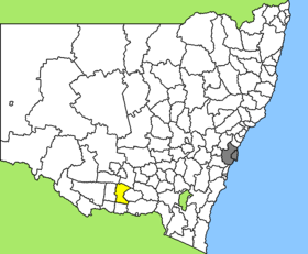
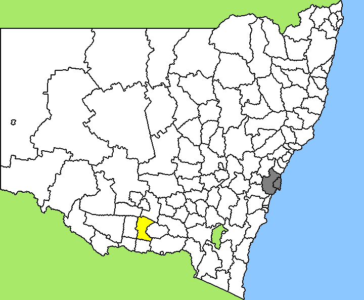
Lage des Urana Shire in New South WalesGliederung Staat:  Australien
Bundesstaat:  New South Wales
Verwaltungssitz: Urana Daten und Zahlen Fläche: 3.357 km² Einwohner: 1.257 (2006) [1] Bevölkerungsdichte: 0,4 Einwohner je km² Wards: 3 -35.333333333333146.26666666667Koordinaten: 35° 20′ S, 146° 16′ OUrana Shire ist ein lokales Verwaltungsgebiet (LGA) im australischen Bundesstaat New South Wales. Das Gebiet ist 3.357 km² groß und ist mit etwa 1.300 Einwohnern die kleinste LGA des Staates nach Bevölkerung.
Urana liegt in der Region nördlich des Murray River etwa 350 km westlich der australischen Hauptstadt Canberra und 380 km nordöstlich von Melbourne. Das Gebiet umfasst 17 Ortsteile und Ortschaften: Boonoke North, Boonongo, Cocketgedong, Coonong, Coorabin, Cullivel, Greenvale, Morundah, Oaklands, Rand, Urana, Urana South, Widgiewa, Yuluma und Teile von Boree Creek, Bundure und Daysdale. Der Sitz des Shire Councils befindet sich in der Ortschaft Urana im Zentrum der LGA östlich des Lake Urana, wo etwa 340 Einwohner leben.
Verwaltung
Der Urana Shire Council hat neun Mitglieder, die von den Bewohnern der drei Wards gewählt werden (je drei aus den Wards A, B und C). Diese drei Bezirke sind unabhängig von den Ortschaften festgelegt. Aus dem Kreis der Councillor rekrutiert sich auch der Mayor (Bürgermeister) des Councils.
Weblinks
Einzelnachweise
- ↑ Australian Bureau of Statistics (25. Oktober 2007): Urana (A) (Local Government Area) (Englisch). 2006 Census QuickStats. Abgerufen am 6. April 2010.
Kategorie:- Local Government Area in New South Wales
Wikimedia Foundation.