Batanta

Batanta

Vorlage:Infobox Insel/Wartung/Bild fehlt

Batanta
Gewässer Pazifischer Ozean
Inselgruppe Raja Ampat
Geographische Lage 0° 52′ 0″ S, 130° 40′ 0″ O-0.86666666666667130.666666666671184Koordinaten: 0° 52′ 0″ S, 130° 40′ 0″ O
Batanta (Molukken-Papua)
Batanta
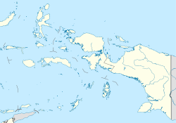
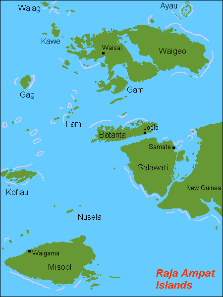
Fläche 453 km²
Höchste Erhebung 1.184 m
Hauptort Jodlo
Raja-Ampat-Inseln mit Batanta in der Kartenmitte

Batanta ist die kleinste der vier Hauptinseln der Raja Ampat-Inselgruppe vor West-Neuguinea (Indonesien). Salawati, Misool und Waigeo bilden die anderen drei Hauptinseln der Inselgruppe. Batanta liegt nördlich von Salawati, welches direkt westlich der Vogelkopf-Halbinsel vorgelagert ist. Batanta hat eine Fläche von 453 km², die höchste Erhebung erreicht 1184 m. Auf der Insel ist der Blauer Baumwaran (Varanus macraei) beheimatet. Diese Großwaran Spezies ist bis dato nur hier gesichtet worden.


Wikimedia Foundation.

Игры ⚽ Поможем написать реферат

Schlagen Sie auch in anderen Wörterbüchern nach:

  • Batanta — Saltar a navegación, búsqueda Mapa de las islas Raja Ampat Batanta es una de las cuatro mayores islas del archipiélago Raja Ampat en la provincia de Papúa, Indonesia. Tiene una superficie total de 453 km². Otras islas del archipiélago son… …   Wikipedia Español

  • Batanta — is an island north of Salawati Island in Papua province, Indonesia. Its area is 453 km² and its highest point is 1184 m.Infobox Islands name = Batanta image caption = locator native name = native name link = location = Pacific Ocean coordinates …   Wikipedia

  • Batanta — Batanta, Insel bei Neuguinea, südlich von der Insel Waigiu, durch die Dampierrestraße getrennt …   Pierer's Universal-Lexikon

  • Batanta — 0°52′4″S 130°39′27″E / 0.86778, 130.6575 …   Wikipédia en Français

  • Iles Raja Ampat — Îles Raja Ampat Îles Raja Ampat Carte des îles Raja Ampat. Géographie Pays …   Wikipédia en Français

  • Raja Ampat — Îles Raja Ampat Îles Raja Ampat Carte des îles Raja Ampat. Géographie Pays …   Wikipédia en Français

  • Îles Raja Ampat — Carte des îles Raja Ampat. Géographie Pays …   Wikipédia en Français

  • Raja Ampat — Saltar a navegación, búsqueda Raja Ampat (Kabupaten Raja Ampat) Vista de satélite de la península de Doberai y las islas de Raja Ampat (NASA) …   Wikipedia Español

  • Mar de Halmahera — (Laut Sawu) Océano o mar de la IHO (n.º id.: 48e) Ubicación geográfica Océano Océano Pacífico …   Wikipedia Español

  • Melanotaenia — Boeseman s rainbowfish Melanotaenia boesemani Scientific classification Kingdom: Animalia …   Wikipedia

Share the article and excerpts

Direct link
Do a right-click on the link above
and select “Copy Link”