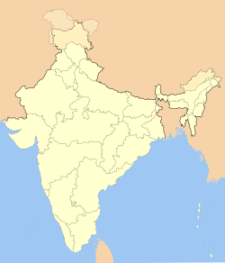
Villupuram

Villupuram
Viluppuram
Viluppuram (Indien)
DEC
Staat: Indien
Bundesstaat: Tamil Nadu
Distrikt: Viluppuram
Lage: 11° 57′ N, 79° 30′ O11.94194444444479.4988888888897Koordinaten: 11° 57′ N, 79° 30′ O
Einwohner: 95.439

Viluppuram (Tamil: விழுப்புரம் Viḻuppuram [ˈʋɨɻɯpːuɾʌm]; auch: Villupuram) ist eine Stadt mit knapp 100.000 Einwohnern im südindischen Bundesstaat Tamil Nadu. Sie liegt im Nordwesten Tamil Nadus unweit der Küste des Golfs von Bengalen rund 150 Kilometer südwestlich der Hauptstadt Chennai (Madras). Die nächstgrößere Stadt ist Puducherry (Pondicherry) ca. 35 Kilometer östlich. Viluppuram ist Hauptstadt des gleichnamigen Distriktes.

Viluppuram ist ein wichtiges Eisenbahnkreuz, das Chennai mit dem Süden Tamil Nadus verbindet. Die Hauptstrecke von Chennai nach Tiruchirappalli passiert Viluppuram, außerdem gehen vom Bahnhof der Stadt Nebenstrecken in Richtung Puducherry, Cuddalore und Tiruvannamalai ab. Auch der National Highway 45 von Chennai nach Madurai führt durch Viluppuram.

Zum Zeitpunkt der indischen Volkszählung von 2001 hatte Viluppuram 95.439 Einwohner.[1] Hochrechnungen für das Jahr 2008 zufolge beträgt die Einwohnerzahl 98.653.[2] Viluppuram ist der Geburtsort des Schauspielers Sivaji Ganesan, eines der wichtigsten Akteure des tamilischen Films.

Einzelnachweise

  1. Census of India 2001: Population, population in the age group 0-6 and literates by sex - Cities/Towns (in alphabetic order)
  2. World Gazetteer: Viluppuram

Weblinks


Wikimedia Foundation.

Игры ⚽ Нужна курсовая?

Schlagen Sie auch in anderen Wörterbüchern nach:

  • Villupuram — Original name in latin Villupuram Name in other language Villapurum, Villupuram State code IN Continent/City Asia/Kolkata longitude 11.93975 latitude 79.49244 altitude 50 Population 97380 Date 2012 03 01 …   Cities with a population over 1000 database

  • Villupuram — Admin ASC 2 Code Orig. name Villupuram Country and Admin Code IN.25.7646150 IN …   World countries Adminstrative division ASC I-II

  • Arcot-Villupuram State Highway (SH-4) — State Highway (SH 4) connects Arcot with Villupuram. Total length of SH 4 is 114 km.SH 4 Route: Arcot Arani Chetput Vallathi Gingee Muttathur Villupuram RoadVillupuram Road refers to the junction of SH 4 with NH 45 near Villupuram (Katpadi Gate) …   Wikipedia

  • Highways of Tamil Nadu — Map indicating Highways network of Tamil Nadu In Tamil Nadu, a separate Highways Department (HD) was established on April, 1946 and the same has been renamed as Highways Minor Ports Department (HMPD) on 30 October 2008.[1] HMPD of Tamil Nadu is… …   Wikipedia

  • Chinnasalem —   city   …   Wikipedia

  • Nangathur —   village   …   Wikipedia

  • List of Indian trains — A list of Indian trains, both old current.A*Abida Begum Express *Ajanta Express (Manmad Aurangabad Parbhani Nanded Secunderabad) *AgniVeena Express *AhilyaNagari Express(Indore Bhopal Nagpur Vijaywada Chennai Coimbatore Trivandrum) *Ahimsa… …   Wikipedia

  • Tirukoilur — Infobox Indian Jurisdiction native name = Tirukoilur | type = city | latd = 11.95 | longd = 79.2 locator position = right | state name = Tamil Nadu district = Viluppuram district altitude = 73 population as of = 2001 population total = 27,108|… …   Wikipedia

  • Nellai Express — The Nellai Express is a super fast train on the Indian Railways, connecting Tirunelveli Jn with Chennai Egmore. Contents 1 Numbers and Route 2 Loco 3 Time Schedule 4 Relevance …   Wikipedia

  • Tindivanam —   city   …   Wikipedia

Share the article and excerpts

Direct link
Do a right-click on the link above
and select “Copy Link”