- Wabash River
-
Wabash River 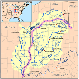
Verlauf des Wabash River
Daten Gewässerkennzahl US: 449850 Lage Ohio, Indiana, Kentucky (USA) Flusssystem Mississippi River Abfluss über Ohio River → Mississippi River → Golf von Mexiko Quelle Bei St. Henry im Mercer County (Ohio)
40° 21′ 7″ N, 84° 45′ 57″ W40.351991-84.765795Mündung Ohio River bei Uniontown (Kentucky) 37.7981003-88.027253499Koordinaten: 37° 47′ 53″ N, 88° 1′ 38″ W
37° 47′ 53″ N, 88° 1′ 38″ W37.7981003-88.027253499Mündungshöhe 99 m[1] Länge 765 km Einzugsgebiet 85.340 km² 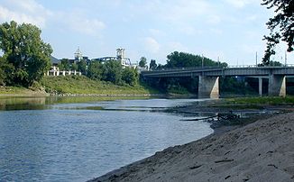
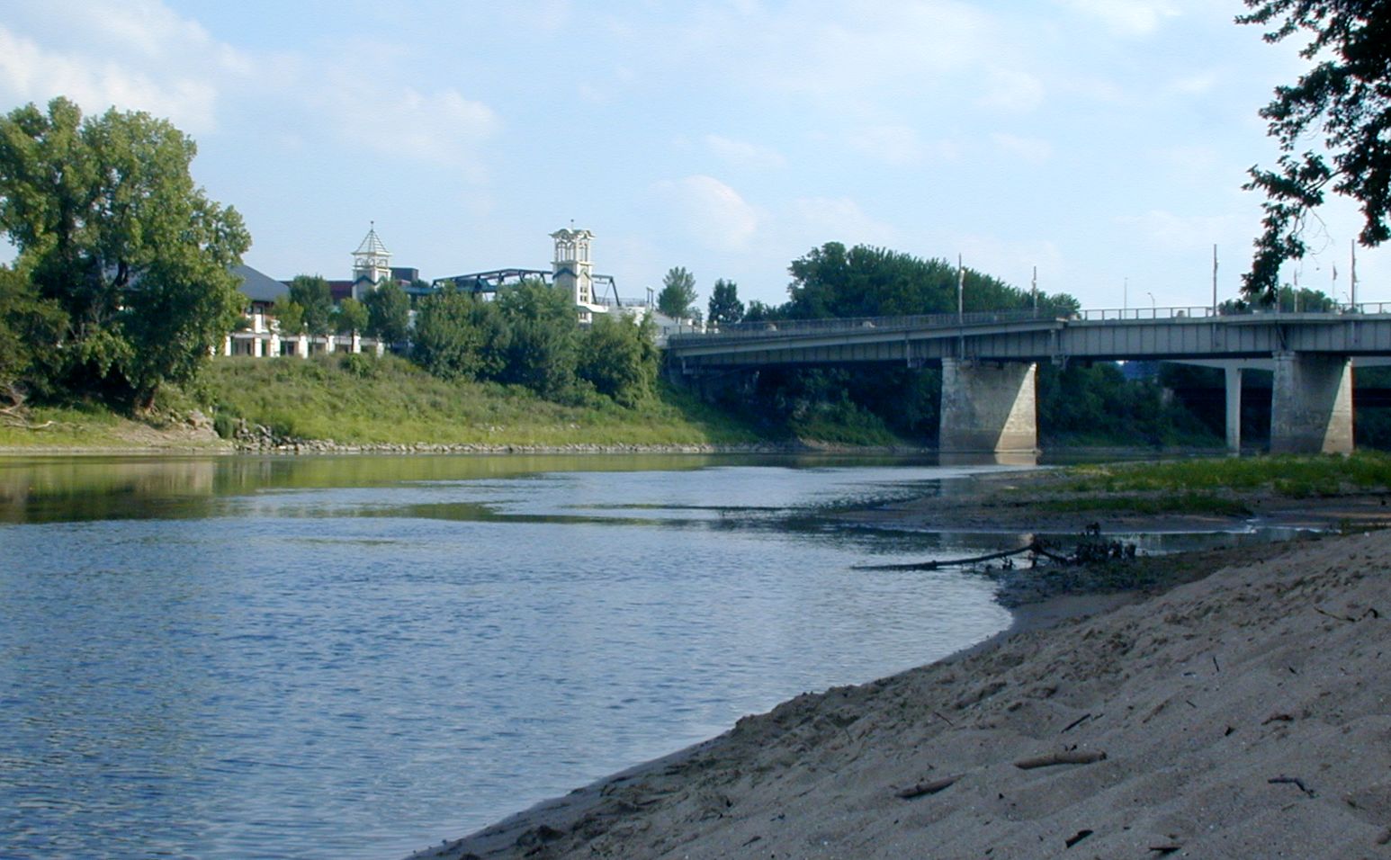
Wabash River bei Lafayette
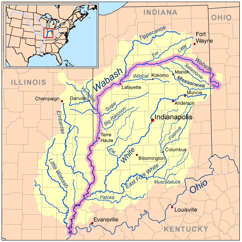
Der Wabash River ist ein 765 Kilometer langer Zufluss des Ohio Rivers und der größte Zufluss des Ohios auf der Nordseite. Er entspringt bei St. Henry im Nordwesten des Bundesstaats Ohio und verläuft bald danach quer durch Indiana. Südlich von Terre Haute bildet er die Grenze zwischen Indiana und Illinois. Seine größten Zuflüsse sind der Tippecanoe und der White River, beide in Indiana. Der Little Wabash River und der Embarras River aus Illinois sind ebenfalls Nebenflüsse des Wabash Rivers.
Der Wabash River ist der offizielle Staatsfluss von Indiana und wird auch im Staatslied On the banks of the Wabash, far away von Paul Dresser genannt. Nach dem Fluss ist auch die Wabash Railroad benannt, die wiederum Namensgeber für den Zug (und das entsprechende Lied) Wabash Cannonball war. Weil er eine sehr lange staudammfreie Strecke (661 Kilometer, von Huntington bis zu seiner Mündung) aufweist, ist er auch als Angelrevier mit typisch nordamerikanischen Fischen, wie Katzenwels, Zander und Karpfen, interessant. Er bietet auch die längste staudammfreie Flussstrecke östlich des Mississippi Rivers.
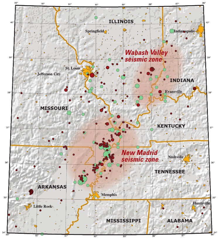
Der Wabash fließt durch das aktive Erdbebengebiet Wabash Valley seismic zone.
-

Karte des New Madrid und Wabash Erdbebengebiet
-

Der Fluss Wabash bei New Harmony 1832-1833. Ausschnitt aus dem Gemälde „Cutoff River Arm des Wabash“ von Karl Bodmer.
Weblinks
-
 Commons: Wabash River – Sammlung von Bildern, Videos und Audiodateien
 - Offizielle Seite zum Wabash river. Sie ist verbunden mit Google Earth.
- Die Wabash River Heritage Corridor Commission
- Wabash River im Geographic Names Information System des United States Geological Survey
Einzelnachweise
- ↑ USGS - GNIS - Wabash River
Kategorien:- Flusssystem Wabash River
- Fluss in Indiana
- Fluss in Ohio
- Fluss in Illinois
- Fluss in Nordamerika
-

Wikimedia Foundation.