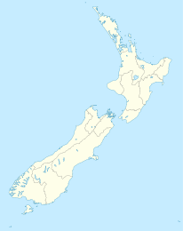
Waipawa

Waipawa
Waipawa
Waipawa (Neuseeland)
Waipawa
Koordinaten 39° 56′ S, 176° 35′ O-39.933333333333176.58333333333Koordinaten: 39° 56′ S, 176° 35′ O
Einwohner 1.872 (2001)
Region Hawke’s Bay
Distrikt Central-Hawke’s-Bay-Distrikt

Waipawa ist die zweitgrößte Stadt im Distrikt Central-Hawke’s-Bay-Distrikt im Osten der Nordinsel Neuseelands. Der Ort ist die älteste europäische Siedlung im Inland Neuseelands. Beim Zensus 2001 hatte der Ort 1.872 Einwohner, ein Rückgang um 2 %seit 1996.[1]

Die Gemeinde liegt 7 km nordöstlich von Waipukurau und 46 km südwestlich von Hastings am Nordufer des Waipawa River, einem Zufluss des Tukituki River.[2][3]

Der Ort wurde anfangs nach Frederick Abbott benannt, der hier 9.600 Acre Land erhielt, auf dem er 2.000 Schafe, 20 Rinder und 2 Pferde halten wollte. Da er auf seinem Weg nach Süden immer an einer Stelle den Waipawa River überquerte, nannte man diese Furt Abbott’s Ford. Ab dem 25. Februar 1860 versteigerte er sein Land an Siedler und eine Gemeinde Abbottsford entstand. Diese bestand anfangs nur aus einigen Häusern. Es gab bald eine Kirche, ein Gerichtsgebäude, vier Hotels, zwei Pubs, zwei Läden, einen Schmied und anderes Kleingewerbe. Auch das Vermessungsbüro des Distriktes hatte hier seinen Sitz. Später erhielt der Ort die Bezeichnung der Māori für den Ort "Waipawa" (dunkles Wasser).[4][5] Anfang der 1900er Jahre wurde das noch heute genutzte Waipawa Municipal Theatre gebaut.

Im Ort befindet sich das Hauptbüro des Distriktrates. Er besitzt auch eine Grundschule, eine Bibliothek und einen Campingplatz.

Hauptarbeitgeber sind drei Transportunternehmen und ein Verpackungsbetrieb von Mr Apple Waipawa, in dem in der Saison 2,2 Millionen Kisten Äpfel für den Export verpackt werden.

Einige Häuser aus den 1860er Jahren sind noch erhalten. Ein kleines Museum zur Siedlergeschichte befindet sich an der Hauptstraße.

Weblinks

Quellen

  1. Daten zu Waipawa von Statistics New Zealand
  2. Peter Dowling (Hrsg.:Reed New Zealand Atlas,Reed Books, 2004, ISBN 0-7900-0952-8, Karte 42
  3. Roger Smith, GeographX: The Geographic Atlas of New Zealand. Robbie Burton, 2005, ISBN 1-877333-20-4 Karte 108
  4. waipawa.com
  5. [1]

Weblinks


Wikimedia Foundation.

Игры ⚽ Поможем решить контрольную работу

Schlagen Sie auch in anderen Wörterbüchern nach:

  • Waipawa — is the second largest town in Central Hawke s Bay in the east of the North Island of New Zealand. At the 2001 Census it had a population of 1,872, a change of 2.0 percent since the 1996 census.The town is located 7 km northeast of Waipukurau and… …   Wikipedia

  • Waipawa — Original name in latin Waipawa Name in other language State code NZ Continent/City Pacific/Auckland longitude 41.41222 latitude 175.51528 altitude 238 Population 1899 Date 2011 08 01 …   Cities with a population over 1000 database

  • Waipawa River — The Waipawa River is a river of southern Hawke s Bay, in New Zealand s eastern North Island. It flows from the slopes of Te Atua Mahuru in the Ruahine Range southeast past the town of Waipawa before joining the Ngaruroro River …   Wikipedia

  • Old Bed of Waipawa River — Mouth Waipawa River Basin countries New Zealand The Old Bed of Waipawa River is a river of the Hawke s Bay Region of New Zealand s North Island. It flows roughly parallel with and north of the Waipawa River, which it meets to the east of Waipawa …   Wikipedia

  • Central-Hawke’s-Bay-Distrikt — Central Hawke’s Bay District Council Karte Basisdaten …   Deutsch Wikipedia

  • List of rivers of New Zealand — This is a list of all waterways named as rivers in New Zealand. In a small number of cases, which have not been fully indexed here, there are multiple rivers bearing the same name; in these cases the notation (#) indicates the number of rivers… …   Wikipedia

  • New Zealand electorates — New Zealand This article is part of the series: Politics and government of New Zealand Constitution …   Wikipedia

  • Palmerston North - Gisborne Line — The Palmerston North Gisborne Line (PNGL) is a secondary main line railway in the North Island of New Zealand. It branches from the North Island Main Trunk Railway in Palmerston North and runs east through the Manawatu Gorge to Woodville, where… …   Wikipedia

  • Waimarama Taumaunu — Infobox netballer name = Waimarama Taumaunu caption = fullname = maidenname = dateofbirth = birth date and age|1962|10|18|df=yes placeofbirth = Waipawa, New Zealand dateofdeath = placeofdeath = height = position = GD, GK, WD school = university …   Wikipedia

  • Hawke's Bay — Hawke’s Bay Karte Basisdaten Hauptstadt: Napier …   Deutsch Wikipedia

Share the article and excerpts

Direct link
Do a right-click on the link above
and select “Copy Link”