Walton and Weybridge

Walton and Weybridge
51.383333333333-0.41666666666666
Walton and Weybridge (Vereinigtes Königreich)
Walton and Weybridge

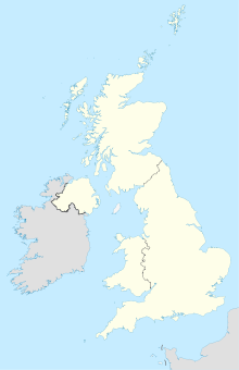
Walton and Weybridge war ein von 1933-1974 bestehender Verwaltungsbezirk (Urban District) innerhalb der südenglischen Grafschaft Surrey. Gebildet wurde der Bezirk aus den Gemeinden Walton-on-Thames und Weybridge. Diese Orte befinden sich im Südwesten des Ballungsgebiets von London am Londoner Autobahnring M25. Im Zuge der Verwaltungsreform von 1974 wurde der Bezirk aufgelöst und Walton and Weybridge mit der Gemeinde Esher zum neuen Bezirk von Elmbridge vereinigt. Heute leben im Gebiet des alten Urban Districts rund 54.000 Einwohner.

Söhne und Töchter des Bezirks


Wikimedia Foundation.

Игры ⚽ Нужно решить контрольную?

Schlagen Sie auch in anderen Wörterbüchern nach:

  • Walton and Weybridge Urban District — infobox historic subdivision Name= Walton and Weybridge HQ= Town Hall, New Zealand Avenue, Walton on Thames Status= Urban district Start= 1933 End= 1974 Replace= Elmbridge Arms= PopulationFirst= 25,658 PopulationFirstYear= 1931 PopulationLast= 51 …   Wikipedia

  • Runnymede and Weybridge (UK Parliament constituency) — UK constituency infobox Name = Runnymede and Weybridge Map1 = RunnymedeWeybridge Map2 = Surrey Type = County Year = 1997 Entity = Surrey County = Surrey EP = South East England MP = Philip Hammond Party = ConservativeRunnymede and Weybridge is a… …   Wikipedia

  • Walton Rowing Club — is an amateur rowing club, on the River Thames in England. Its club and boat house is situated at on the Surrey bank of the Thames at Walton on Thames just above Sunbury Lock. The club organises several rowing events, and members have competed at …   Wikipedia

  • Weybridge — 51.371944444444 0.46194444444444 Koordinaten: 51° 22′ N, 0° 28′ W …   Deutsch Wikipedia

  • Weybridge — infobox UK place country = England latitude=51.37204 longitude= 0.45270 official name= Weybridge map type= Surrey population = 19,463 shire district= Elmbridge shire county = Surrey region= South East England constituency westminster= Runnymede… …   Wikipedia

  • Weybridge Rowing Club — is a rowing club situated in the Weybridge area with a variety of different ages and abilities of rowers from twelve upwards. They are a well known club and have experienced coaches and a good community atmosphere.LocationThe Club is situated on… …   Wikipedia

  • List of District Health Authorities in England and Wales — District Health Authorities were administrative units of the National Health Service in England and Wales from 1982 to 1996. The districts were a second tier below the health regions. They replaced the Area Health Authorities (which generally… …   Wikipedia

  • Smith, Sir Keith Macpherson; and Smith, Sir Ross Macpherson — ▪ Australian pilots Respectively,   born Dec. 20, 1890, Adelaide, S.Aus. died Dec. 19, 1955, Sydney, N.S.W. born Dec. 4, 1892, Adelaide, S.Aus. died April 13, 1922, Brooklands, near Walton and Weybridge, Surrey, Eng.       brothers, Australian… …   Universalium

  • Walton-on-Thames — Coordinates: 51°23′12″N 0°24′48″W / 51.386797°N 0.413394°W / 51.386797; 0.413394 …   Wikipedia

  • Walton Bridge — Infobox Bridge bridge name= Walton Bridge caption= Walton Bridge current bridge from upstream official name= carries= A224 road crosses=River Thames locale= Walton on Thames maint= id= designer = design= material = Steel spans = pierswater = 3… …   Wikipedia

Share the article and excerpts

Direct link
Do a right-click on the link above
and select “Copy Link”