- Ward (South Dakota)
-

Dieser Artikel wurde aufgrund von inhaltlichen Mängeln auf der Qualitätssicherungsseite des Projektes USA eingetragen. Hilf mit, die Qualität dieses Artikels auf ein akzeptables Niveau zu bringen, und beteilige dich an der Diskussion! 
Ward 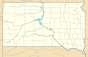

Ward Lage in South DakotaBasisdaten Staat: Vereinigte Staaten Bundesstaat: South Dakota County: Koordinaten: 44° 9′ N, 96° 28′ W44.154166666667-96.461111111111535Koordinaten: 44° 9′ N, 96° 28′ W Zeitzone: Central Standard Time (UTC−6) Einwohner: 41 (Stand: 2000) Bevölkerungsdichte: 58,6 Einwohner je km² Fläche: 0,7 km² (ca. 0 mi²)
davon 0,7 km² (ca. 0 mi²) LandHöhe: 535 m Vorwahl: +1 605 FIPS: 46-68660 GNIS-ID: 1258820 Ward ist der nördlichste Ort im Moody County im US-Bundesstaat South Dakota. Der Ort hatte 41 Einwohner (Stand: 2000) auf einer Fläche von 0,7 km².
Lage
Ward liegt direkt an der Staatsgrenze zum Pipestone County in Minnesota. Nächstgrößere Städte sind das 25km entfernte Brookings im Nordwesten und Flandreau 20km im Südwesten. Pipestone in Minnesota im Südosten ist ebenfalls 20km Luftlinie entfernt.
Name
Ward wurde nach dem Förderer der Eisenbahnlinie durch das Staatsgebiet von Dakota zwischen 1887 und 1889 James A. Ward benannt.
Weblinks


Wikimedia Foundation.