- Washington & Old Dominion Railroad Trail
-
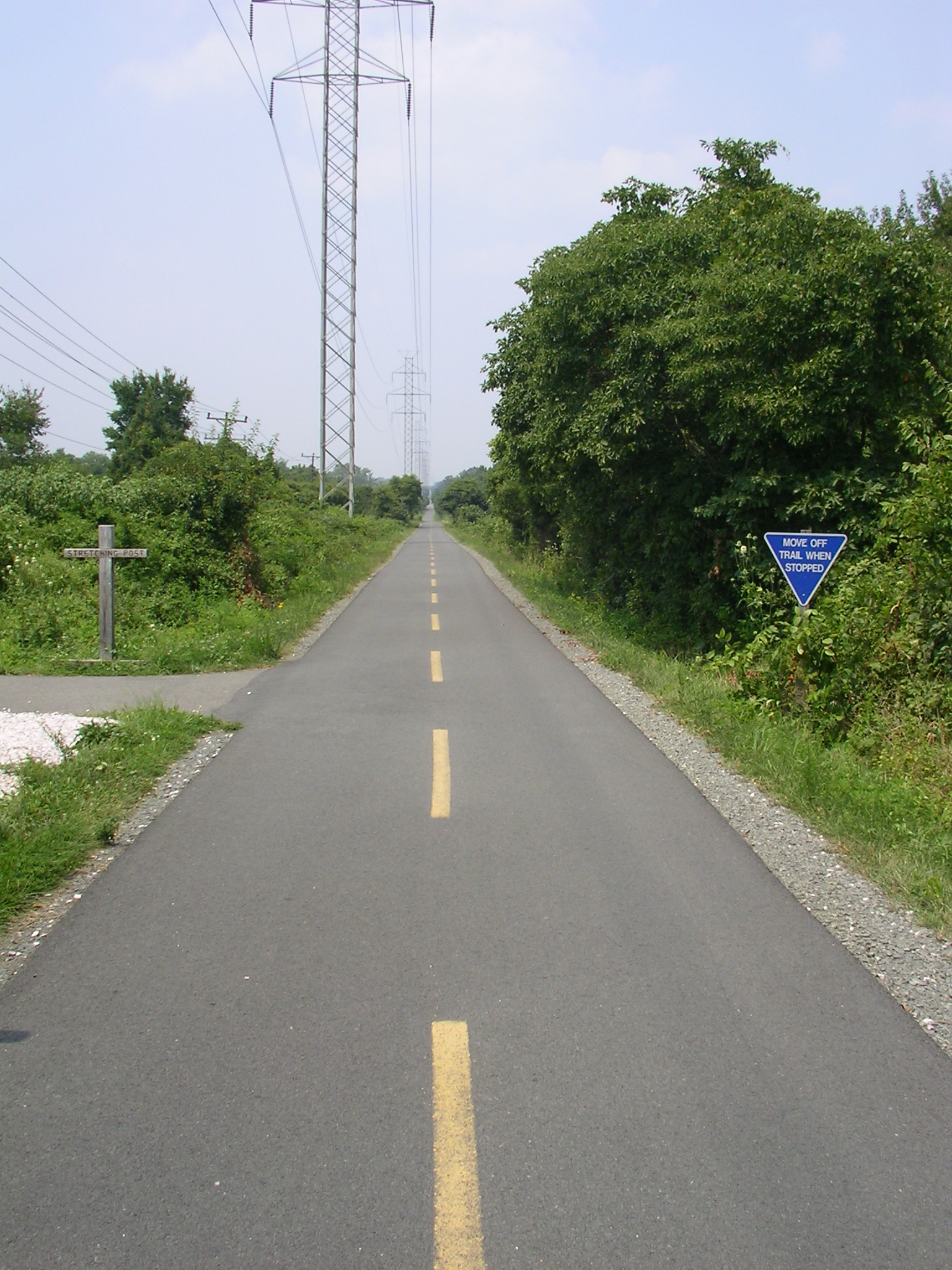
 W&OD Trail auf Höhe Ashburn
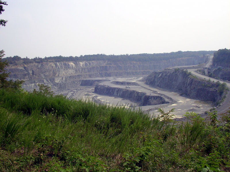
 Steinbruch (Luck Stone Quarry) bei Mile 29.8
Der Washington & Old Dominion Railroad Regional Park oder Washington & Old Dominion Railroad Trail (manchmal als W&OD Trail oder W&OD abgekürzt und oft einfach als "the WOD" (ausgesprochen "wad") bezeichnet) ist ein sehr bekannter und ungewöhnlich geformter Regionalpark in Northern Virginia. Die Besonderheit des Parks ist ein asphaltierter Pfad, der auf der Trasse der Washington and Old Dominion Railroad, die durch dicht besiedelte Städte und Vorstädte führt, erbaut wurde.
Obwohl der Park 72 Kilometer (45 Meilen) lang ist, ist er nur rund 30 Meter breit. Der asphaltierte Pfad ist fast durchgehend etwa drei Meter breit und geeignet zum Spazieren, Joggen, Radfahren, und Inline-Skaten. Ein Kiesweg zum Reiten läuft 52 km lang parallel zum asphaltierten Pfad.
Der Pfad beginnt an der Grenze von Arlington County und der Stadt Alexandria, VA, an der Ausfahrt 6 des Interstate 395 in Shirlington. Der Pfad ist an seinem Ursprung mit dem asphaltierten Four Mile Run Trail verbunden, der ostwärts durch Arlington entlang einer Flusseinmündung verläuft, wo er auf den Mount Vernon Trail beim Ronald Reagan National Airport nahe dem Potomac River trifft. Dies ist auch die geringste Seehöhe des gesamten Pfads (42,98 m).
Der Pfad verläuft größtenteils parallel zum Potomac River und zur Virginia State Route 7. Er führt nordwestwärts nach Purcellville (Loudoun County), u.a. durch Arlington, Falls Church, Fairfax County, Vienna, Reston, Herndon, Sterling, Ashburn, Leesburg, Paeonian Springs und Hamilton.
Außerdem verläuft der Pfad größtenteils neben einer Stromleitung von Dominion Virginia Power. Der Pfad erreicht seine höchste Erhebung (185,93 m) am Gipfel des Clarks Cap in Catoctin Mountain, westlich von Leesburg. Dort in der Nähe (Mile 38.2) führt der Weg unter einer alten steinernen Straßenüberführung, die einst die Virginia State Route 7 über die Bahnstrecke führte.
Die Northern Virginia Regional Park Authority (NVRPA) verwaltet und erhält den Park und dessen Pfade. NVRPA erhält einen Großteil der Umgebung des Parks in ihrem Naturzustand. Längsseits des Pfads wurden einige Informationstafeln aufgestellt, die die historischen und natürlichen Besonderheiten des Parks beschreiben.
Weblinks
- Offizielle Seite der Northern Virginia Regional Park Authority über den Washington & Old Dominion Railroad Regional Park
- Friends of the W&OD
- Friends of the W&OD: Karte des W&OD Trail mit Entfernungsangaben
- Friends of the W&OD: Seehöhenangaben und Karte des W&OD Trail
- Washington & Old Dominion Trail auf BikeWashington.org
- Inoffizielle Seite über den Washington & Old Dominion Trail
- Washington & Old Dominion Trail mit Beschreibung der Abschnitte und Entfernungsangaben
- Karte, die den Routenverlauf darstellt
Wikimedia Foundation.