- Wattle Range Council
-
Council of Wattle Range 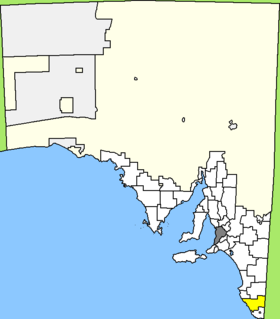
Lage des Wattle Range Council in South AustraliaGliederung Staat:  Australien
Bundesstaat:  South Australia
Verwaltungssitz: Millicent Daten und Zahlen Fläche: 3.924 km² Einwohner: 11.888 (2006) [1] Bevölkerungsdichte: 3 Einwohner je km² Wards: 4 -37.595140.35416666667Koordinaten: 37° 36′ S, 140° 21′ ODer Wattle Range Council ist ein lokales Verwaltungsgebiet (LGA) im australischen Bundesstaat South Australia. Das Gebiet ist 3.924 km² groß und hat etwa 12.000 Einwohner.
Wattle Range liegt im äußersten Südosten von South Australia an der Grenze zu Victoria etwa 420 km südöstlich der Metropole Adelaide und 410 km westlich von Melbourne. Das Gebiet beinhaltet 40 Ortsteile und Ortschaften: Beachport, Benara, Benara Flat, Canunda, Comaum, Coonawarra, Furner, Glencoe, Glencoe West, Glenroy, Grey, Hatherleigh, Kalangadoo, Katnook, Killanoola, Kirip, Koorine, Krongart, Leggs Lane, Maaoupe, Millicent, Mount Burr, Mount Graham, Mount McIntyre, Nangula, Nangwarry, Penola, Pompoon, Rendlesham, Rivoli Bay, Rocky Camp, Sebastapol, Short, Snuggery, Southend, St Clair, Tantanoola, Thornlea, Wattle Range und Wyrie. Der Verwaltungssitz des Councils befindet sich in Millicent im Westen der LGA.
Verwaltung
Der Council von Wattle Range hat zwölf Mitglieder, elf Councillor werden von den Bewohnern der vier Wards gewählt (je zwei aus Riddoch, Sorby Adams und Kintore Ward, fünf aus Corcoran Ward). Diese vier Bezirke sind unabhängig von den Ortschaften festgelegt. Der Ratsvorsitzende und Mayor (Bürgermeister) wird zusätzlich von allen Bewohnern der LGA gewählt.
Weblinks
Einzelnachweise
- ↑ Australian Bureau of Statistics (25. Oktober 2007): Wattle Range (DC) (Local Government Area) (Englisch). 2006 Census QuickStats. Abgerufen am 6. April 2010.

Wikimedia Foundation.