- West Hartford
-
West Hartford 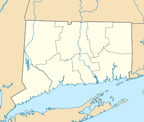

West Hartford Lage in ConnecticutBasisdaten Staat: Vereinigte Staaten Bundesstaat: Connecticut County: Koordinaten: 41° 46′ N, 72° 45′ W41.767777777778-72.75388888888950Koordinaten: 41° 46′ N, 72° 45′ W Zeitzone: Eastern Standard Time (UTC−5) Einwohner: 61.173 (Stand: 2005) Bevölkerungsdichte: 1.075,1 Einwohner je km² Fläche: 58,0 km² (ca. 22 mi²)
davon 56,9 km² (ca. 22 mi²) LandHöhe: 50 m Postleitzahlen: 06107, 06110-06119 Vorwahl: +1 860 FIPS: 09-82590 GNIS-ID: 0213529 Webpräsenz: www.west-hartford.com Bürgermeister: Scott Slifka West Hartford ist eine Stadt im Hartford County im US-amerikanischen Bundesstaat Connecticut mit 65.200 Einwohnern (Stand: 2004). Die geografischen Koordinaten sind: 41,77° Nord, 72,75° West. Das Stadtgebiet hat eine Größe von 57,9 km².
Inhaltsverzeichnis
Geschichte
In den Jahren 1672 - 1677 wurde die Gemarkung der "West Division" der Gemeinde Hartford mit Quaker Lane, Mountain Road sowie den Gemeinden Bloomfield und Newington abgesteckt. Später kamen auch noch Teile von Hartford und Farmington hinzu. Der erste Siedler, Stephen Hosmer, ließ sich 1679 auf dem Gebiet der heutigen Gemarkung von West Hartford nieder wo er eine Mühle am Forellenbach (Trout Brook) baute.
Die West Division Hartfords wurde 1711 zur Kirchengemeinde (West Division Parish oder auch West Society). 1806 wurde die Gemarkung durch den Landtag von Connecticut in "West Hartford" umbenannt. 1854 wurde West Hartford schließlich von Hartford abgespalten und als eigenständige Gemeinde im Gemeinderegister eingetragen. Im Jahr 2004 konnte die Gemeinde mit einem Festmonat ihr 150jähriges Jubiläum feiern.
Wie viele Orte zu dieser Gegend lebte die Gemeinde über viele Jahre überwiegend von der Landwirtschaft. Im Laufe der Zeit entwickelte sich die Gemeinde zu einem wohlhabenden Vorort von Hartford.
Schulen
- Aiken Elementary School
- Braeburn Elementary School
- Bugbee Elementary School
- Charter Oak Elementary School
- Louise Duffy Elementary School
- Morley Elementary School
- Norfeldt Elementary School
- Smith Elementary School
- Webster Hill Elementary School
- Whiting Lane Elementary School
- Wolcott Elementary School
- King Philip Middle School
- Sedgwick Middle School
- Bristow Middle School
- Conard High School
- Hall High School
- American School for the Deaf
Weiterführende Bildungseinrichtungen
- University of Hartford
- St. Joseph College
- University of Connecticut
Bevölkerungsentwicklung
- 1850 - 4.411
- 1860 - 1.296
- 1870 - 1.533
- 1880 - 1.828
- 1890 - 1.930
- 1900 - 3.186
- 1910 - 4.808
- 1920 - 8.854
- 1930 - 24.941
- 1940 - 33.776
- 1950 - 44.402
- 1960 - 62.382
- 1970 - 68.031
- 1980 - 61.301
- 1990 - 60.110
- 2000 - 63.589
- 2002 - 61.365
Persönlichkeiten
- Edward Williams Morley (1838−1923), Chemiker
- Roger Sperry (1913−1994), Neurowissenschaftler und Gewinner des Medizin-Nobelpreises 1981
Söhne und Töchter der Stadt
- John Gregory Dunne (1932−2003), Schriftsteller, Journalist und Drehbuchautor
- John Franklin Enders (1897−1985), Bakteriologe und Gewinner des Medizin-Nobelpreises 1954
- Edward N. Lorenz (1917−2008), Professor der Meteorologie
- Peter Paige (* 1969), Schauspieler
- Theodore Sedgwick (1746−1813), Politiker
- William Thompson Sedgwick (1855−1921), Professor für Public Health
- Noah Webster (1758−1843), Lexikograf, Rechtschreibreformer, Publizist, Übersetzer und Schriftsteller
Kategorien:- Ort in Connecticut
- Hartford County

Wikimedia Foundation.