- Wethersfield (Connecticut)
-
Wethersfield 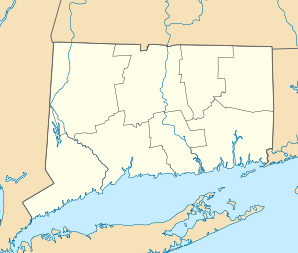

Wethersfield Lage in ConnecticutBasisdaten Staat: Vereinigte Staaten Bundesstaat: Connecticut County: Koordinaten: 41° 42′ N, 72° 40′ W41.701111111111-72.66944444444441Koordinaten: 41° 42′ N, 72° 40′ W Zeitzone: Eastern Standard Time (UTC−5) Einwohner: 26.220 (Stand: 2005) Bevölkerungsdichte: 816,8 Einwohner je km² Fläche: 33,9 km² (ca. 13 mi²)
davon 32,1 km² (ca. 12 mi²) LandHöhe: 41 m Postleitzahl: 06109 Vorwahl: +1 860 FIPS: 09-84900 GNIS-ID: 0213533 Webpräsenz: wethersfieldct.com Bürgermeister: Andrew S. Adil Wethersfield ist eine Stadt im Hartford County im US-Bundesstaat Connecticut mit 27.000 Einwohnern (Stand: 2004). Die geographischen Koordinaten sind: 41,70° Nord, 72,67° West. Das Stadtgebiet hat eine Größe von 34,0 km².
Inhaltsverzeichnis
Geschichte
Wethersfield wurde 1634 von Farmern im benachbarten Watertown als Stadtwohnsitz gegründet und zählt zu den ältesten Städten in Connecticut. Am 23. April 1637 wurden einige Einwohner der Gemeinde bei einem Überfall von Pequot-Indianern getötet. Im Mai 1781 planten hier George Washington und der französische General de Rochambeau die Schlacht von Yorktown in Virginia.
Schulen
- Charles Wright School
- Emerson-Williams School
- A. W. Hanmer School
- Highcrest School
- Silas Deane Middle School
- Wethersfield High School
Museen
Webb Deane Stevens Museum
Söhne und Töchter der Stadt
- Betsey Johnson, Designerin und Modeschöpferin
- John Mehegan, Jazz-Pianist, Dozent und Kritiker
- Stephen Mix Mitchell, Politiker in der Gründerzeit der USA
- Asher Robbins, US-Senator
- Annabella Sciorra, Schauspielerin
- Charles Wright, Botaniker
Kategorien:- Ort in Connecticut
- Hartford County

Wikimedia Foundation.