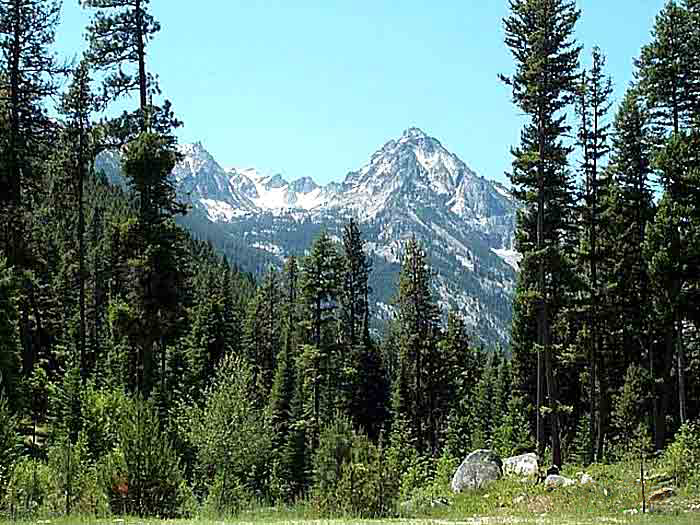
Bitterroot Mountains — Range Trapper Peak, in the Central Bitterroot Range … Wikipedia
Bitterroot Range — Infobox protected area | name = Bitterroot Range caption = locator x = 60 locator y = 33 location = Idaho Montana USA nearest city = Missoula, MT lat degrees = 46 lat minutes = 00 lat seconds = 00 lat direction = N long degrees = 114 long minutes … Wikipedia
Bitterroot Range — Teil der Bitterroot Range in Montana, Blick von El Capitan nach Norden Die Bitterrootkette (engl. Bitterroot Range) ist eine etwa 500 km lange Bergkette, die sich entlang der Grenze zwischen den US amerikanischen Bundesstaaten Idaho und Montana… … Deutsch Wikipedia
Bitterroot — For the waterway, see Bitterroot River. Bitterroot Lewisia rediviva var. rediviva in Wenas Wildlife Area, Washington Scientific classification Kingdo … Wikipedia
Bitterroot — Bit ter*root , n. (Bot.) A plant ({Lewisia rediviva}) allied to the purslane, but with fleshy, farinaceous roots, growing in the mountains of Idaho, Montana, etc. It gives the name to the Bitter Root mountains and river. The Indians call both the … The Collaborative International Dictionary of English
Bitterroot Range — [after BITTERROOT, found esp. in the foothills] range of the Rocky Mountains, along the Ida. Mont. border: highest peak, c. 11,000 ft (3,353 m) … English World dictionary
Bitterroot Range — [ bɪtəruːt reɪndʒ], lang gestreckte, wald und erzreiche Kette der Rocky Mountains an der Grenze Montana/Idaho, USA, bis 3 100 m über dem Meeresspiegel … Universal-Lexikon
Bitterroot Valley — The Bitterroot Valley is located in southwestern Montana in the northwestern United States. It extends over 100 miles (160 km) from remote Horse Creek Pass north to a point near the city of Missoula. To the west is the Bitterroot Range and the… … Wikipedia
Bitterroot Range — a mountain range on the boundary between Idaho and Montana, a part of the Rocky Mountains: highest peak, ab. 10,000 ft. (3050 m). Also, Bitter Root Range. * * * Segment of the northern Rocky Mountains, U.S. Extending north south 300 mi (480 km)… … Universalium
Bitterroot Range — geographical name range of the Rocky Mountains on Idaho Montana boundary see Beaverhead Mountains, Garfield Mountain … New Collegiate Dictionary
 Trapper Peak in den Bitterroot Mountains
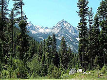