- Boelhe
-
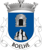
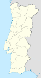
Boelhe Wappen Karte 
Basisdaten Region: Norte Unterregion: Tâmega Distrikt: Porto Concelho: Penafiel Koordinaten: 41° 8′ N, 8° 15′ W41.135331864722-8.243268Koordinaten: 41° 8′ N, 8° 15′ W Einwohner: 1.843 (Stand: 2001) Fläche: 4,83 km² Bevölkerungsdichte: 382 Einwohner pro km² Boelhe ist eine Gemeinde im Norden Portugals.
Boelhe gehört zum Kreis Penafiel im Distrikt Porto, besitzt eine Fläche von 4,83 km² und hat 1.843 Einwohner (2001). Die Kirche São Gens de Boelhe aus dem 12. Jahrhundert stellt eine besondere Sehenswürdigkeit dar.
Weblinks
- Karte der Freguesia Boelhe beim Instituto Geográfico do Exército
Freguesias im Concelho PenafielAbragão | Boelhe | Bustelo | Cabeça Santa | Canelas | Capela | Castelões | Croca | Duas Igrejas | Eja | Figueira | Fonte Arcada | Galegos | Guilhufe | Irivo | Lagares | Luzim | Marecos | Milhundos | Novelas | Oldrões | Paço de Sousa | Penafiel | Perozelo | Pinheiro | Portela | Rans | Rio de Moinhos | Santa Marta | Santiago de Subarrifana | São Mamede de Recezinhos | São Martinho de Recezinhos | São Miguel de Paredes | Sebolido | Urrô | Valpedre | Vila Cova
Wikimedia Foundation.
Schlagen Sie auch in anderen Wörterbüchern nach:
Boelhe — Boëlhe Boëlhe (en wallon Boye) est une section de la commune belge de Geer située en Région wallonne dans la province de Liège. C était une commune à part entière avant la fusion des communes de 1977. Code postal : 4250 Portail de la… … Wikipédia en Français
Boëlhe — [bwal][1] (en wallon Boye) est une section de la commune belge de Geer située en Région wallonne dans la province de Liège. C était une commune à part entière avant la fusion des communes de 1977. Code postal : 4250 Notes ↑ Jean Marie… … Wikipédia en Français
Monuments of Portugal — The Monuments of Portugal were constructed throughout the Portuguese territory, and date back to the period of pre historic settlement of occupation. Subsequently, the region that is today Portugal has been colonized by many civilizations, which… … Wikipedia
Geer (commune) — Pour les articles homonymes, voir Geer. Geer Géolocalisation sur la carte … Wikipédia en Français
Районы округа Порту — … Википедия
Боэлье — Район Боэлье Boelhe Герб … Википедия
List of postal codes in Belgium — Belgian postal codes are numeric and consist of 4 numbers, although the last one is often zero. The first digit indicates the province (except for the 3xxx numbers that are shared by the eastern part of Flemish Brabant and Limburg and the and… … Wikipedia
List of postal codes in Portugal — Aveiro districtMealhada municipality*3050 Antes *3050 Barcouço *3050 Casal Comba *3050 Luso *3050 Mealhada *3050 Pampilhosa *3050 Vacariça *3050 Ventosa do BairroMurtosa municipality*3870 Bunheiro *3870 Monte *3870 Murtosa *3870 TorreiraOliveira… … Wikipedia
Penafiel — (pron. IPA2|pɨnɐfi ɛɫ or [IPA|penɐfi ɛɫ] ) is a Portuguese city of the Porto district in the North of the country.The city of Penafiel itself had, as of 2001, a population of 9,343. The municipal areas surrounding Penafiel City have a population… … Wikipedia
Abragão — Wappen Karte … Deutsch Wikipedia


