Perozelo

Perozelo
Perozelo
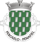
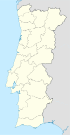
Wappen Karte
Wappen von Perozelo
Perozelo (Portugal)
Perozelo
Basisdaten
Region: Norte
Unterregion: Tâmega
Distrikt: Porto
Concelho: Penafiel
Koordinaten: 41° 9′ N, 8° 16′ W41.148333333333-8.2638888888889Koordinaten: 41° 9′ N, 8° 16′ W
Einwohner: 1.366 (Stand: 2001)
Fläche: 4,92 km²
Bevölkerungsdichte: 278 Einwohner pro km²

Vorlage:Infobox Ort in Portugal/Wartung/Art ist leer

Vorlage:Infobox Ort in Portugal/Wartung/Karte ist leer


Vorlage:Infobox Ort in Portugal/Wartung/Höhe ist leer Vorlage:Infobox Ort in Portugal/Wartung/PLZ ist leer Vorlage:Infobox Ort in Portugal/Wartung/Bürgermeister ist leer

Vorlage:Infobox Ort in Portugal/Wartung/Einwohnerstand ist leer

Vorlage:Infobox Ort in Portugal/Wartung/Verwaltungsort ist leer Vorlage:Infobox Ort in Portugal/Wartung/Webseite ist leer Vorlage:Infobox Ort in Portugal/Wartung/Email ist leer

Perozelo ist eine Gemeinde (Freguesia) im Norden Portugals.

Perozelo gehört zum Kreis Penafiel im Distrikt Porto, besitzt eine Fläche von 4,92 km² und hat 1366 Einwohner (2001).

Weblinks


Wikimedia Foundation.

Игры ⚽ Поможем написать курсовую

Schlagen Sie auch in anderen Wörterbüchern nach:

  • Районы округа Порту — …   Википедия

  • Перозелу — Район Перозелу Perozelo Герб …   Википедия

  • Sidónio Pais — Infobox Officeholder honorific prefix = name =Sidónio Pais honorific suffix = imagesize =200px caption = order =Minister of Foment term start =September 3, 1911 term end =November 12, 1911 primeminister =João Chagas predecessor =Brito Camacho… …   Wikipedia

  • List of postal codes in Portugal — Aveiro districtMealhada municipality*3050 Antes *3050 Barcouço *3050 Casal Comba *3050 Luso *3050 Mealhada *3050 Pampilhosa *3050 Vacariça *3050 Ventosa do BairroMurtosa municipality*3870 Bunheiro *3870 Monte *3870 Murtosa *3870 TorreiraOliveira… …   Wikipedia

  • Penafiel — (pron. IPA2|pɨnɐfi ɛɫ or [IPA|penɐfi ɛɫ] ) is a Portuguese city of the Porto district in the North of the country.The city of Penafiel itself had, as of 2001, a population of 9,343. The municipal areas surrounding Penafiel City have a population… …   Wikipedia

  • Abragão — Wappen Karte …   Deutsch Wikipedia

  • Boelhe — Wappen Karte …   Deutsch Wikipedia

  • Bustelo (Penafiel) — Bustelo Wappen Karte …   Deutsch Wikipedia

  • Cabeça Santa — Wappen Karte …   Deutsch Wikipedia

  • Croca — Wappen Karte …   Deutsch Wikipedia

Share the article and excerpts

Direct link
Do a right-click on the link above
and select “Copy Link”