Bridgetown (Nova Scotia)

Bridgetown (Nova Scotia)
Bridgetown
Lage in Nova Scotia
Bridgetown (Nova Scotia)
Bridgetown
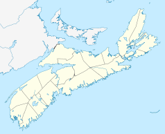
Bridgetown
Staat: Kanada
Provinz: Nova Scotia
County: Annapolis County
Koordinaten: 44° 50′ N, 65° 17′ W44.84139-65.28944Koordinaten: 44° 50′ N, 65° 17′ W
Zeitzone: Atlantic Time (UTC−4)
Postleitzahl: B0S
Gründung: 1783

Bridgetown ist eine Stadt in Nova Scotia, Kanada. Die Stadt ist in der Verwaltungseinheit Annapolis Subd. B mit 3.707 Einwohnern eingegliedert. In der Stadt selbst leben 1.035 Einwohner.

Geschichte

Die Gegend um Bridgetown war sowohl von Mi'kmaq-Indianern, Akadiern und Briten umkämpft. Die Schlacht von Bloody Creek im Jahr 1757 war eine der Vielen, die geschlagen wurden, um die Kontrolle über die Region zu erhalten. Als die Akadier von den Briten vertrieben wurden, kamen 1783 neue Siedler aus den amerikanischen Kolonien, Loyalisten, die der britischen Krone die Treue hielten. Sie gründeten die Stadt und bauten 1803 die erste Brücke über den Annapolis River. Kapitän James Crosskill aus England übernahm die Führung der Stadt und legte 1821 die Grenzen fest. Im Jahr 1822 erhielt die Stadt offiziell den Namen Bridgetown. Die Stadtrechte wurden ihr im Jahr 1897 verliehen.

Wirtschaft

Im 19. Jahrhundert prägte der Schiffbau die Stadt. Heute lebt die Stadt von der Landwirtschaft und der Weiterverarbeitung ihrer Produkte. Ende September, zur Apfelernte, feiert die Stadt jedes Jahr das Bridgetown Ciderfest.

Partnerstädte


Wikimedia Foundation.

Игры ⚽ Поможем решить контрольную работу

Schlagen Sie auch in anderen Wörterbüchern nach:

  • Bridgetown, Nova Scotia — Bridgetown (2006 pop.: 972) is a Canadian town in Annapolis County, Nova Scotia.Situated on the Annapolis River at the head of the tide, the area saw Mi kmaq settlements in the area, followed by Acadian settlers from Port Royal and then British… …   Wikipedia

  • Nova Scotia — Nouvelle Écosse (French) Alba Nuadh (Gaelic) …   Wikipedia

  • Nova Scotia Route 201 — Route 201 Route information Maintained by Nova Scotia Department of Transportation and Infrastructure Renewal Length: 38 km …   Wikipedia

  • Nova Scotia Highway 101 — Map of all coordinates from Google Map of all coordinates from Bing Export all coordinates as KML …   Wikipedia

  • Nova Scotia Trunk 1 — Trunk 1 Evangeline Trail Route information Maintained by Nova Scotia Department of Transportation and Infrastructure Renewal …   Wikipedia

  • List of Nova Scotia provincial highways — This is a list of numbered highways in the province of Nova Scotia. Arterial (100 series) highways : See 100 Series Highways * *) * *) *) *) * * * * Highway 102 interchange at Miller Lake * * *Historical Note: Nova Scotia s original arterial… …   Wikipedia

  • Middleton, Nova Scotia — Middleton   Town   …   Wikipedia

  • Digby, Nova Scotia — Digby   Town   Digby Harbour …   Wikipedia

  • Lunenburg, Nova Scotia — Not to be confused with Lunenburg County, Nova Scotia or Lunenburg (municipal district), Nova Scotia. Old Town Lunenburg * UNESCO World Heritage Site …   Wikipedia

  • Yarmouth, Nova Scotia — This article is about a town in Nova Scotia. For other places, see Yarmouth. Yarmouth   Town   Main Street Yarmouth …   Wikipedia

Share the article and excerpts

Direct link
Do a right-click on the link above
and select “Copy Link”