Brooks Range

Brooks Range
Die Brookskette im Norden Alaskas
Die Brookskette

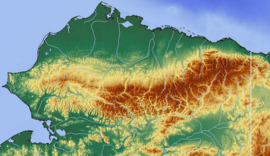
Die bis 2749 m hohe Brookskette (engl. Brooks Range [ˈbrʊks ˌreɪndʒ]) ist neben der Alaskakette die zweite große Bergkette Alaskas und zieht sich entlang des 68. Breitengrades vom Beringmeer im Westen bis zur Beaufortsee im Nordosten oberhalb des Polarkreises über mehr als 1000 km durch Alaska.

Der Mount Chamberlin ist mit 2.749 m die höchste Erhebung der Brookskette, die flächenmäßig etwa ein Fünftel des Staates bedeckt.

Entstanden ist die Brookskette vor etwa 90 Millionen Jahren durch eine Kollision Alaskas mit einer anderen Kontinentalplatte. Durch das Gebirge wird das Innere Alaskas etwas vor den Stürmen, die jeden Winter von den Eismeeren kommen, geschützt.

Auf der Nordseite liegt die North Slope, eine baumlose, flache und von unzähligen Seen bedeckte Tundra, die sich bis zur arktischen Küste erstreckt. Auf der Südseite liegen im Binnenland die riesigen Flusstäler des Koyukuk und des Yukon Rivers.

Die Brookskette gliedert sich in die Gebirgszüge De Long Mountains, Baird Mountains, Schwatka Mountains, Endicott Mountains, Philip Smith Mountains, Eastern Brooks Range und den Colville Area am Polarmeer.

Die höchsten Berge der Brookskette
(alle in der Eastern Brooks Range gelegen)
  • Mount Chamberlin (2749 m)
  • Mount Isto (2736 m)
  • Mount Hubley (2717 m)
  • Mount Michelson (2699 m)
  • Contact Peak (2646 m)
  • Mount Waw (2626 m)
  • Tugak Peak (2591 m)
  • Schwanda Peak (2591 m)
  • Mount Suki (2530 m)

Literatur

  • Geographic Society, Alaska; Rennick, Penny: Brooks Range (Alaska Geographic). Alaska Geographic Society, ISBN 978-1-56661-032-2. 

68.2-149.57Koordinaten: 68° 12′ N, 149° 30′ W


Wikimedia Foundation.

Игры ⚽ Нужно решить контрольную?

Schlagen Sie auch in anderen Wörterbüchern nach:

  • Brooks Range — [after A. H. Brooks (1871 1924), U.S. geologist] mountain range extending across N Alas.: highest peak, 9,239 ft (2,816 m) …   English World dictionary

  • Brooks Range — Brooks′ Range′ n. geg a mountain range in N Alaska, forming a watershed between the Yukon River and the Arctic Ocean: highest peak, 9239 ft. (2815 m) …   From formal English to slang

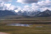
  • Brooks Range — Geobox|Range name=Brooks Range image caption=Brooks Range from near Galbraith Lake country=United States |country1=Canada region=Alaska |region1=Yukon unit= border= length imperial=| length orientation= width imperial= | width orientation=… …   Wikipedia

  • Brooks Range — a mountain range in N Alaska, forming a watershed between the Yukon River and the Arctic Ocean: highest peak, 9239 ft. (2815 m). * * * Mountain range, northern Alaska, U.S. It extends about 600 mi (1,000 km) from Kotzebue Sound to the Canadian… …   Universalium

  • Brooks Range — Chaîne Brooks Chaîne Brooks Géographie Altitude 2 749 m, Mont Chamberlin …   Wikipédia en Français

  • Brooks Range — Sp Brùkso kalnãgūbris Ap Brooks Range L Š. Amerikos Kordiljerų Š dalis, JAV (Aliaska) …   Pasaulio vietovardžiai. Internetinė duomenų bazė

  • Brooks Range — geographical name mountain range N Alaska extending from Kotzebue Sound to Canadian border; highest peak over 9000 feet (2740 meters) …   New Collegiate Dictionary

  • Brooks Range — /bruks ˈreɪndʒ/ (say broohks raynj) noun a mountain range in the US, in northern Alaska, forming a watershed between the Yukon River and the Arctic Ocean. Highest peak, about 3050 m …  

  • Brooks Range — a mountain range in N Alaska, forming a watershed between the Yukon River and the Arctic Ocean: highest peak, 9239 ft. (2815 m). * * * [bro͝oks] a mountain chain that extends across northern Alaska. It is the northwestern end of the Rocky… …   Useful english dictionary

  • Brooks Range — …   Википедия

Share the article and excerpts

Direct link
Do a right-click on the link above
and select “Copy Link”