- Koyukuk River
-
Koyukuk River 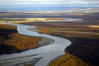
Der Koyukuk River aus der Luft
Daten Lage Alaska (Interior) Flusssystem Yukon Quellgebiet Endicott Mountains, Brookskette
67° 2′ 49″ N, 151° 4′ 26″ W67.046944-151.073889Mündung Yukon River 64.923333-157.553889Koordinaten: 64° 55′ 24″ N, 157° 33′ 14″ W
64° 55′ 24″ N, 157° 33′ 14″ W64.923333-157.553889Länge 805 km Der Koyukuk River ist ein 805 km langer Fluss im Norden Alaskas. Sein Quellgebiet liegt in den Endicott Mountains, einem Gebirgszug in der Brookskette. Er speist den Yukon River, in den er bei der Ortschaft Koyukuk in einer im Koyukuk National Wildlife Refuge gelegenen großen Flussaue mündet. Einige seiner Arme reichen bis über den Polarkreis und in den Gates-of-the-Arctic-Nationalpark. Der Koyukuk selbst wird von den Flüssen Glacier, Alatna und John gespeist.
Der Fluss ist nach den Koyukon, einer Gruppe athapaskischer Menschen in Nordalaska, benannt.
Geschichte
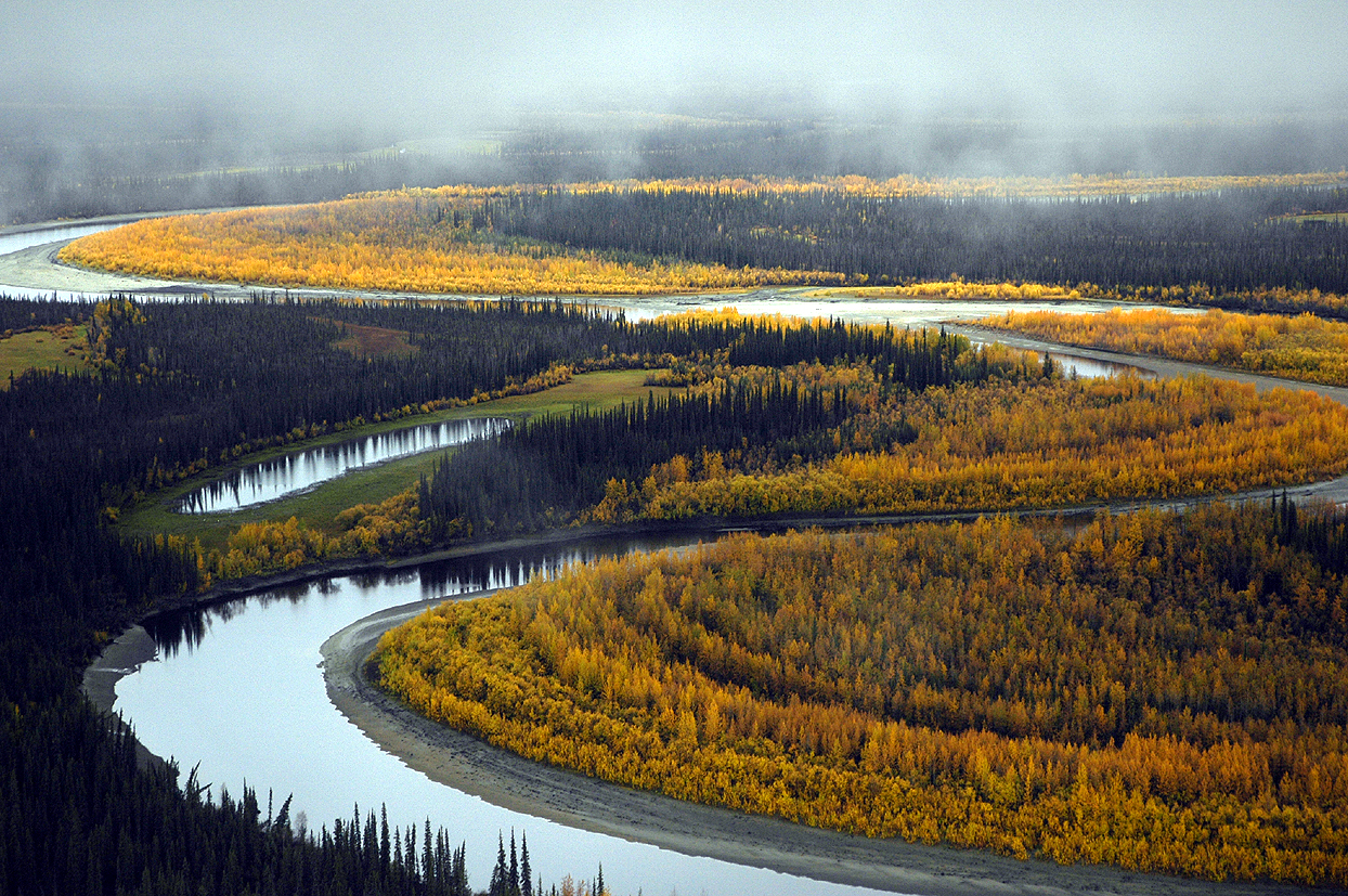
 South Fork des Koyukuk
Soldaten der United States Army erkundeten 1885 erstmals den Fluss. Goldfunde im Jahr 1893 und der Goldrausch am Klondike River 1898 führten zur Besiedlung der Gegend mit Handelsposten und Minen-Camps. 1929 erkundete der Umweltaktivist Robert Marshall die Gegend und gab der entlang des Flusses verlaufenden Brookskette den Namen „Gates of the Arctic“.
Der 164 km lange Teil der North Fork des Koyukuk River im Nationalpark wurden 1980 durch den Alaska National Interest Lands Conservation Act als National Wild and Scenic River unter der Verwaltung des National Park Service ausgewiesen.
Literatur
- Geographic Society, Alaska: Up the Koyukuk (Alaska Geographic). Graphic Arts Center Publishing Company, ISBN 978-0-88240-200-0.
Weblinks
 Commons: Koyukuk River – Sammlung von Bildern, Videos und Audiodateien
- Koyukuk River im Geographic Names Information System des United States Geological Survey
- Koyukuk National Wildlife Refuge
- Koyukuk (North Fork) Wild and Scenic River

Alagnak | Alatna | Andreafsky | Aniakchak | Beaver Creek | Birch Creek | Charley | Chilikadrotna | Delta | Fortymile | Gulkana | Ivishak | John | Kobuk | Koyukuk | Mulchatna | Noatak | Nonvianuk | Nowitna | Salmon | Selawik | Sheenjek | Tinayguk | Tlikakila | Unalakleet | Wind
Wikimedia Foundation.
Schlagen Sie auch in anderen Wörterbüchern nach:
Koyukuk River — The Koyukuk River is a principal tributary of the Yukon River, approximately 500 mi (805 km) long, in northern Alaska in the United States. It drains an area north of the Yukon on the southern side of the Brooks Range. The river is named for the… … Wikipedia
Koyukuk River — River, central Alaska, U.S. It rises on the southern slope of the Brooks Range and flows southwest for 500 mi (800 km) to join the Yukon River, of which it is a major tributary. It was named for the Koyukon, a local Indian people. * * * ▪ river,… … Universalium
North Fork Koyukuk River — as it passes through The Gates of the Arctic … Wikipedia
Koyukuk Wilderness — Koyukuk National Wildlife Refuge Feuchtgebiet mit Fichtenwald … Deutsch Wikipedia
Koyukuk — steht für: Koyukuk (Alaska), eine Ortschaft in Alaska Koyukuk River, einen Fluss in Alaska Yukon Koyukuk Census Area, ein Gebiet zur Erhebung statistischer Daten in Alaska Koyukuk National Wildlife Refuge, ein Wildtier Schutzgebiet in Alaska … Deutsch Wikipedia
Koyukuk — may refer to: * Koyukuk, Alaska * Koyukuk River * Koyukuk Refuge … Wikipedia
Koyukuk, Alaska — Infobox Settlement official name = Koyukuk, Alaska settlement type = City nickname = motto = imagesize = image caption = image mapsize = 250px map caption = Location of Koyukuk, Alaska mapsize1 = map caption1 = subdivision type = Country… … Wikipedia
Koyukuk (rivière) — 64° 55′ 24″ N 157° 33′ 14″ W / 64.9233, 157.554 … Wikipédia en Français
river — river1 riverless, adj. riverlike, adj. /riv euhr/, n. 1. a natural stream of water of fairly large size flowing in a definite course or channel or series of diverging and converging channels. 2. a similar stream of something other than water: a… … Universalium
Yukon River — River, northwestern North America. Formed by the confluence of the Lewes and Pelly rivers in southwestern Yukon Territory, Can., it is 1,980 mi (3,190 km) long. It flows northwest across the Yukon border into Alaska, then southwest across central … Universalium
Koyukuk River
18+
© Academic, 2000-2026
- Kontaktieren Sie uns: Unterstützung, Werbung
Wörterbücher Export, schritte mit PHP, Joomla, Drupal, WordPress, MODx.