Abitibi River

Abitibi River
Abitibi River
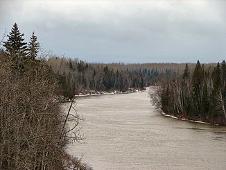
Abitibi River bei Iroquois Falls

Abitibi River bei Iroquois FallsVorlage:Infobox Fluss/KARTE_fehlt

DatenVorlage:Infobox Fluss/GKZ_fehlt
Lage Cochrane District, Ontario (Kanada)
Flusssystem Moose River
Abfluss über Moose River → Hudson Bay
Quelle Lake Abitibi, 38 km östlich von Iroquois Falls
48° 47′ 6″ N, 80° 10′ 23″ W48.785-80.173055555556265
Quellhöhe 265 mVorlage:Infobox Fluss/NACHWEISE_fehlen
Mündung in den Moose River 30 km südsüdwestlich von Moosonee
51.071388888889-80.925555555556

51° 4′ 17″ N, 80° 55′ 32″ W51.071388888889-80.925555555556
Vorlage:Infobox Fluss/MÜNDUNGSHÖHE_fehlt
Länge 547 km[1]
Einzugsgebiet 29.500 km²[1]

Vorlage:Infobox Fluss/ABFLUSS_fehlt

Rechte Nebenflüsse Sucker River, Little Abitibi River
Linke Nebenflüsse Black River, Frederick House River, North Driftwood River
Kleinstädte Iroquois Falls
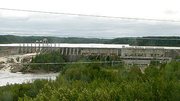
Blick von der Ontario Northland Railway auf den Otter Rapids Dam

The Abitibi River ist ein Fluss im nordöstlichen Ontario in Kanada. Er fließt vom See Lake Abitibi in nordwestlicher Richtung und mündet in den Moose River, der zur James Bay fließt. Der Abitibi River hat - gemessen vom Ende des Lac Loïs - eine Länge von etwa 540 km.

Der Fluss bildete früher eine wichtige Route im Pelzhandel der Hudson's Bay Company. Heutzutage bildet die Holz- und Papierindustrie einen wichtigen Faktor in der stark bewaldeten Region, durch welche der Abitibi River fließt.

Der Abitibi River fließt an der Stadt Iroquois Falls vorbei, welche nach den nahegelegenen Wasserfällen am Fluss benannt wurde.

Nebenflüsse

  • Little Abitibi River
  • Frederick House River
  • Black River

Einzelnachweise

  1. a b Atlas of Canada

Weblinks


Wikimedia Foundation.

Игры ⚽ Поможем решить контрольную работу

Schlagen Sie auch in anderen Wörterbüchern nach:

  • Abitibi River — ▪ river, Ontario, Canada       river, northeastern Ontario, Canada. From its source in the shallow 359 square mile (931 square km) Abitibi Lake, lying across the Ontario Quebec border, the river descends 868 feet (265 m) as it flows generally… …   Universalium

  • Abitibi River — The Abitibi River is a river in northeastern Ontario, Canada, which flows northwest from Lake Abitibi to join the Moose River which empties into James Bay. This river is convert|540|km long.The river was an important fur trading route for the… …   Wikipedia

  • Little Abitibi River — Infobox River river name = Little Abitibi River image size = caption = origin = mouth = basin countries = Canada (Ontario) length = 120 km elevation = mouth elevation = discharge = watershed = The Little Abitibi River is a river in northern… …   Wikipedia

  • Abitibi — may refer to: * Abitibi Témiscamingue (Canada), a region of Quebec * Abitibi Consolidated, a Canadian pulp and paper manufacturer * Abitibi (electoral district) (Canada), a former federal electoral district * Abitibi (provincial electoral… …   Wikipedia

  • Abitibi Canyon, Ontario — Abitibi Canyon is a community on the Abitibi River in northeastern Ontario. Abitibi Canyon is in Northern Unorganized Cochrane District, in Cochrane District.External links* [http://www.abitibicanyon.com/ Abitibi Canyon reunion website] *… …   Wikipedia

  • Abitibi-Consolidated — Infobox Company company name = Abitibi Consolidated Inc. company company type = Public foundation = Canada (1997) location = flagicon|Canada Montreal, Quebec key people = John W. Weaver, CEO Jacques Bougie, Chairman Pierre Rougeau, CFO industry …   Wikipedia

  • Moose River — River, northeastern Ontario, Canada. It flows northeast for more than 60 mi (100 km) to empty into James Bay. A wide stream, it is actually the estuary for several rivers, including the Abitibi and Mattagami. * * * ▪ river, Ontario, Canada… …   Universalium

  • Abitibi Canyon — 49°52′40″N 81°34′15″O / 49.87778, 81.57083 Abitibi Canyon est une communauté canadienne …   Wikipédia en Français

  • abitibi — ˌabəˈtibē noun (plural abitibi or abitibis) Usage: usually capitalized Etymology: of Algonquian origin; akin to Fox or Ojibwa abi ta bi g, literally, halfway across water, from abi ta halfway + bi water + g (locative suffix) 1. : an Algonkian… …   Useful english dictionary

  • Abitibi greenstone belt — The Abitibi greenstone belt is a 2,800 2,600 million year old greenstone belt that spans across the Ontario Quebec border in Canada. It is mostly made of volcanic rocks, but also includes ultramafic rocks, mafic intrusions, granitoid rocks, and… …   Wikipedia

Share the article and excerpts

Direct link
Do a right-click on the link above
and select “Copy Link”