Aldeia do Souto

Aldeia do Souto
Aldeia do Souto
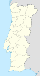
Wappen Karte
Das Wappen fehlt noch
Aldeia do Souto (Portugal)
Aldeia do Souto
Basisdaten
Region: Centro
Unterregion: Cova da Beira
Distrikt: Castelo Branco
Concelho: Covilhã
Koordinaten: 40° 22′ N, 7° 24′ W40.366944444444-7.3980555555555Koordinaten: 40° 22′ N, 7° 24′ W
Einwohner: 265 (Stand: 2001)
Fläche: 10,21 km²
Bevölkerungsdichte: 26 Einwohner pro km²

Vorlage:Infobox Ort in Portugal/Wartung/Art ist leer

Vorlage:Infobox Ort in Portugal/Wartung/Karte ist leer


Vorlage:Infobox Ort in Portugal/Wartung/Höhe ist leer Vorlage:Infobox Ort in Portugal/Wartung/PLZ ist leer Vorlage:Infobox Ort in Portugal/Wartung/Bürgermeister ist leer

Vorlage:Infobox Ort in Portugal/Wartung/Einwohnerstand ist leer

Vorlage:Infobox Ort in Portugal/Wartung/Verwaltungsort ist leer Vorlage:Infobox Ort in Portugal/Wartung/Webseite ist leer Vorlage:Infobox Ort in Portugal/Wartung/Email ist leer

Aldeia do Souto ist eine Gemeinde im Kreis Covilhã in Portugal.

Demografie

Die 10,21 Quadratkilometer große Gemeinde hat 265 Einwohner (2001). Dies entspricht einer Dichte von 26,0 Einwohnern / km ².

Persönlichkeiten

Weblinks


Wikimedia Foundation.

Игры ⚽ Нужен реферат?

Schlagen Sie auch in anderen Wörterbüchern nach:

  • Aldeia do Souto — Freguesia de Portugal …   Wikipedia Español

  • Aldeia do Mato — Wappen Karte …   Deutsch Wikipedia

  • Souto (Abrantes) — Wappen Karte …   Deutsch Wikipedia

  • Aldeia do Mato — Freguesia de Portugal Entidad Freguesia  • País …   Wikipedia Español

  • Souto (Abrantes) — Para otros usos de este término, véase Souto (desambiguación). Souto Freguesia de Portugal …   Wikipedia Español

  • Aldeia do Mato — Infobox Parish pt official name = Aldeia do Mato image coat of arms = Municipality = Abrantes area total = 31.40 population total = 560 (2001) population density = 18 website = none footnotes =Aldeia do Mato is a Portuguese parish, located in the …   Wikipedia

  • Souto (Abrantes) — Infobox Parish pt official name = Souto image coat of arms = Municipality = Abrantes area total = 15.02 population total = 567 (2001) population density = 38 website = none footnotes =Souto is a Portuguese parish, located in the municipality of… …   Wikipedia

  • List of postal codes in Portugal — Aveiro districtMealhada municipality*3050 Antes *3050 Barcouço *3050 Casal Comba *3050 Luso *3050 Mealhada *3050 Pampilhosa *3050 Vacariça *3050 Ventosa do BairroMurtosa municipality*3870 Bunheiro *3870 Monte *3870 Murtosa *3870 TorreiraOliveira… …   Wikipedia

  • Freguesias de Portugal — Anexo:Freguesias de Portugal Saltar a navegación, búsqueda Contenido 1 A 1.1 Abrantes 1.2 Águeda 1.3 …   Wikipedia Español

  • Anexo:Freguesias de Portugal — Contenido 1 A 1.1 Abrantes 1.2 Águeda 1.3 Aguiar da Beira 1.4 …   Wikipedia Español

Share the article and excerpts

Direct link
Do a right-click on the link above
and select “Copy Link”