Angeja

Angeja
Angeja
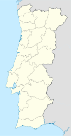
Wappen Karte
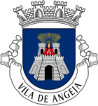
Wappen von Angeja
Angeja (Portugal)
Angeja
Basisdaten
Region: Centro
Unterregion: Baixo Vouga
Distrikt: Aveiro
Concelho: Albergaria-a-Velha
Koordinaten: 40° 41′ N, 8° 33′ W40.683333333333-8.55Koordinaten: 40° 41′ N, 8° 33′ W
Einwohner: 2.320 (Stand: 2001)
Fläche: 20,9 km²
Bevölkerungsdichte: 111 Einwohner pro km²


Vorlage:Infobox Ort in Portugal/Wartung/Karte ist leer


Vorlage:Infobox Ort in Portugal/Wartung/Höhe ist leer Vorlage:Infobox Ort in Portugal/Wartung/PLZ ist leer Vorlage:Infobox Ort in Portugal/Wartung/Bürgermeister ist leer

Vorlage:Infobox Ort in Portugal/Wartung/Einwohnerstand ist leer

Vorlage:Infobox Ort in Portugal/Wartung/Verwaltungsort ist leer Vorlage:Infobox Ort in Portugal/Wartung/Webseite ist leer Vorlage:Infobox Ort in Portugal/Wartung/Email ist leer

Angeja ist eine Freguesia (Gemeinde) des Kreises Albergaria-a-Velha. Sie ist 20,9 km² groß und hat 2320 Einwohner (2001).[1]

Am 20. Juni 1991 wurde sie zur Kleinstadt (Vila) erhoben.

Einzelnachweise

  1. Daten zu Angeja (en). alea.pt. Abgerufen am 30. April 2011.

Weblinks


Wikimedia Foundation.

Игры ⚽ Нужна курсовая?

Schlagen Sie auch in anderen Wörterbüchern nach:

  • Angeja — Saltar a navegación, búsqueda Angeja Escudo Bandera Gentilicio Ange …   Wikipedia Español

  • Angeja — Géolocalisation sur la carte : Portugal …   Wikipédia en Français

  • Angeja — Infobox Parish pt official name = Angeja image coat of arms = Municipality = Albergaria a Velha area total = 21,08 km² population total = 2.320 2001 population density = 110,1 postal code = 3850 email = jfangeja@sapo.pt geral@jf angeja.pt website …   Wikipedia

  • Marquis of Angeja — The Coat of Arms of the Noronha family, Marquesses of Angeja and Counts of Vila Verde. Count of Vila Verde (in Portuguese Conde de Vila Verde) was a Portuguese title of nobility created by a royal decree, dated from December 10, 1654, by King… …   Wikipedia

  • Autoroute portugaise A29 — Autoroute Angeja Porto  A 29  Longueur 52 km De Canelas ( A20 ) …   Wikipédia en Français

  • Count of Peniche — The Coat of Arms of the Noronha family, Counts of Peniche. Count of Peniche (in Portuguese Conde de Peniche) was a Portuguese title of nobility created by a royal decree, dated from December 6, 1806, by Prince Regent John, on behalf of Queen… …   Wikipedia

  • Autoroute portugaise A25 — Pour les articles homonymes, voir A25. Autoroute Aveiro Vilar Formoso Auto Estrada das Beiras Litoral e Alta  A 25  Longueur 197 km (199 km) …   Wikipédia en Français

  • Museu Nacional do Traje — Fachada principal del Museu Nacional da Moda e do Traje, en la Quinta do Monteiro Mor. El Museo Nacional del Traje y de la Moda ( en portugués : Museu Nacional do Traje e da Moda) situado en el Palácio do Monteiro Mor, en la freguesia de… …   Wikipedia Español

  • Autoestrada A25 — Vorlage:Infobox hochrangige Straße/Wartung/PT A Autoestrada A 25 in Portugal …   Deutsch Wikipedia

  • Autoestrada A29 — Vorlage:Infobox hochrangige Straße/Wartung/PT A Autoestrada A 29 in Portugal Karte …   Deutsch Wikipedia

Share the article and excerpts

Direct link
Do a right-click on the link above
and select “Copy Link”