Cabeza Prieta Mountains

Cabeza Prieta Mountains

p1f1

Cabeza Prieta Mountains
Höchster Gipfel Cerro del Pinacate (1.390 m)
Lage Sonora (Mexiko), Arizona (USA)
Cabeza Prieta Mountains (Mexiko)
Cabeza Prieta Mountains
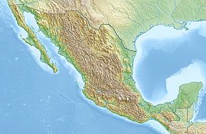
Koordinaten 31° 45′ N, 113° 31′ W31.75-113.516666666671390Koordinaten: 31° 45′ N, 113° 31′ W
Fläche 20.047 km²

Die Cabeza Prieta Mountains sind eine Gebirgskette im US-Bundesstaat Arizona (37 %) und im mexikanischen Bundesstaat Sonora (63 %). Höchste Erhebung der Gebirgskette ist der Cerro del Pinacate in Sonora. Die Cabeza Prieta Mountains haben eine Fläche von 20.047 km². Die Gebirgskette erstreckt sich über 170 Kilometer Nord-Süd und 187 Kilometer Ost-West.

Höchste Erhebungen

  1. Cerro del Pinacate, Sonora, 1390 m
  2. Sheep Mountain, Arizona, 962 m
  3. Pinta Benchmark, Arizona, 899 m
  4. Copper Mountains High Point, Arizona, 880 m
  5. Quitovaguita Benchmark, Arizona, 869 m
  6. Cabeza Benchmark, Arizona, 863 m
  7. Mohawk Peak, Arizona, 843 m
  8. Tinajas Altas, Arizona, 843 m
  9. Sierra el Choclo Duro High Point, Sonora, etwa 810 m
  10. Granite Benchmark, Arizona, 760 m

Wikimedia Foundation.

Игры ⚽ Нужна курсовая?

Schlagen Sie auch in anderen Wörterbüchern nach:

  • Cabeza Prieta Mountains — Geobox|Range name=Cabeza Prieta Mountains image size= image caption= country=United States state=Arizona geology=|orogeny= highest=Unnamed highest elevation imperial=2832 map caption=The Cabeza Prieta Mountains are a mountain range in the western …   Wikipedia

  • Cabeza Prieta National Wildlife Refuge — Infobox protected area | name = Cabeza Prieta National Wildlife Refuge iucn category = IV caption = locator x = 47 locator y = 121 location = Pima County and Yuma County, Arizona, USA nearest city = Yuma, AZ lat degrees = lat minutes = lat… …   Wikipedia

  • Mohawk Mountains — Coordinates: 32°35′26″N 113°38′52″W / 32.5906064°N 113.647697°W / 32.5906064; 113.647697 …   Wikipedia

  • Copper Mountains — For the range in Nevada, see Copper Mountains (Nevada). Copper Mountains Range Country United States …   Wikipedia

  • Bryan Mountains — Geobox|Range name=Bryan Mountains image size= image caption= country=United States state=Arizona geology=|orogeny= highest=Unnamed highest elevation imperial=2412 map caption=The Bryan Mountains is a mountain range in the Sonoran Desert of… …   Wikipedia

  • Growler Mountains — Geobox|Range name=Growler Mountains image size= image caption= country= United States state= Arizona geology=|orogeny= highest=Unnamed highest elevation imperial=3294 map caption= The Growler Mountains is a 23 mile, (37 km) long north south… …   Wikipedia

  • List of mountain ranges of Arizona — There are 194 named mountain ranges in Arizona. The extra items listed may include::Mingus Mountain, the high, NW section of the Black Hills:Shiprock:Sierra Madre Occidental (of W continental Mexico) The list*Agua Caliente Mountains ndash;Yuma… …   Wikipedia

  • Sierra Pinta — Geobox|Range name=Sierra Pinta image size= image caption= country=United States state=Arizona geology=|orogeny= highest=unnamed highest elevation imperial=2202 map caption= The Sierra Pinta (Spanish for Mountains Spot (Mark) ) is a medium sized,… …   Wikipedia

  • Cerro del Pinacate — Maar Elegante mit den Pinacate Peaks im Hintergrund Höhe …   Deutsch Wikipedia

  • List of mountain ranges of Yuma County, Arizona — A list of mountain ranges of Yuma County, Arizona. Yuma, Arizona ndash;Winterhaven, California is on the Colorado River in the southern section of the Lower Colorado River Valley.Adjacent notable towns at this confluence of California… …   Wikipedia

Share the article and excerpts

Direct link
Do a right-click on the link above
and select “Copy Link”