Caiguna

Caiguna
Caiguna
Staat: Australien Australien
Bundesstaat: Flag of Western Australia.svg Western Australia
Gegründet: 1963
Koordinaten: 32° 15′ S, 125° 31′ O-32.253135125.516246Koordinaten: 32° 15′ S, 125° 31′ O
 
Zeitzone: AWST (UTC+8)
Postleitzahl: 6443
LGA: Shire of Dundas
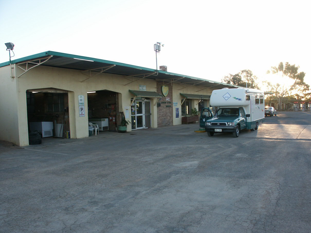
Caiguna (Australien)
Caiguna
Caiguna
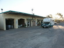
John Eyre Motel in Caiguna

Caiguna liegt 373 Kilometer von der Stadt Norseman und 146 Kilometer von Balladonia entfernt.

Der Name des Ortes bedeutet in der Sprache der Aborigine „Weg der Speere“. Gegründet wurde Caiguna im Jahre 1962 als eine Zwischenstation für das Verkehrsaufkommen anlässlich der Commonwealth Games in Richtung Perth. 10 Kilometer vom Ort entfernt, befindet sich ein Mahnmal für John Baxter, der am 29. April 1841 an diesem Ort von zwei Mitgliedern der Eyre-Expedition ermordet wurde. Das Mahnmal wurde 1930 von der Western Australian Historical Society errichtet.

Im Westen von Caiguna beginnt der Streckenabschnitt 90 mile straight auf dem Eyre Highway, der mit 146,6 Kilometern die längste kurvenlose Straße Australiens ist und nach Balladonia führt.

In Caiguna gibt es einen Caravanpark, ein Motel und Restaurant und eine Servicestation, die 24 Stunden am Tag geöffnet ist. Unweit des Ortes befindet sich eine Landepiste. Der Ort ist im Jahr 2009 nicht mehr als eine Versorgungsstation.

Weblinks

Informationen über Caiguna und John Baxter


Wikimedia Foundation.

Игры ⚽ Поможем решить контрольную работу

Schlagen Sie auch in anderen Wörterbüchern nach:

  • Caiguna, Western Australia — Infobox Australian Place | type = town name = Caiguna state = wa caption = John Eyre Motel, Caiguna. lga = Shire of Dundas postcode = 6443 pop = est = 1963 stategov = Eyre fedgov = Kalgoorlie dist1 = 1098 location1= Perth dist2 = 374 location2=… …   Wikipedia

  • UTC+8:45 — UTC+8:45  часовой пояс для пяти австралийских населённых пунктов: Кейгуна (Caiguna), Юкла (Eucla), Мадура, Мандрабилла, пограничные поселения (Editing Border Village, South Australia). Круглый год …   Википедия

  • Time zone — Timezone and TimeZone redirect here. For other uses, see Time zone (disambiguation). Local time redirects here. For the mathematical concept, see Local time (mathematics). This article is about time zones in general. For a list of time zones by… …   Wikipedia

  • Connie Sue Highway — From Warburton ( …   Wikipedia

  • Nullarbor Plain — Nullarbor redirects here. For other uses, see Nullarbor (disambiguation). NASA Visible Earth, Nullarbor. The true Nullarbor is the light tan semi circular area adjacent to the coast. Image acquired by the Terra (satellite) on 19 August 2002 The… …   Wikipedia

  • List of time zones — This is a list of time zones, sorted by time offsets from Coordinated Universal Time (UTC). Countries and regions observing the respective time zones are listed under it. This only gives current offsets. For more detailed and historic information …   Wikipedia

  • Eyre Highway — Infobox Australian Road road name = Eyre Highway route route route photo = caption = length = 1675 direction = West East start = finish = est = through = Balladonia, Cocklebiddy, Eucla, Ceduna, Kimba route = Norseman SA/WA Border: exits =… …   Wikipedia

  • Norseman, Western Australia — Norseman Western Australia Norseman townsite …   Wikipedia

  • Eucla, Western Australia — Infobox Australian Place | type = town name = Eucla state = wa caption = Road sign lga = Shire of Dundas postcode = 6443 pop = 50 est = 1870s (gazetted in 1885) stategov = Eyre fedgov = Kalgoorlie dist1 = 1434 location1= Perth dist2 = 11… …   Wikipedia

  • John Baxter (explorer) — John Baxter ( ndash;29 April 1841) was a friend and companion of Edward John Eyre on his crossing of the Nullarbor Plain in 1840 1841. When the party was low on supplies and in desperate need of water, somewhere near present day Caiguna, Baxter… …   Wikipedia

Share the article and excerpts

Direct link
Do a right-click on the link above
and select “Copy Link”